MyTopo
Cima Dome California US Topo Map
Couldn't load pickup availability
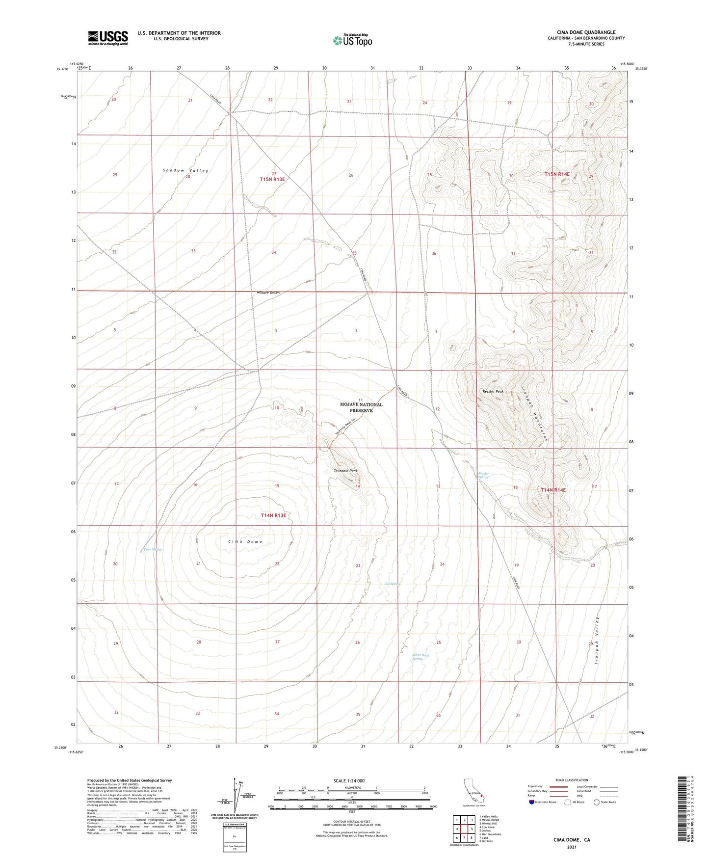
2021 topographic map quadrangle Cima Dome in the state of California. Scale: 1:24000. Based on the newly updated USGS 7.5' US Topo map series, this map is in the following counties: San Bernardino. The map contains contour data, water features, and other items you are used to seeing on USGS maps, but also has updated roads and other features. This is the next generation of topographic maps. Printed on high-quality waterproof paper with UV fade-resistant inks.
Quads adjacent to this one:
West: Cow Cove
Northwest: Valley Wells
North: Mescal Range
Northeast: Mineral Hill
East: Joshua
Southeast: Mid Hills
South: Cima
Southwest: Marl Mountains
This map covers the same area as the classic USGS quad with code o35115c5.
Contains the following named places: Billy Boy Mine, Cima Dome, Copper King Mine, Cut Spring, Deer Spring, Evening Star Mine, Geer Dolomite Quarry, Geer Prospect, Ginn Prospect, Hartman Mine, Johnny Prospects, Johnny Shaft, Johnny Tunnel, Kessler Peak, Kessler Ranch, Kessler Spring, New Era Mine, New Era Number Three Mine, Ord Tank, Rex Prospect, Ross Prospect, Standard Mine Number Two, Teutonia Mine, Teutonia Peak, Valley View Ranch, White Rock Spring