MyTopo
Mescal Range California US Topo Map
Couldn't load pickup availability
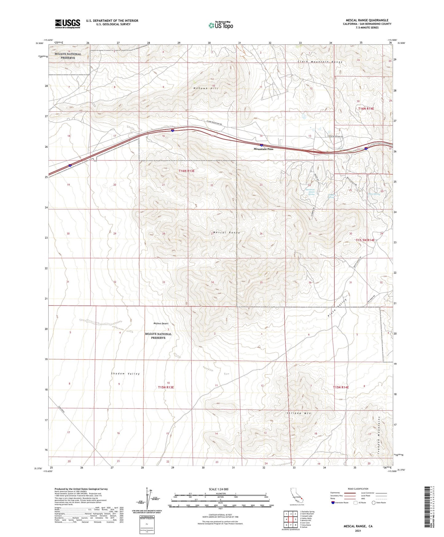
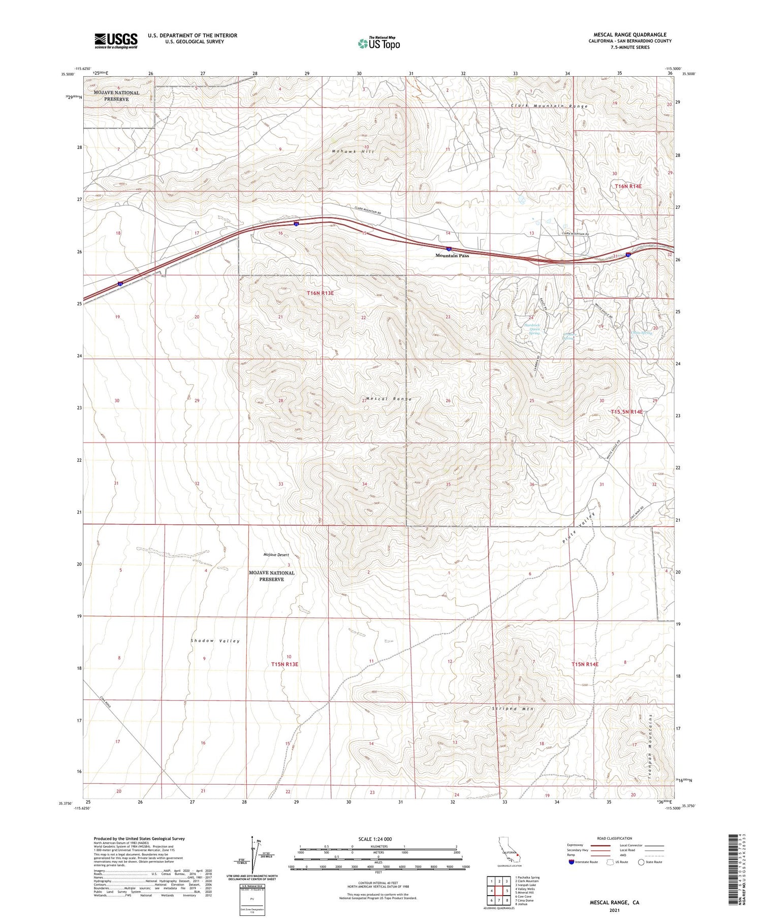
2021 topographic map quadrangle Mescal Range in the state of California. Scale: 1:24000. Based on the newly updated USGS 7.5' US Topo map series, this map is in the following counties: San Bernardino. The map contains contour data, water features, and other items you are used to seeing on USGS maps, but also has updated roads and other features. This is the next generation of topographic maps. Printed on high-quality waterproof paper with UV fade-resistant inks.
Quads adjacent to this one:
West: Valley Wells
Northwest: Pachalka Spring
North: Clark Mountain
Northeast: Ivanpah Lake
East: Mineral Hill
Southeast: Joshua
South: Cima Dome
Southwest: Cow Cove
This map covers the same area as the classic USGS quad with code o35115d5.
Contains the following named places: Agnes Mine, Alice Prospect, Birthday Mine, Blue Buzzard Mine, Bullsnake Prospect, Candy and Cake Number 3 Prospect, China Spring, Clark Mountain Station, Delfonte Sandstone Quarry, Groaner Spring, Hardrock Queen Spring, Iron Horse Mine, KXVR-FM (Mountain Pass), Mescal Range, Mexican Well, Mohawk Hill, Mohawk Mine, Mojave Desert, Mollusk Mine, Mountain Pass, Mountain Pass Mine, Piute Valley, Reynolds-Robbins Prospects, Rogers Camp, Silver Star Mine, Silverado Mine, Simon-Ray Prospect, Standard Mine Number One, Striped Mountain, Yucca Mine