MyTopo
Clark Mountain California US Topo Map
Couldn't load pickup availability
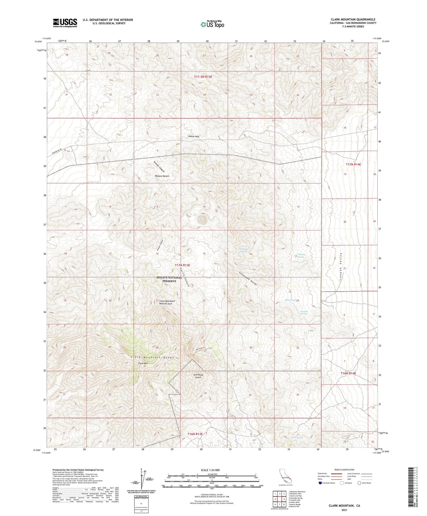
2021 topographic map quadrangle Clark Mountain in the state of California. Scale: 1:24000. Based on the newly updated USGS 7.5' US Topo map series, this map is in the following counties: San Bernardino. The map contains contour data, water features, and other items you are used to seeing on USGS maps, but also has updated roads and other features. This is the next generation of topographic maps. Printed on high-quality waterproof paper with UV fade-resistant inks.
Quads adjacent to this one:
West: Pachalka Spring
Northwest: Mesquite Mountains
North: Mesquite Lake
Northeast: State Line Pass
East: Ivanpah Lake
Southeast: Mineral Hill
South: Mescal Range
Southwest: Valley Wells
This map covers the same area as the classic USGS quad with code o35115e5.
Contains the following named places: Antimony Mine, Benson Mine, Burro Spring, Clark Mountain, Clark Mountain Natural Arch, Clark Mountain Range, Colosseum Gorge, Colosseum Mine, Copper World Mine, Curtis Canyon, Greens Canyon, Greens Mine, Greens Well, Ivanpah Springs, Keany Pass, Kiwisar Canyon, Stonewall Mine, Taylor Mine, Whiskey Spring, Whitfield Spring, Willow Spring