MyTopo
State Line Pass California US Topo Map
Couldn't load pickup availability
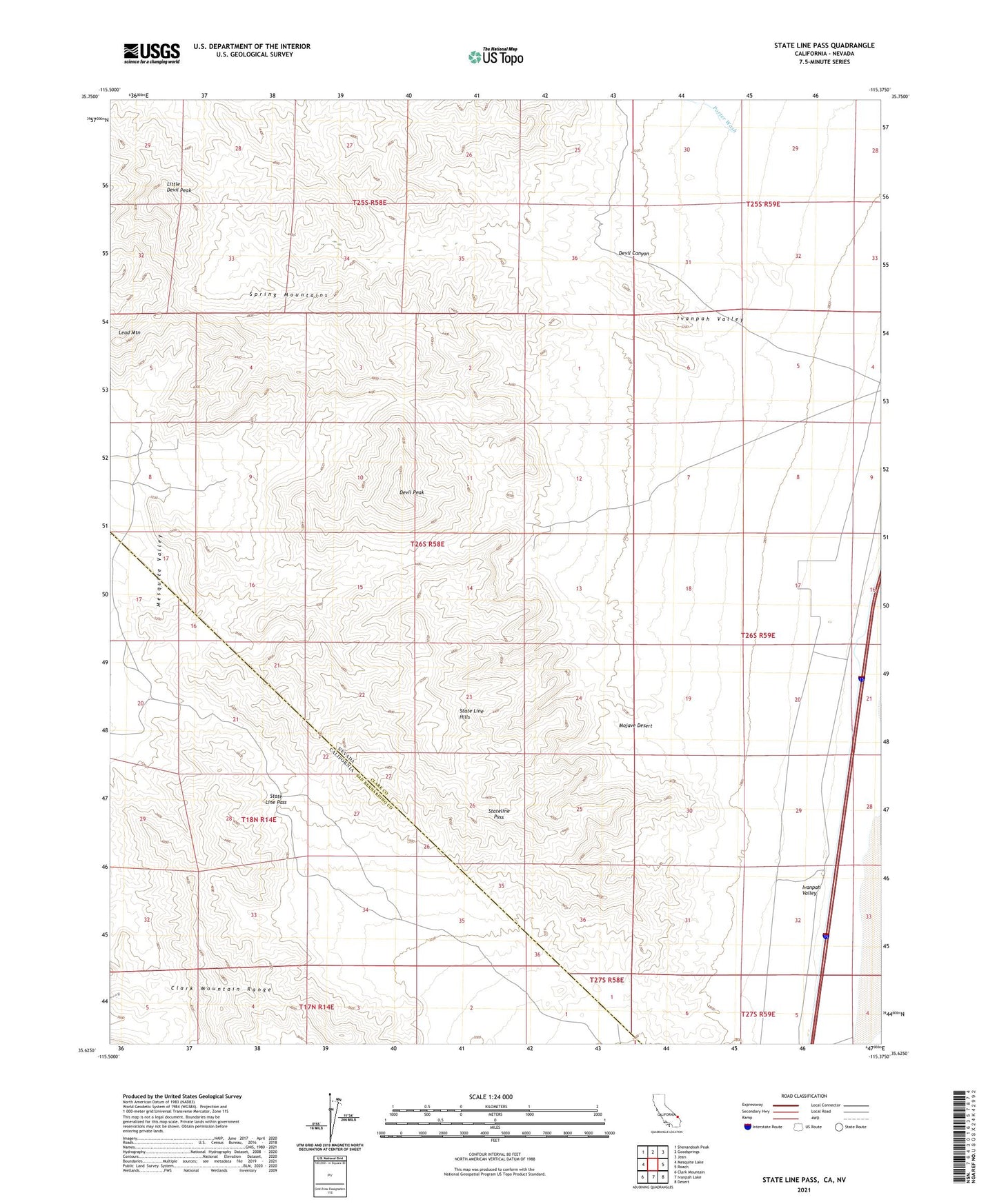
2021 topographic map quadrangle State Line Pass in the states of Nevada, California. Scale: 1:24000. Based on the newly updated USGS 7.5' US Topo map series, this map is in the following counties: San Bernardino, Clark. The map contains contour data, water features, and other items you are used to seeing on USGS maps, but also has updated roads and other features. This is the next generation of topographic maps. Printed on high-quality waterproof paper with UV fade-resistant inks.
Quads adjacent to this one:
West: Mesquite Lake
Northwest: Shenandoah Peak
North: Goodsprings
Northeast: Jean
East: Roach
Southeast: Desert
South: Ivanpah Lake
Southwest: Clark Mountain
Contains the following named places: Addison Mine, Brandy Mine, Christmas Mine, Copper Hill Mine, Devil Canyon, Devil Peak, Eureka Mine, Ingomar and Milford Number Two Mines, Kelly Mine, Lead Mountain, Little Devil Peak, Mountain Queen Mine, New Year Mine, Picture Rock Mine, Silver Gem Mine, State Line Hills, State Line Pass, Stateline Pass, Stateline Wilderness, Tam O'Shanter Mine, Umpire Perlite Mine