
MyTopo
Clements California US Topo Map
Couldn't load pickup availability
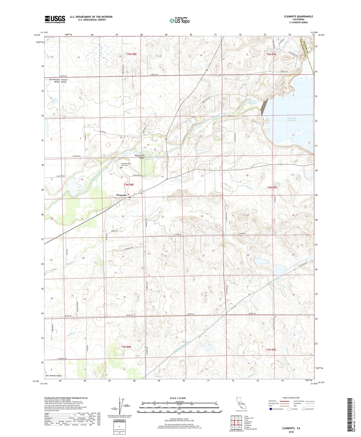
2022 topographic map quadrangle Clements in the state of California. Scale: 1:24000. Based on the newly updated USGS 7.5' US Topo map series, this map is in the following counties: San Joaquin, Amador. The map contains contour data, water features, and other items you are used to seeing on USGS maps, but also has updated roads and other features. This is the next generation of topographic maps. Printed on high-quality waterproof paper with UV fade-resistant inks.
Quads adjacent to this one:
West: Lockeford
Northwest: Clay
North: Goose Creek
Northeast: Ione
East: Wallace
Southeast: Valley Springs SW
South: Linden
Southwest: Waterloo
This map covers the same area as the classic USGS quad with code o38121b1.
Contains the following named places: Camanche 31-016 Dam, Camanche Dam, Clements, Clements Buckaroos Rodeo Grounds, Clements Elementary School, Clements Glen View Cemetery, Clements Pit, Clements Post Office, Clements Rural Fire Protection District, Dogtown, Featherstone Ranch Pit, Justice School, Lockeford Division, Mokelumne Beach, Mokelumne River Fish Installation, Murphy Creek, Stillman Magee Park, Top of the Hill First Southern Baptist Church, Washington School, ZIP Code: 95227


