MyTopo
Valley Springs SW California US Topo Map
Couldn't load pickup availability
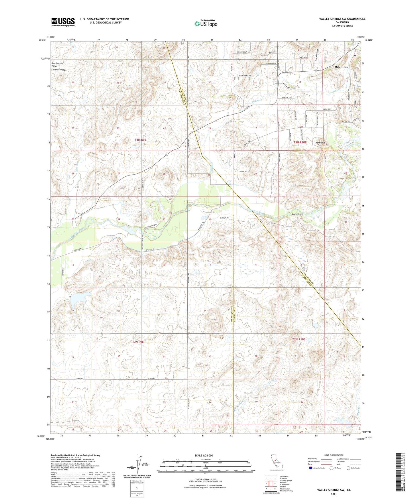
2021 topographic map quadrangle Valley Springs SW in the state of California. Scale: 1:24000. Based on the newly updated USGS 7.5' US Topo map series, this map is in the following counties: San Joaquin, Calaveras, Stanislaus. The map contains contour data, water features, and other items you are used to seeing on USGS maps, but also has updated roads and other features. This is the next generation of topographic maps. Printed on high-quality waterproof paper with UV fade-resistant inks.
Quads adjacent to this one:
West: Linden
Northwest: Clements
North: Wallace
Northeast: Valley Springs
East: Jenny Lind
Southeast: Bachelor Valley
South: Farmington
Southwest: Peters
This map covers the same area as the classic USGS quad with code o38120a8.
Contains the following named places: Douglas School, Foothill Sanitary Landfill, Gilmore 571 Dam, Indian Creek, Jenny Lind Fire Protection District Station 1 Headquarters, Mother Lode Acres, Oak Grove, Opal Hill, Ospital Ranch, South Gulch, Stone Corral Church, Stone Corral Ranch, ZIP Code: 95230