MyTopo
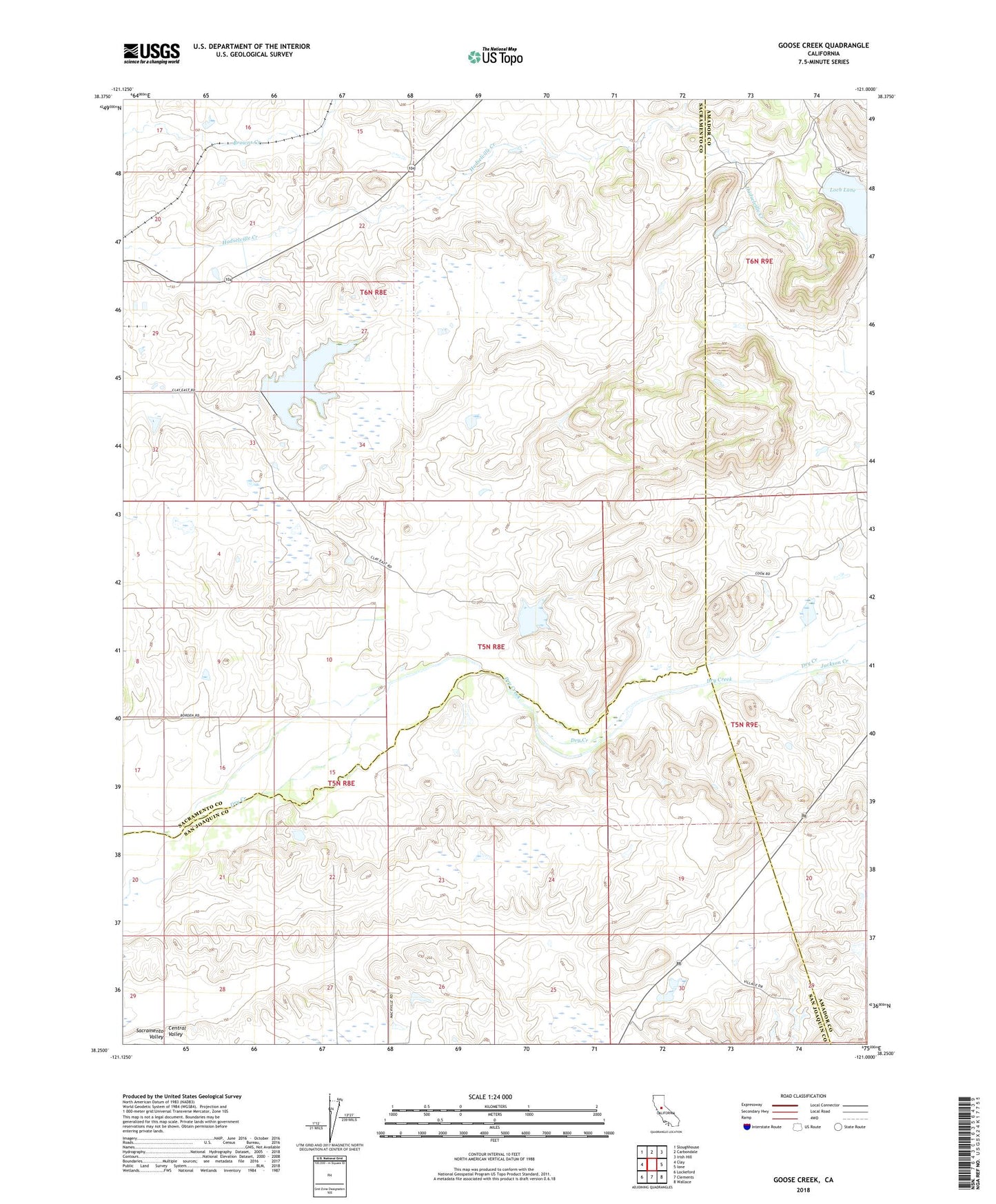
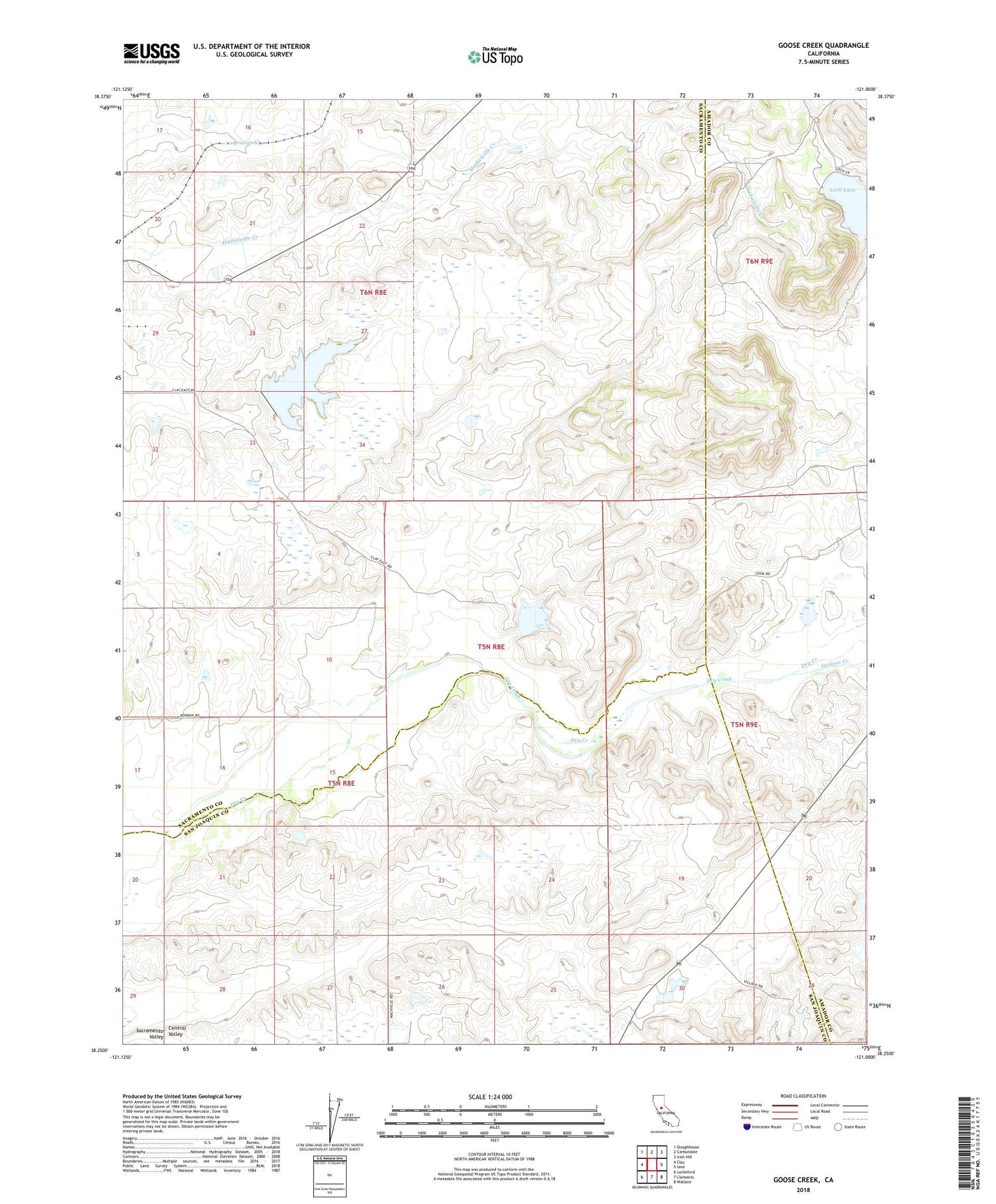
Goose Creek California US Topo Map
Couldn't load pickup availability
2022 topographic map quadrangle Goose Creek in the state of California. Scale: 1:24000. Based on the newly updated USGS 7.5' US Topo map series, this map is in the following counties: Sacramento, San Joaquin, Amador. The map contains contour data, water features, and other items you are used to seeing on USGS maps, but also has updated roads and other features. This is the next generation of topographic maps. Printed on high-quality waterproof paper with UV fade-resistant inks.
Quads adjacent to this one:
West: Clay
Northwest: Sloughhouse
North: Carbondale
Northeast: Irish Hill
East: Ione
Southeast: Wallace
South: Clements
Southwest: Lockeford
This map covers the same area as the classic USGS quad with code o38121c1.
Contains the following named places: Arroyo Seco, Hamel 459 Dam, Hutson School, Ione Quarry, Jackson Creek, Loch Lane, Rancho Seco 1009-013 Dam, Rancho Seco Park, Rancho Seco Power Plant, ZIP Code: 95638