MyTopo
Lockeford California US Topo Map
Couldn't load pickup availability
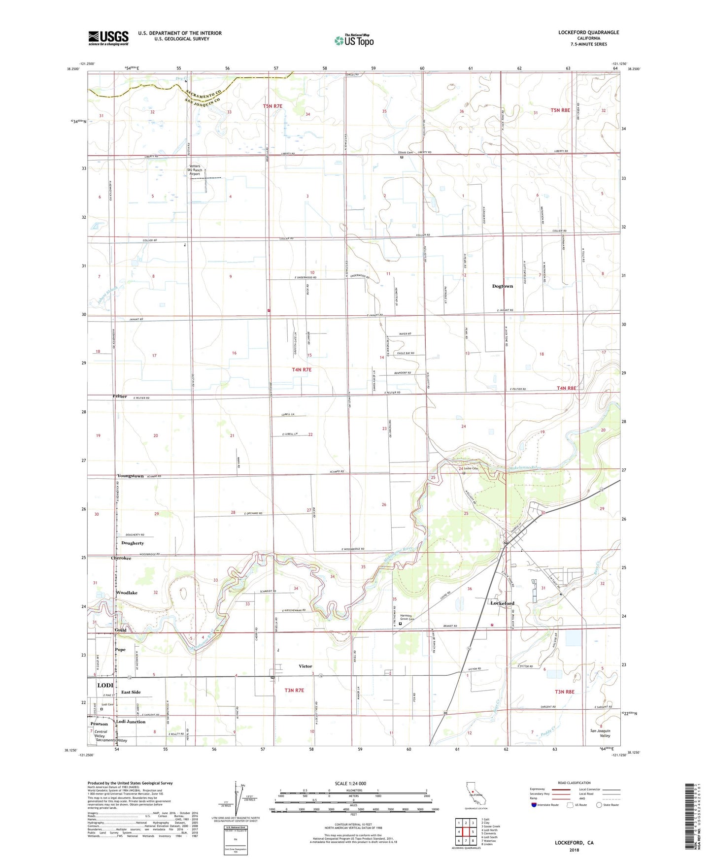
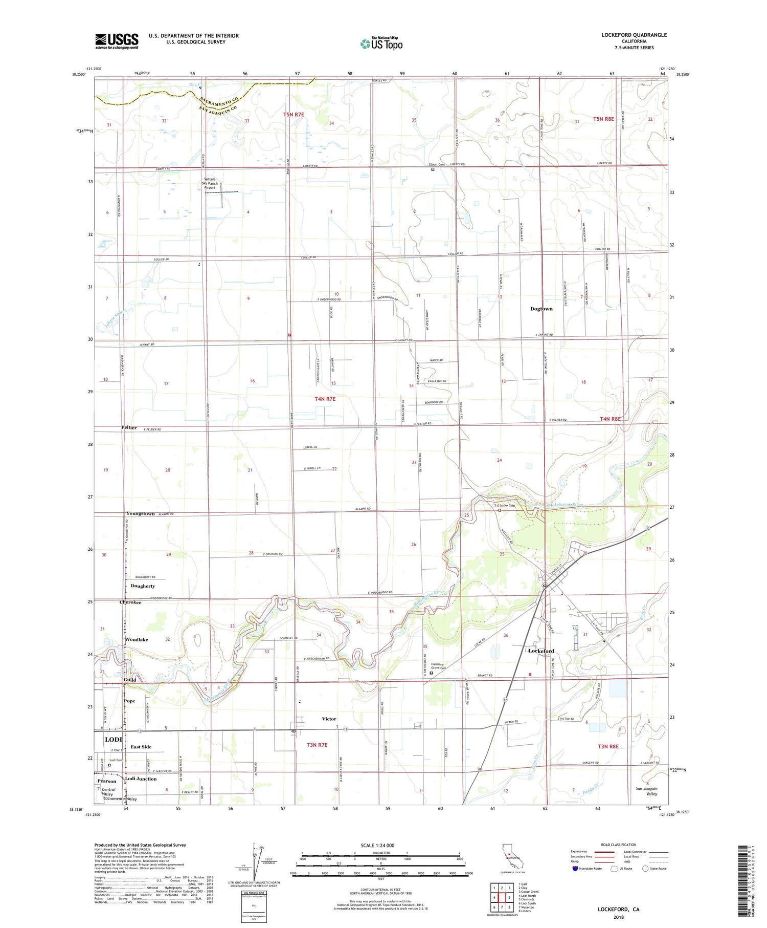
2021 topographic map quadrangle Lockeford in the state of California. Scale: 1:24000. Based on the newly updated USGS 7.5' US Topo map series, this map is in the following counties: San Joaquin, Sacramento. The map contains contour data, water features, and other items you are used to seeing on USGS maps, but also has updated roads and other features. This is the next generation of topographic maps. Printed on high-quality waterproof paper with UV fade-resistant inks.
Quads adjacent to this one:
West: Lodi North
Northwest: Galt
North: Clay
Northeast: Goose Creek
East: Clements
Southeast: Linden
South: Waterloo
Southwest: Lodi South
This map covers the same area as the classic USGS quad with code o38121b2.
Contains the following named places: Brunswick School, Cherokee, Colony Substation, Coyote Creek, De Wit Dairy, Dogtown Census Designated Place, Dougherty, Dry Creek School, East Side, Elliott, Elliott Cemetery, Ferdun Ranch Airport, First Landmark Missionary Baptist Church, Foothill Shopping Center, Goose Creek, Gospel Lighthouse Pentecostal Church of God, Grace Church of Lockeford, Guild, Harmony Grove Cemetery, La Lomito Rancho, Liberty Rural Fire Protection District, Locke Cemetery, Lockeford, Lockeford Census Designated Place, Lockeford Community Center, Lockeford Elementary School, Lockeford Post Office, Lodi Gas Field, Lodi Junction, Lodi Memorial Park and Cemetery, Mokelumne Rural Fire Department, Oak View Elementary School, Pearson, Peltier, Pope, Roma, S and R Egg Ranch, Saint Joachim Catholic Church, Seifert Dairy Farm, Silva Brothers Dairy, Vetters Sky Ranch Airport, Victor, Victor Census Designated Place, Victor Elementary School, Victor Post Office, Victor School, Woodlake, Youngstown, ZIP Codes: 95220, 95237