
MyTopo
Coso Peak California US Topo Map
Couldn't load pickup availability
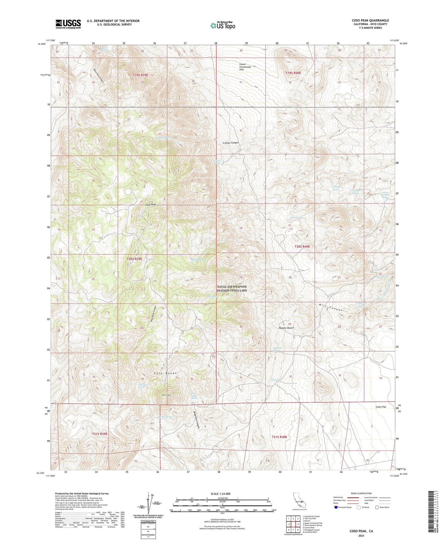
2021 topographic map quadrangle Coso Peak in the state of California. Scale: 1:24000. Based on the newly updated USGS 7.5' US Topo map series, this map is in the following counties: Inyo. The map contains contour data, water features, and other items you are used to seeing on USGS maps, but also has updated roads and other features. This is the next generation of topographic maps. Printed on high-quality waterproof paper with UV fade-resistant inks.
Quads adjacent to this one:
West: Upper Centennial Flat
Northwest: Centennial Canyon
North: Talc City Hills
Northeast: Darwin
East: China Gardens Spring
Southeast: Louisiana Butte
South: Petroglyph Canyon
Southwest: Cactus Peak
Contains the following named places: Black Spring, Chappo Spring, Cole Spring, Coles Flat, Coso, Coso Peak, Coso Springs, Crystal Canyon, Crystal Spring, Dead End Cabin, Domingo Spring, Indian Gardens Spring, Josephine Mine, Langs Well, Lone Pine Division, Lost Cabin Spring, Mariposa Mine, Mariposa Spring, Mill Canyon, Mill Spring, She Cat Spring, Silver Peak, Summer Spring, Tub Spring, Wild Horse Spring, Wrinkle Spring


