MyTopo
Bear Valley California US Topo Map
Couldn't load pickup availability
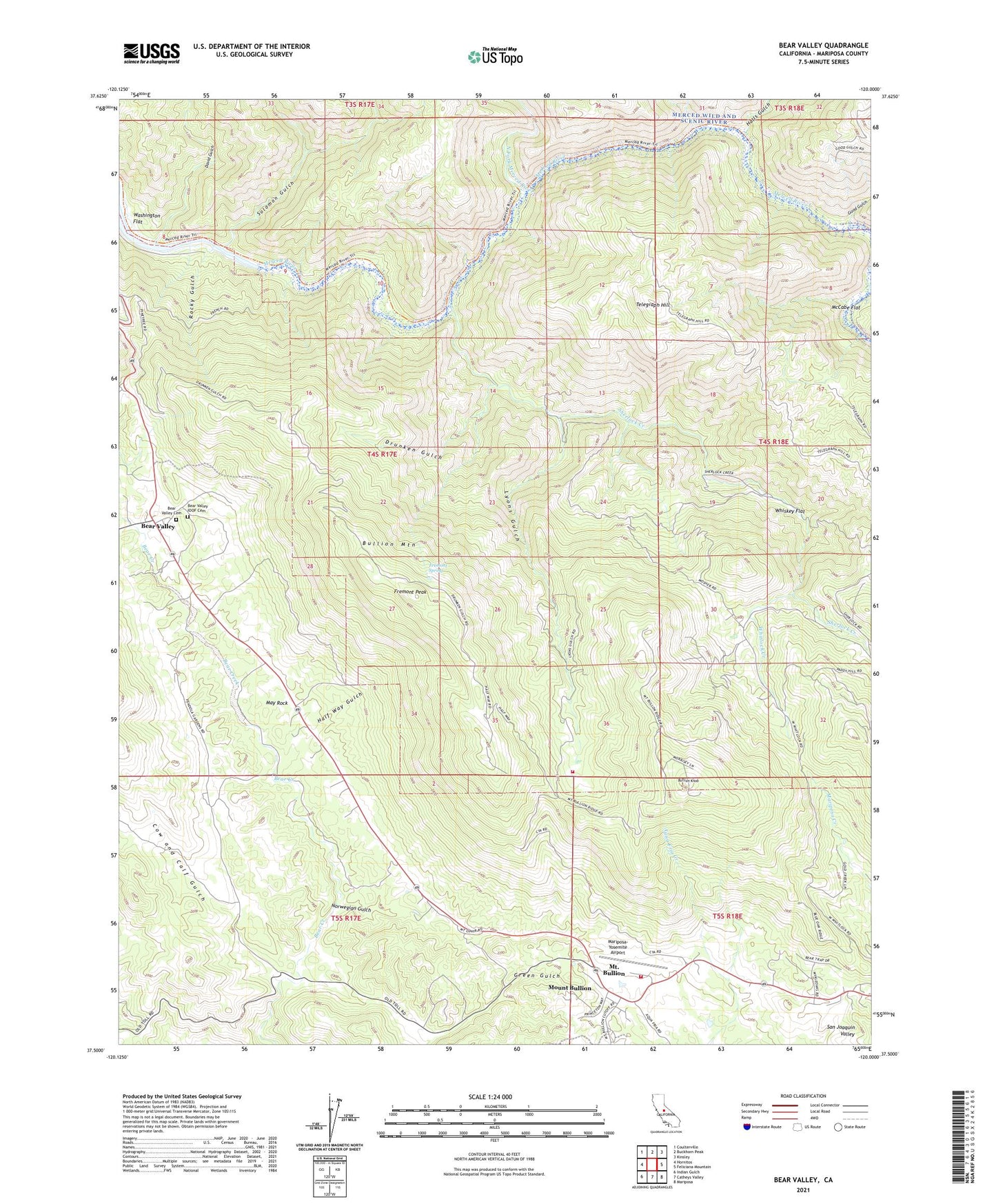
2021 topographic map quadrangle Bear Valley in the state of California. Scale: 1:24000. Based on the newly updated USGS 7.5' US Topo map series, this map is in the following counties: Mariposa. The map contains contour data, water features, and other items you are used to seeing on USGS maps, but also has updated roads and other features. This is the next generation of topographic maps. Printed on high-quality waterproof paper with UV fade-resistant inks.
Quads adjacent to this one:
West: Hornitos
Northwest: Coulterville
North: Buckhorn Peak
Northeast: Kinsley
East: Feliciana Mountain
Southeast: Mariposa
South: Catheys Valley
Southwest: Indian Gulch
This map covers the same area as the classic USGS quad with code o37120e1.
Contains the following named places: Bear Valley, Bear Valley Cemetery, Bear Valley Census Designated Place, Bear Valley IOOF Cemetery, Bear Valley School, Bear Valley Sub-Station, Bonds Store, Bullion Knob, Bullion Mountain, Cow and Calf Gulch, David Gulch, Department of Forestry and Fire Protection Mount Bullion Conservation Camp, Diltz Mine, Drunken Gulch, Fremont Peak, Fremont Spring, French Mine, Golden Key Mine, Good Gulch, Green Gulch, Half Way Gulch, Halls Gulch, Josephine Mine, KCIV-FM (Mount Bullion), KEFR-FM (Le Grand), KHRA-FM (Mariposa), KMPO-FM (Modesto), KUBB-FM (Mariposa), Las Mariposas, Lyons Gulch, Mariposa County Fire Department Company 25 Mount Bullion / Airport, Mariposa County Landfill, Mariposa-Yosemite Airport, May Rock, McCabe Flat, Mount Bullion, Mount Bullion Census Designated Place, Mount Bullion Youth Conservation Camp, Mount Ophir, Mountain King Mine, North Fork Merced River, Norwegian Gulch, Nutmeg Mine, Pendola Gardens, Permit Mine, Pine Tree Mine, Rocky Gulch, Sherlock Creek, Solomon Gulch, Telegraph Hill, Trabucco Gardens, Washington Flat, Whiskey Flat, Whitlock Creek