MyTopo
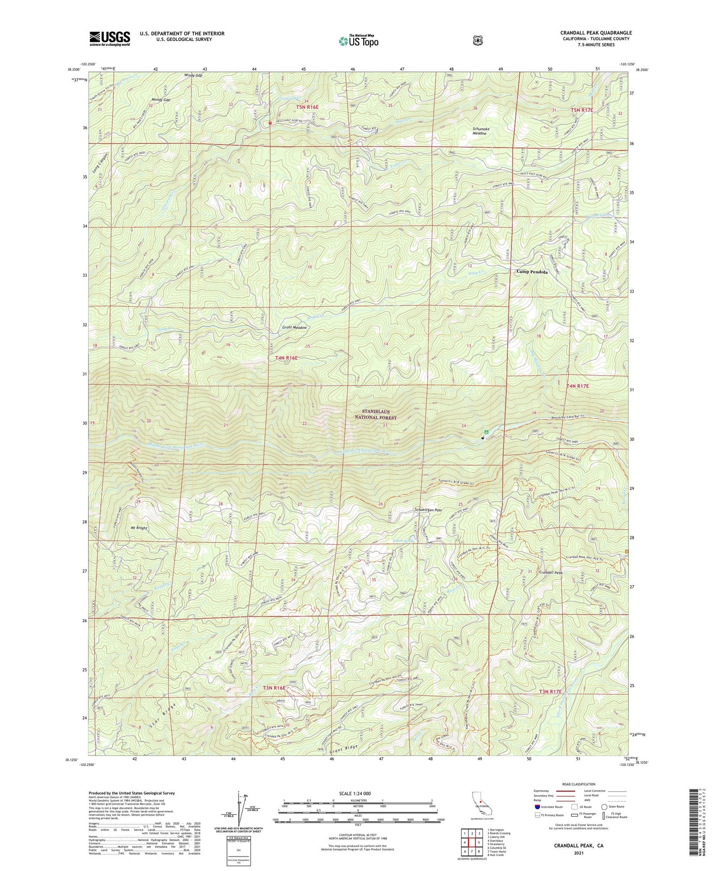
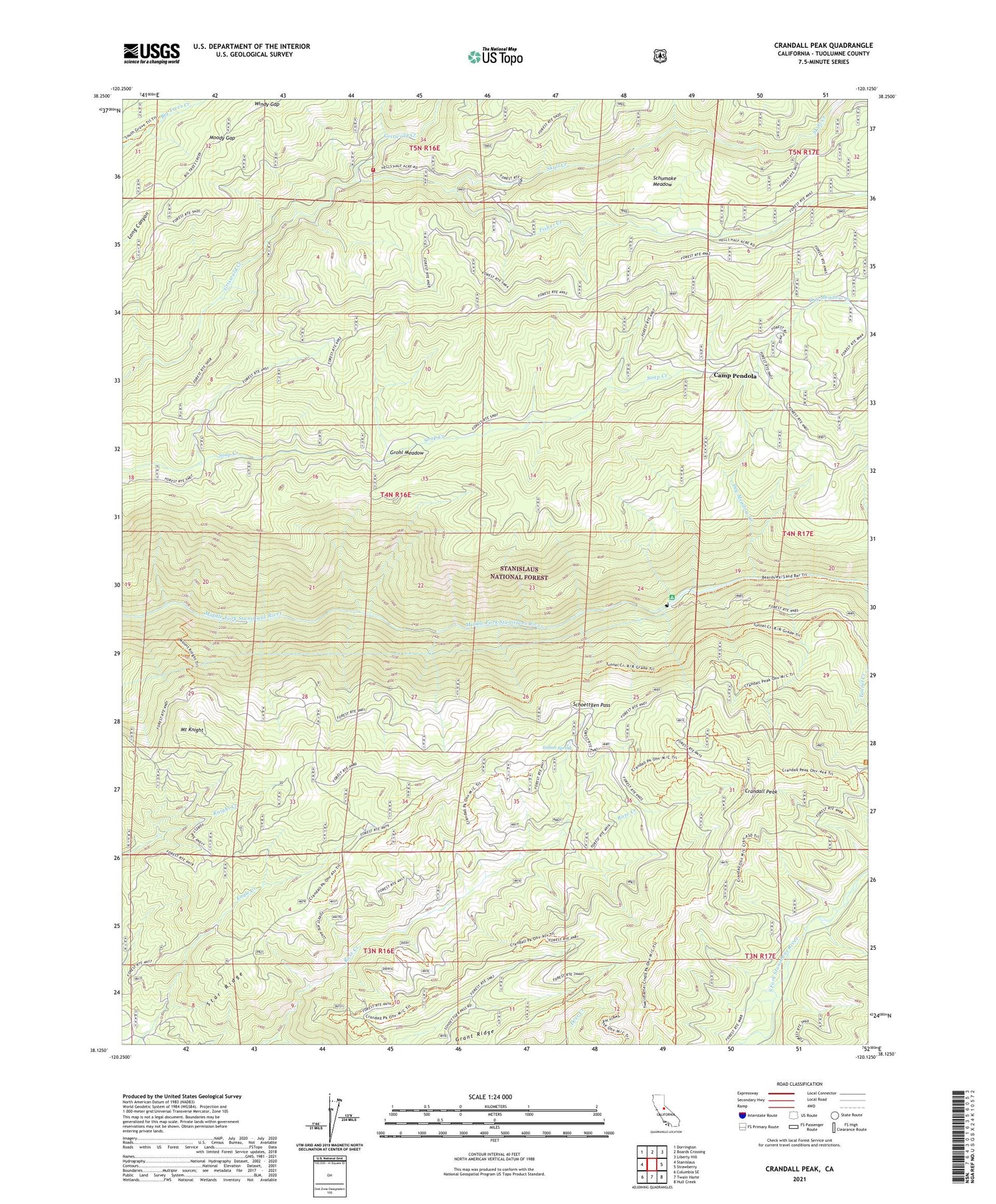
Crandall Peak California US Topo Map
Couldn't load pickup availability
Also explore the Crandall Peak Forest Service Topo of this same quad for updated USFS data
2021 topographic map quadrangle Crandall Peak in the state of California. Scale: 1:24000. Based on the newly updated USGS 7.5' US Topo map series, this map is in the following counties: Tuolumne. The map contains contour data, water features, and other items you are used to seeing on USGS maps, but also has updated roads and other features. This is the next generation of topographic maps. Printed on high-quality waterproof paper with UV fade-resistant inks.
Quads adjacent to this one:
West: Stanislaus
Northwest: Dorrington
North: Boards Crossing
Northeast: Liberty Hill
East: Strawberry
Southeast: Hull Creek
South: Twain Harte
Southwest: Columbia SE
This map covers the same area as the classic USGS quad with code o38120b2.
Contains the following named places: Calaveras South Grove Natural Preserve, Camp John Mensinger Boy Scout Camp, Camp Pendola, Crandall Peak, Department of Forestry and Fire Protection Skull Creek, Dry Meadow Creek, Dry Meadow Station, Eagle Creek Camp, Fisher Creek, Grant Ridge, Grohl Meadow, Indian Spring, Moody Gap, Mount Knight, Sand Bar Flat Campground, Sand Bar Flat Dam, Schoettgen Pass, Schumake Meadow, Skull Creek, Skull Creek California Division Forestry Fire Station, Soap Creek Pass, South Grove, Star Ridge, Tunnel Creek, Tuolumne State Game Refuge, Windy Gap