MyTopo
Liberty Hill California US Topo Map
Couldn't load pickup availability
Also explore the Liberty Hill Forest Service Topo of this same quad for updated USFS data
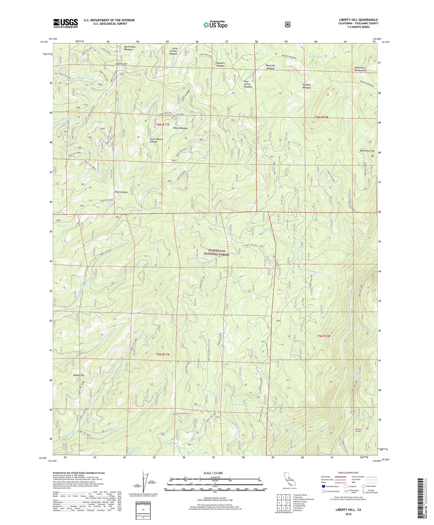
2022 topographic map quadrangle Liberty Hill in the state of California. Scale: 1:24000. Based on the newly updated USGS 7.5' US Topo map series, this map is in the following counties: Tuolumne. The map contains contour data, water features, and other items you are used to seeing on USGS maps, but also has updated roads and other features. This is the next generation of topographic maps. Printed on high-quality waterproof paper with UV fade-resistant inks.
Quads adjacent to this one:
West: Boards Crossing
Northwest: Calaveras Dome
North: Tamarack
Northeast: Spicer Meadow Reservoir
East: Donnell Lake
Southeast: Pinecrest
South: Strawberry
Southwest: Crandall Peak
This map covers the same area as the classic USGS quad with code o38120c1.
Contains the following named places: Basin Creek, Beartrap Meadow, Blue Canyon, Bull Creek, Bummers Flat, Campoodle Creek, Cascade Creek, Grohls Upper Camp, Liberty Hill, Lily Creek, Lion Creek, Little Beaver Canyon, McKee Hill, Mill Creek, North Fork, Post Corral, Post Corral Meadow, Randalls Meadow, Rhodes Lake, Sands Meadow, Shearing Camp, Shoofly Meadow, Smoothwire Camp, Smoothwire Creek, Snyder Camp, South Fork, White Spring, Whittakers Dardanelles