
MyTopo
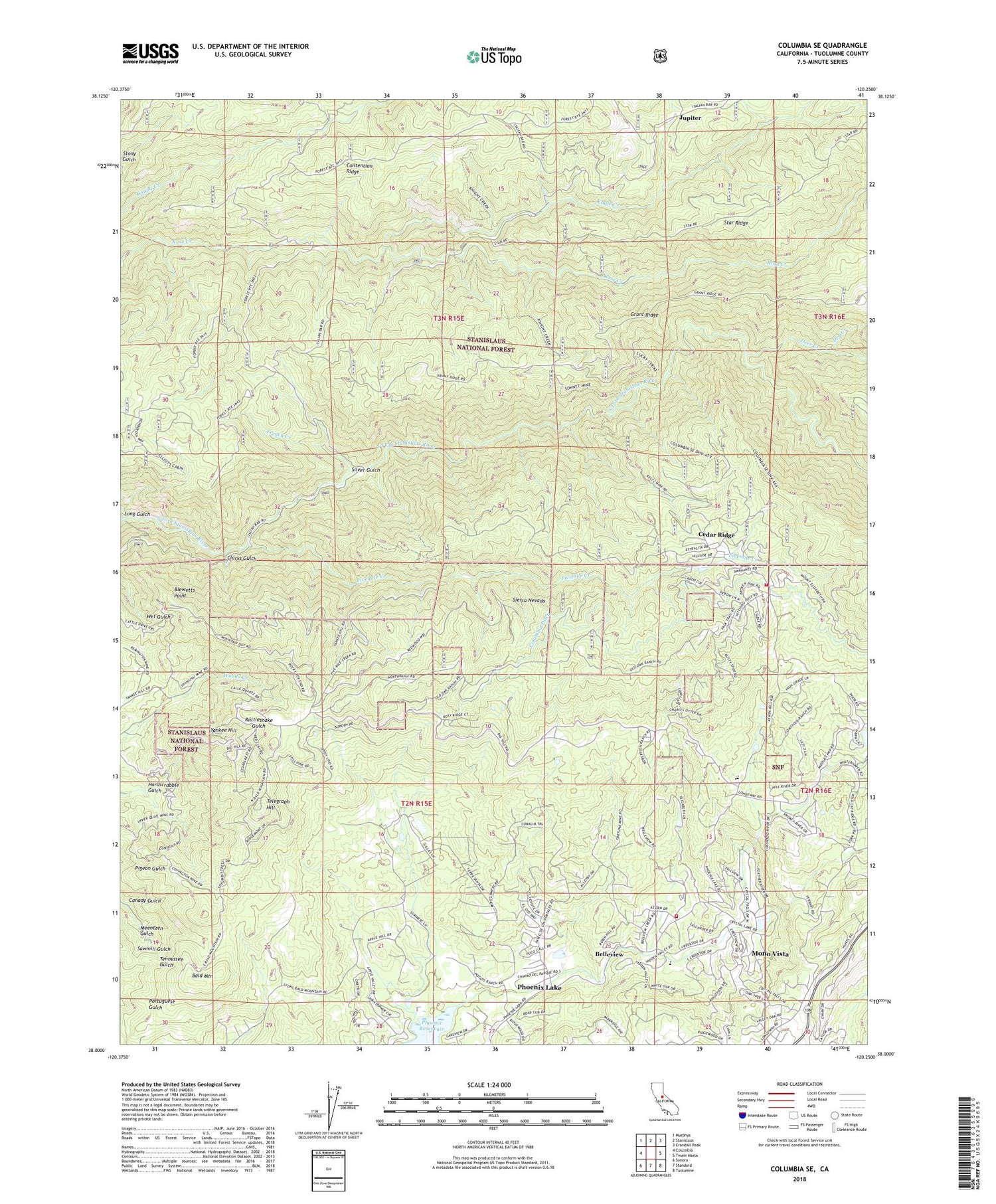
Columbia SE California US Topo Map
Couldn't load pickup availability
Also explore the Columbia SE Forest Service Topo of this same quad for updated USFS data
2021 topographic map quadrangle Columbia SE in the state of California. Scale: 1:24000. Based on the newly updated USGS 7.5' US Topo map series, this map is in the following counties: Tuolumne. The map contains contour data, water features, and other items you are used to seeing on USGS maps, but also has updated roads and other features. This is the next generation of topographic maps. Printed on high-quality waterproof paper with UV fade-resistant inks.
Quads adjacent to this one:
West: Columbia
Northwest: Murphys
North: Stanislaus
Northeast: Crandall Peak
East: Twain Harte
Southeast: Tuolumne
South: Standard
Southwest: Sonora
This map covers the same area as the classic USGS quad with code o38120a3.
Contains the following named places: American Camp Station, Apple Valley Estates, Bald Mountain, Belleview, Belleview Acres, Belleview Elementary School, Bellwood Estates, Blewetts Point, Brentwood Lake, Canady Gulch, Cedar Ridge, Cedar Ridge Census Designated Place, Cedar Rock Lodge, Chaparral Heights, Clarks Gulch, Columbia Ditch, Comstock Ranch, Contention Mine, Contention Ridge, Crystal Falls, Dambacher Mountain Memorial Cemetery, Deer Creek, Dry Creek, Eagle Creek, Five Mile Regional Center, Fivemile Creek, French Camp, French Creek, Gold Ridge Mine, Goldmont Forest, Grant Mine, Hardscrabble Gulch, Hatler Mill, Indian Girl Mine, Italian Bar, Italian Ranch, Jupiter, Keltz Mine, Long Gulch, Lucky Strike Mine, Meentzen Gulch, Mono Vista Census Designated Place, Mountain Lily Mine, Noonday Mine, Old Oak Ranch, Phoenix Lake, Phoenix Lake Census Designated Place, Phoenix Lake County Club Estates, Phoenix Lake Golf Course, Phoenix Lake-Cedar Ridge Census Designated Place, Phoenix Powerhouse, Phoenix Reservoir, Ridgeway Mine, Rifle Mine, Ripperton Mine, Scenic Heights, Shanghai Mine, Silver Gulch, Sonnet Mine, Sonora Meadows, Star Mine, Telegraph Hill, Tuolumne County Fire Department Station 57 Crystal Falls, Tuolumne County Fire Department Station 58 Cedar Ridge, Volunteer Mine, White Oak Estates, Yankee Hill


