MyTopo
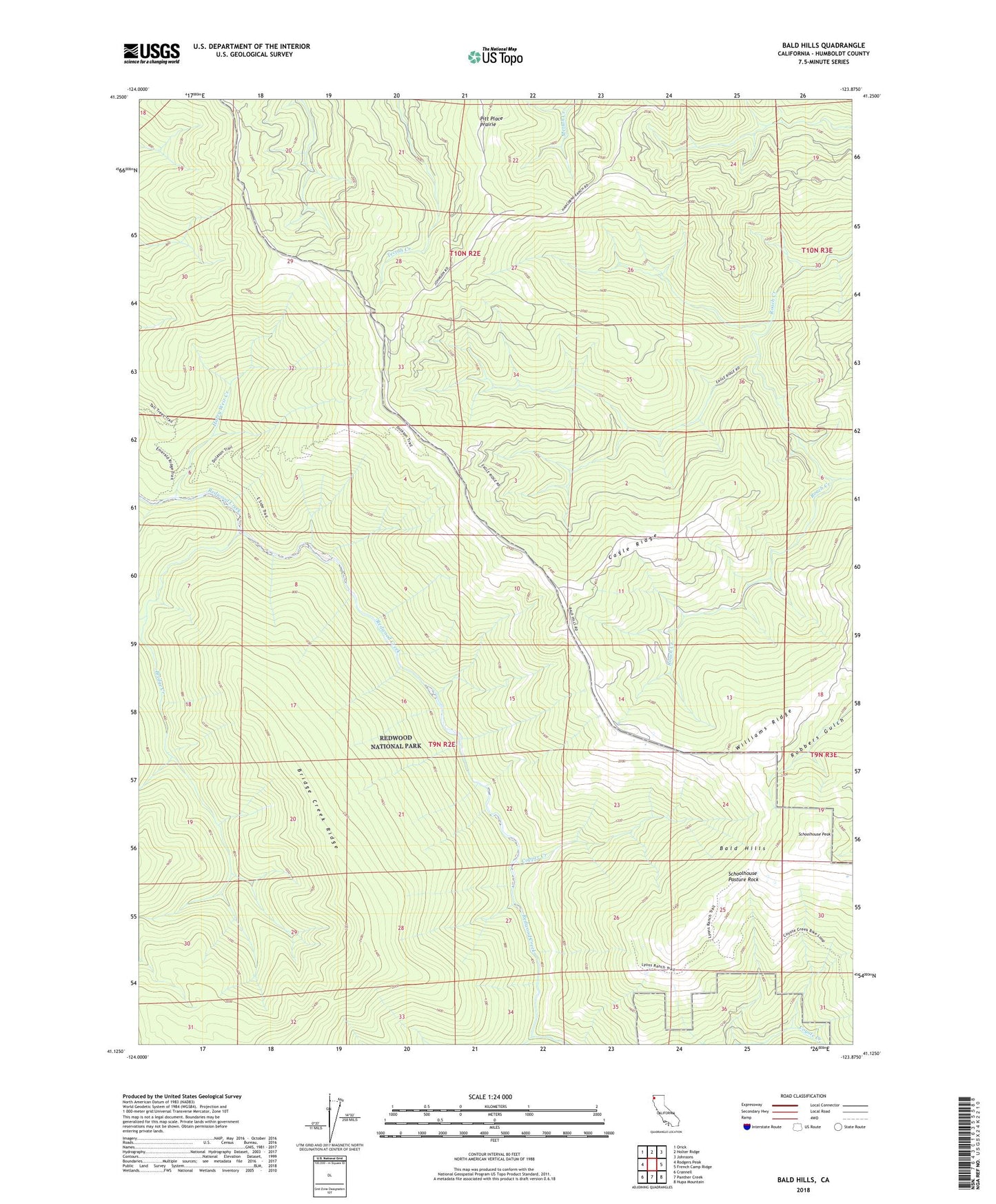
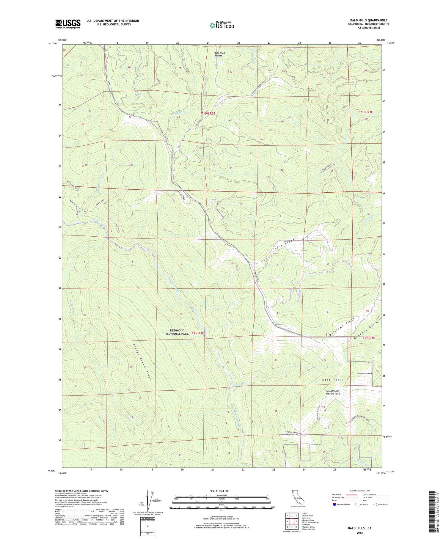
Bald Hills California US Topo Map
Couldn't load pickup availability
2021 topographic map quadrangle Bald Hills in the state of California. Scale: 1:24000. Based on the newly updated USGS 7.5' US Topo map series, this map is in the following counties: Humboldt. The map contains contour data, water features, and other items you are used to seeing on USGS maps, but also has updated roads and other features. This is the next generation of topographic maps. Printed on high-quality waterproof paper with UV fade-resistant inks.
Quads adjacent to this one:
West: Rodgers Peak
Northwest: Orick
North: Holter Ridge
Northeast: Johnsons
East: French Camp Ridge
Southeast: Hupa Mountain
South: Panther Creek
Southwest: Crannell
This map covers the same area as the classic USGS quad with code o41123b8.
Contains the following named places: Anton Lyons Ranch, Bald Hills, Bald Hills School, Bear Prairie, Bridge Creek, Bridge Creek Ridge, Cagle Ridge, Cagle Ridge Prairie, Childs Hill Prairie, Copper Creek, Counts Hill Prairie, Cuddy Cabin, Cuddy Prairie, Devils Creek, Doiason Hill Prairie, Elk Camp, Graham and McCombs Ranch, Griffith Place, Harry Weir Creek, Hog Prairie, Little Bear Prairie, Pitt Place Prairie, Roach Creek Hole, Schoolhouse Pasture, Schoolhouse Pasture Rock, Schoolhouse Peak, Schoolhouse Peak Lookout, Sidehill Prairie, Smith Prairie, Thompson Prairie, Tick Prairie, Tomlinson Brothers Ranch, ZIP Code: 95555