MyTopo
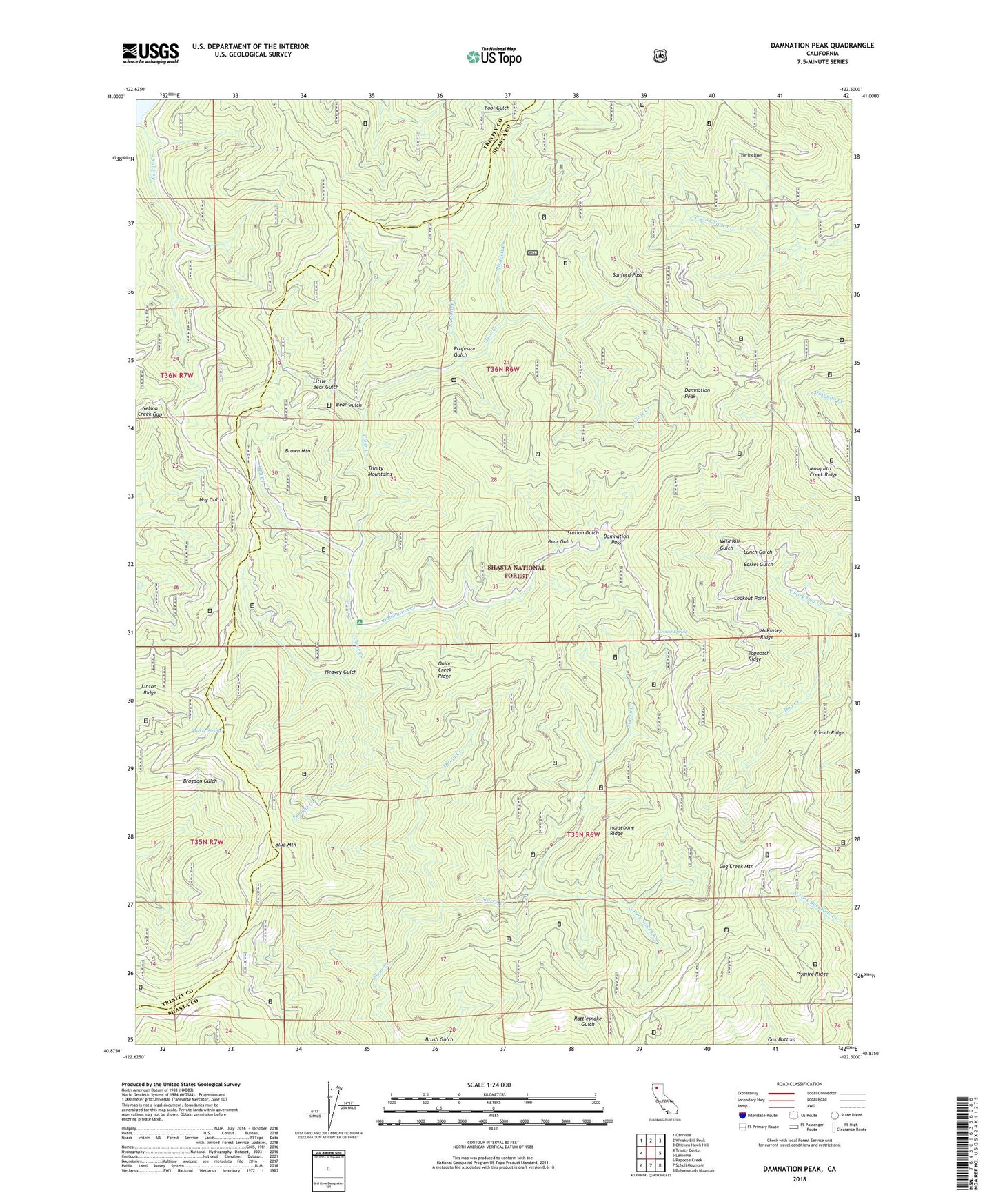
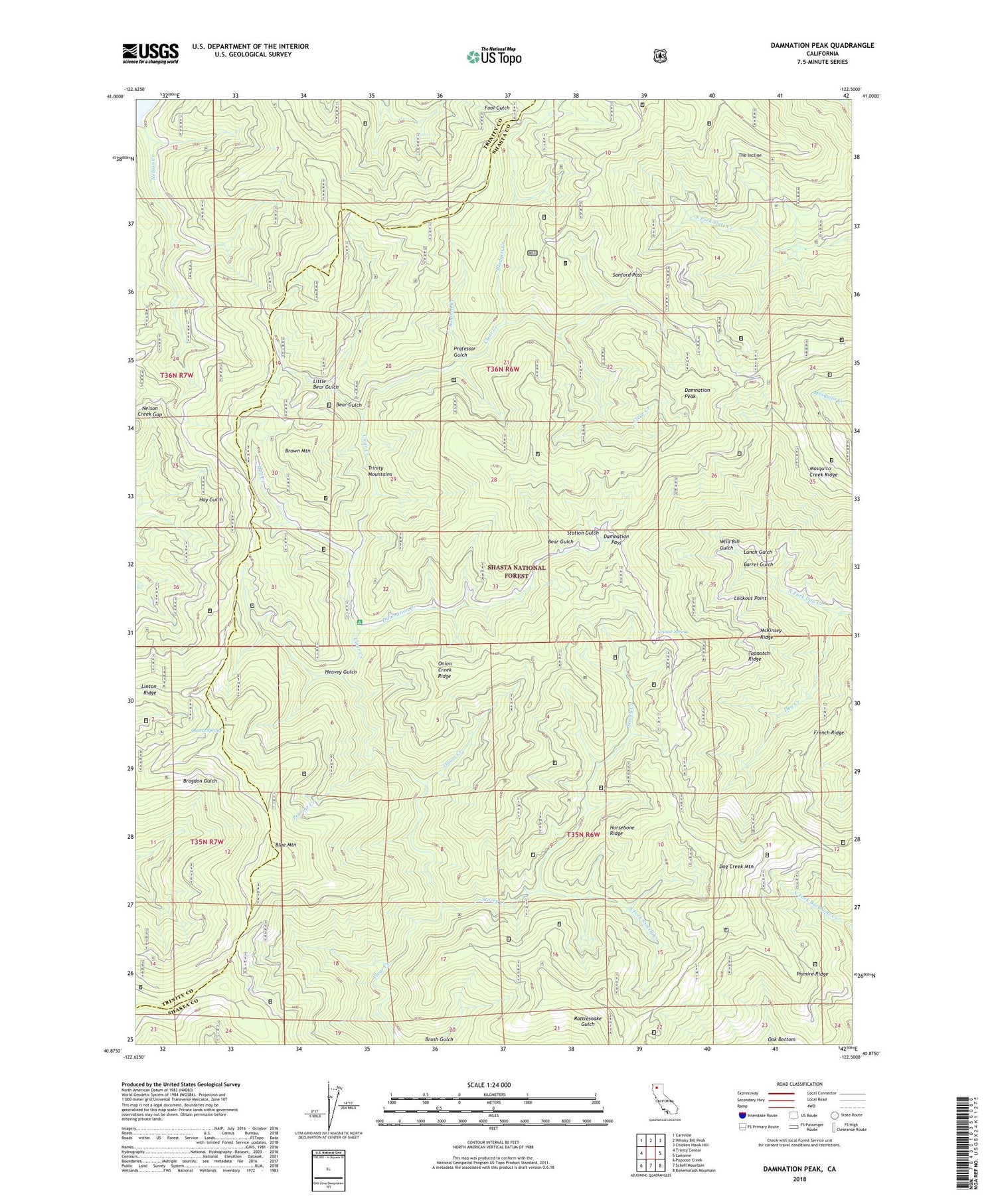
Damnation Peak California US Topo Map
Couldn't load pickup availability
Also explore the Damnation Peak Forest Service Topo of this same quad for updated USFS data
2022 topographic map quadrangle Damnation Peak in the state of California. Scale: 1:24000. Based on the newly updated USGS 7.5' US Topo map series, this map is in the following counties: Shasta, Trinity. The map contains contour data, water features, and other items you are used to seeing on USGS maps, but also has updated roads and other features. This is the next generation of topographic maps. Printed on high-quality waterproof paper with UV fade-resistant inks.
Quads adjacent to this one:
West: Trinity Center
Northwest: Carrville
North: Whisky Bill Peak
Northeast: Chicken Hawk Hill
East: Lamoine
Southeast: Bohemotash Mountain
South: Schell Mountain
Southwest: Papoose Creek
This map covers the same area as the classic USGS quad with code o40122h5.
Contains the following named places: Barrel Gulch, Bear Gulch, Blodgett Creek, Blue Mountain, Brown Mountain, Budweiser Gap, Cates Mine, Clear Creek Camp Ground, Damnation Creek, Damnation Pass, Damnation Peak, Dog Creek Mountain, Fool Gulch Camp, French Ridge, Grouse Spring, Heavey Gulch, Heavey Sheep Camp, Hell Creek, Horsebone Ridge, Lamoine Mill Site, Linton Ridge, Little Bear Gulch, Lookout Point, Lunch Gulch, McKinsey Ridge, Mosquito Creek Ridge, Nelson Creek Gap, North Fork Dog Creek, Oak Bottom, Onion Creek, Onion Creek Ridge, Peavine Creek, Pismire Ridge, Professor Gulch, Quartz Spring, Sanford Creek, Sanford Pass, South Fork Stacey Creek, Stacey Creek, Station Gulch, Sugar Pine Sheep Camp, The Incline, Tollhouse, Topnotch Ridge, Wild Bill Gulch