MyTopo
Whisky Bill Peak California US Topo Map
Couldn't load pickup availability
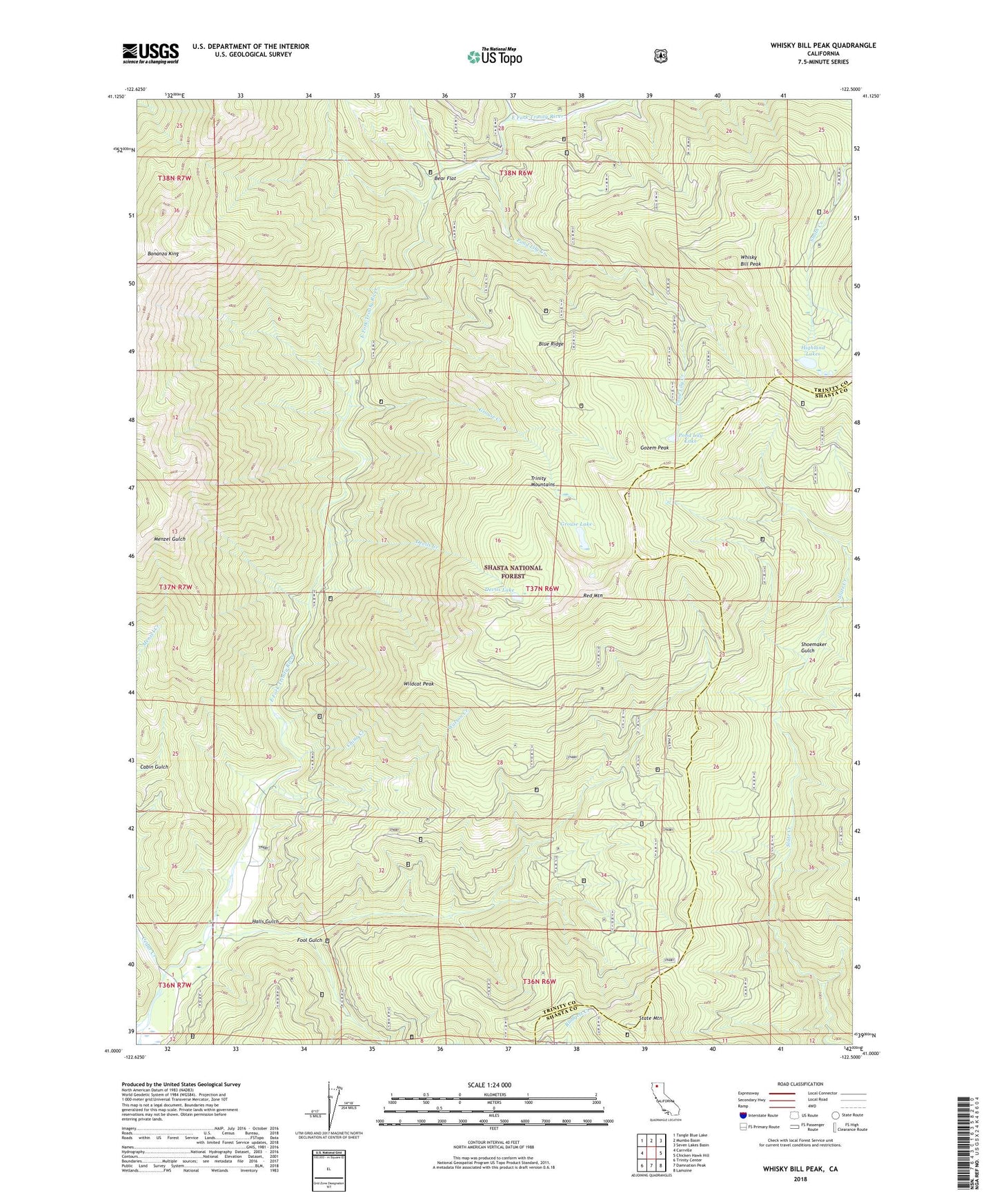
2021 topographic map quadrangle Whisky Bill Peak in the state of California. Scale: 1:24000. Based on the newly updated USGS 7.5' US Topo map series, this map is in the following counties: Trinity, Shasta. The map contains contour data, water features, and other items you are used to seeing on USGS maps, but also has updated roads and other features. This is the next generation of topographic maps. Printed on high-quality waterproof paper with UV fade-resistant inks.
Quads adjacent to this one:
West: Carrville
Northwest: Tangle Blue Lake
North: Mumbo Basin
Northeast: Seven Lakes Basin
East: Chicken Hawk Hill
Southeast: Lamoine
South: Damnation Peak
Southwest: Trinity Center
This map covers the same area as the classic USGS quad with code o41122a5.
Contains the following named places: Bear Flat, Blue Ridge, Cedar Creek, China Creek, Devils Creek, Devils Lake, East Fork Trinity River, Fool Gulch, Gozem Peak, Grouse Creek, Grouse Lake, Halls Gulch, Highland Lakes, Highland Mine, Mumbo Creek, Pond Lily Creek, Pond Lily Lake, Red Mountain, Shoemaker Gulch, State Mountain, Watson Creek, Whipple Ranch, Whisky Bill Peak, Wildcat Peak