MyTopo
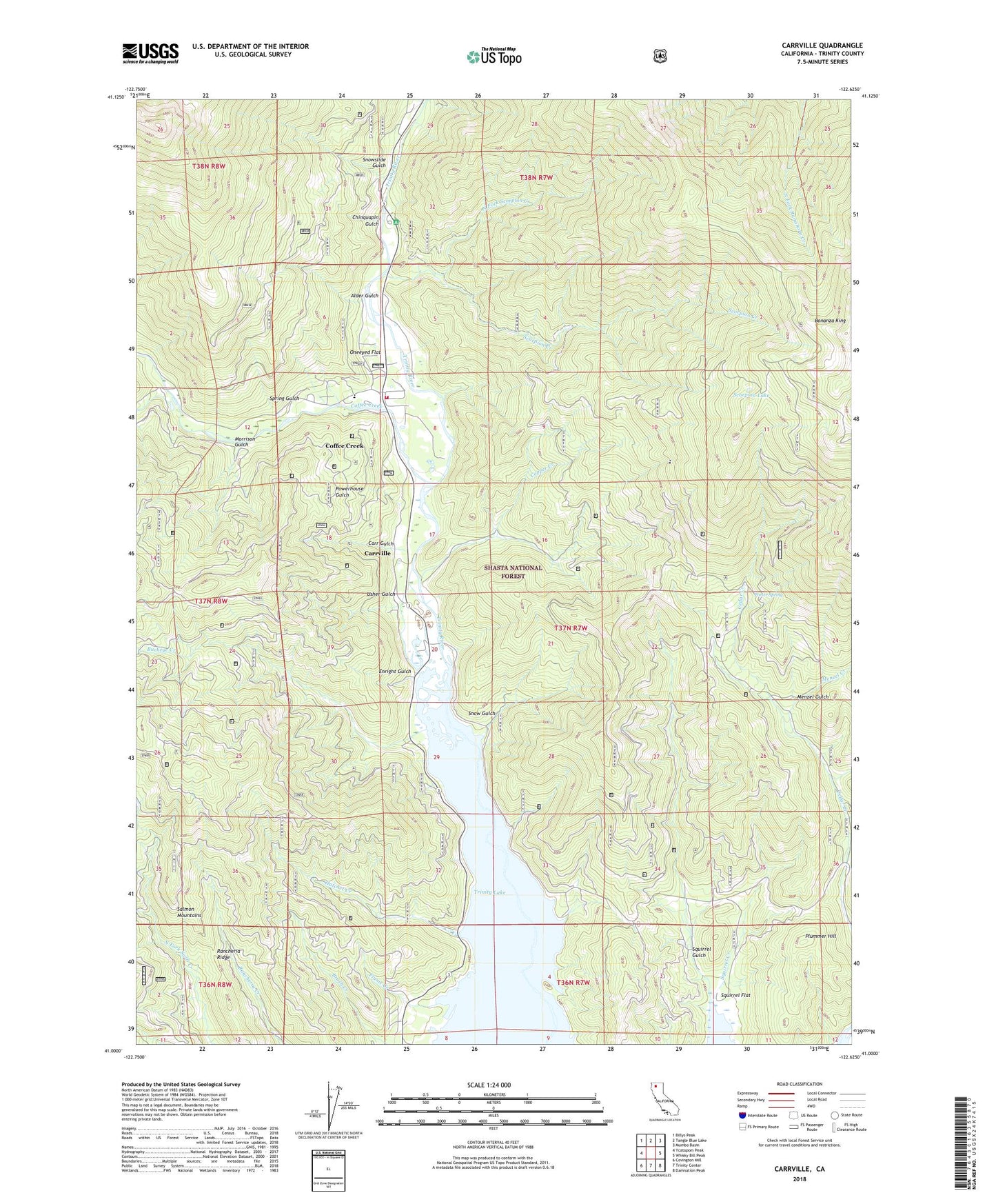
Carrville California US Topo Map
Couldn't load pickup availability
Also explore the Carrville Forest Service Topo of this same quad for updated USFS data
2021 topographic map quadrangle Carrville in the state of California. Scale: 1:24000. Based on the newly updated USGS 7.5' US Topo map series, this map is in the following counties: Trinity. The map contains contour data, water features, and other items you are used to seeing on USGS maps, but also has updated roads and other features. This is the next generation of topographic maps. Printed on high-quality waterproof paper with UV fade-resistant inks.
Quads adjacent to this one:
West: Ycatapom Peak
Northwest: Billys Peak
North: Tangle Blue Lake
Northeast: Mumbo Basin
East: Whisky Bill Peak
Southeast: Damnation Peak
South: Trinity Center
Southwest: Covington Mill
This map covers the same area as the classic USGS quad with code o41122a6.
Contains the following named places: Alder Gulch, Billys Peak Lookout, Bonanza King, Bonanza King Mine, Brush Creek, Buckeye Creek, Cabin Gulch, Carr Gulch, Carrville, Chinquapin Gulch, Coffee Creek, Coffee Creek Census Designated Place, Coffee Creek Elementary School, Coffee Creek Station, Coffee Creek Volunteer Fire Department, Copper Creek, Deadhorse Creek, Enright Gulch, Flume Creek, Hatchet Creek, Kadas Mine, Lick Creek, Little Boulder Creek, Menzel Creek, Menzel Gulch, Minnehaha Creek, Morrison Gulch, North Fork Scorpion Creek, Oneeyed Flat, Plummer Hill, Porter Spring, Powerhouse Gulch, Rancheria Ridge, Scorpion Creek, Scorpion Lake, Snow Gulch, Snowslide Gulch, Spring Gulch, Squirrel Creek, Squirrel Flat, Squirrel Gulch, Stringtown, Trinity River Campground, Usher Gulch