
MyTopo
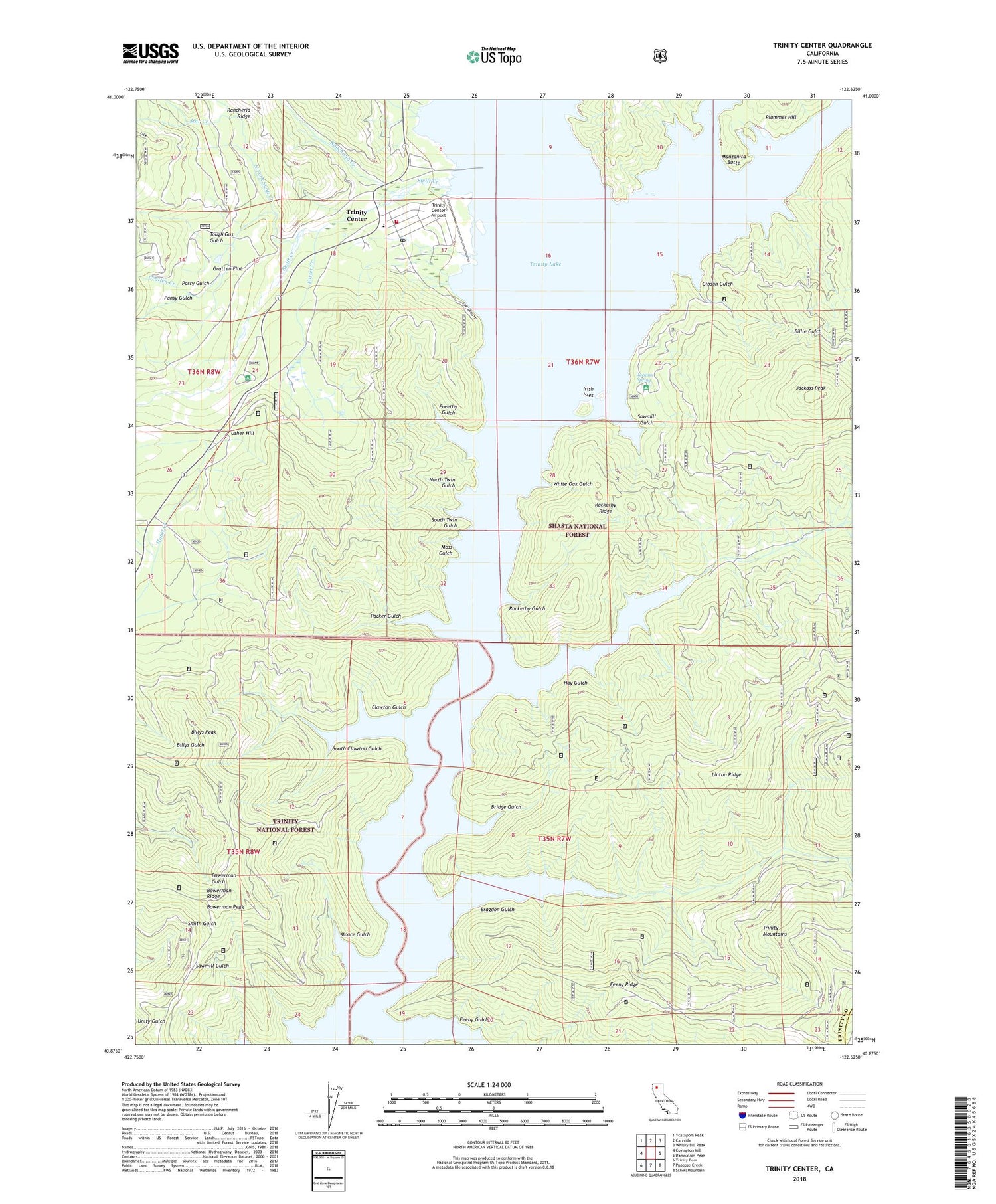
Trinity Center California US Topo Map
Couldn't load pickup availability
Also explore the Trinity Center Forest Service Topo of this same quad for updated USFS data
2022 topographic map quadrangle Trinity Center in the state of California. Scale: 1:24000. Based on the newly updated USGS 7.5' US Topo map series, this map is in the following counties: Trinity, Shasta. The map contains contour data, water features, and other items you are used to seeing on USGS maps, but also has updated roads and other features. This is the next generation of topographic maps. Printed on high-quality waterproof paper with UV fade-resistant inks.
Quads adjacent to this one:
West: Covington Mill
Northwest: Ycatapom Peak
North: Carrville
Northeast: Whisky Bill Peak
East: Damnation Peak
Southeast: Schell Mountain
South: Papoose Creek
Southwest: Trinity Dam
This map covers the same area as the classic USGS quad with code o40122h6.
Contains the following named places: Billie Gulch, Billys Peak, Bowerman Peak, Bowerman Ridge, Bragdon, Bragdon Gulch, Bridge Gulch, Clawton Gulch, Coffee Ditch, Feeny Gulch, Feeny Ridge, Foster Creek, Freethy Gulch, Gibson Gulch, Gratten Creek, Gratten Flat, Hay Gulch, Irish Isles, Jackass Peak, Jackass Spring, Jackass Spring Campground, Manzanita Butte, Moore Gulch, Moss Gulch, Nelson Creek, North Fork Swift Creek, North Twin Gulch, Norwegian Ranch, Packer Gulch, Pansy Gulch, Parry Gulch, Preacher Meadow Campground, Rackerby Gulch, Rackerby Ridge, Rancheria Creek, Sawmill Gulch, Scott Museum, South Clawton Gulch, South Twin Gulch, Star Creek, Swift Creek, Tepee Gulch Camp, Tough Gus Gulch, Trinity Center, Trinity Center Airport, Trinity Center Boat Ramp and Marina, Trinity Center Census Designated Place, Trinity Center Elementary School, Trinity Center Post Office, Trinity Center Recreation Plus Boat Ramp Marina, Trinity Center Volunteer Fire Department, Usher Hill, White Oak Gulch, Wyntoon


