
MyTopo
Delano West California US Topo Map
Couldn't load pickup availability
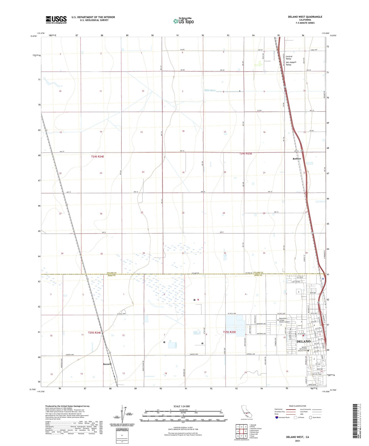
2021 topographic map quadrangle Delano West in the state of California. Scale: 1:24000. Based on the newly updated USGS 7.5' US Topo map series, this map is in the following counties: Tulare, Kern. The map contains contour data, water features, and other items you are used to seeing on USGS maps, but also has updated roads and other features. This is the next generation of topographic maps. Printed on high-quality waterproof paper with UV fade-resistant inks.
Quads adjacent to this one:
West: Allensworth
Northwest: Alpaugh
North: Pixley
Northeast: Sausalito School
East: Delano East
Southeast: McFarland
South: Pond
Southwest: Wasco NW
This map covers the same area as the classic USGS quad with code o35119g3.
Contains the following named places: Albany Park, Albany Park School, American Gun Club, Apostolic Church, Bethel Chapel Filipino Assembly of God Church, Butera, Caratan, Caric, Cesar Chavez Park, Christian Alliance Church, City of Delano, College Ranch, Delano Community Center, Delano Community Correctional Facility, Delano McFarland District Cemetery, Delano Police Department, Earlimart Division, Ellington School, Filipino Assembly of God Church, Filipino Community Council Recreation Center, Fremont Elementary School, Guadalupe Catholic Church, KCHJ-AM (Delano), Kern County Fire Department Station 37 Delano West, Kern Valley State Prison, Kernell, North Kern State Prison, North Kern State Prison Fire Department, Pagliarulo, Primera Iglesia Bautista, Radnor, Saint Paul Baptist Church, Spanish Assembly of God Church, Sun Valley Dairy, Temple Bautista Belen, Valle Vista Park, Valle Vista School, White River, ZIP Code: 93219


