MyTopo
McFarland California US Topo Map
Couldn't load pickup availability
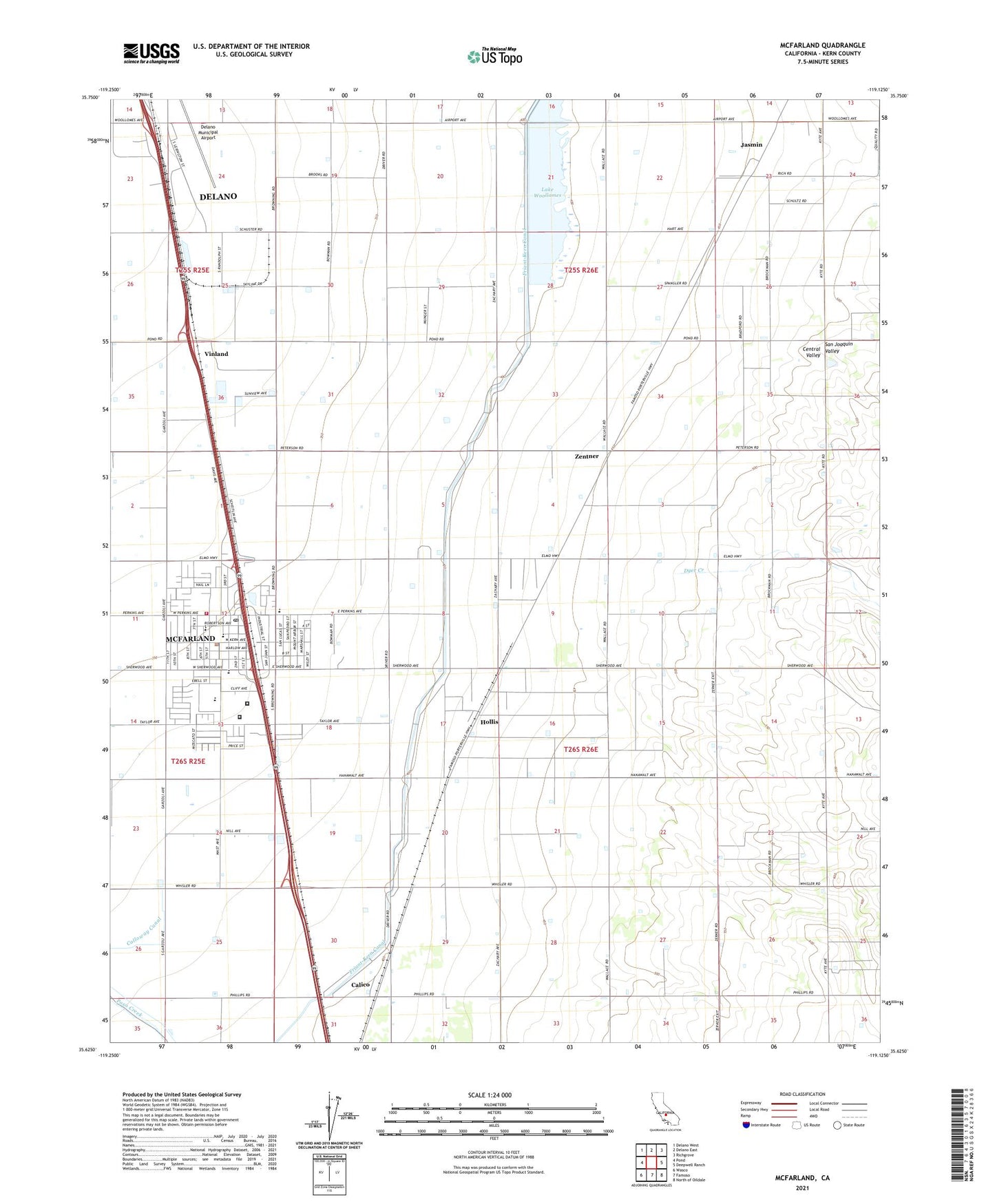
2021 topographic map quadrangle McFarland in the state of California. Scale: 1:24000. Based on the newly updated USGS 7.5' US Topo map series, this map is in the following counties: Kern. The map contains contour data, water features, and other items you are used to seeing on USGS maps, but also has updated roads and other features. This is the next generation of topographic maps. Printed on high-quality waterproof paper with UV fade-resistant inks.
Quads adjacent to this one:
West: Pond
Northwest: Delano West
North: Delano East
Northeast: Richgrove
East: Deepwell Ranch
Southeast: North of Oildale
South: Famoso
Southwest: Wasco
This map covers the same area as the classic USGS quad with code o35119f2.
Contains the following named places: Browning Road Elementary School, Browning Road Park, Calico, Central Valley Modified Community Correctional Facility, City of McFarland, Delano Army Air Field, Delano Municipal Airport, Delano-McFarland Division, Dyer Creek, First Missionary Baptist Church, Golden State Modified Community Correctional Facility, Hollis, Jackson Branch Kern County Library, Jasmin, Jasmin School, Kern Avenue Elementary School, Kern County Fire Department Station 33 McFarland, Lake Woollomes, Mc Farland Post Office, McFarland, McFarland City Hall, McFarland High School, McFarland Middle School, McFarland Park, McFarland Police Department, Raymond-Souche Ranch, San Joaquin High School, V B Ranch Dairy, Vinland, Zentner, ZIP Code: 93250