MyTopo
Sausalito School California US Topo Map
Couldn't load pickup availability
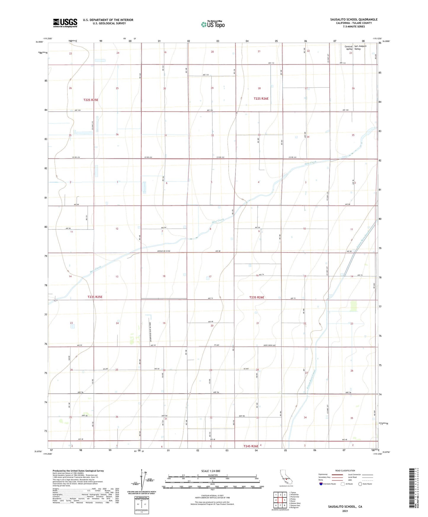
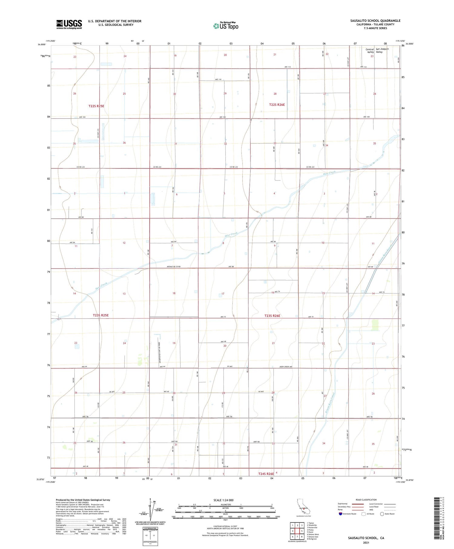
2021 topographic map quadrangle Sausalito School in the state of California. Scale: 1:24000. Based on the newly updated USGS 7.5' US Topo map series, this map is in the following counties: Tulare. The map contains contour data, water features, and other items you are used to seeing on USGS maps, but also has updated roads and other features. This is the next generation of topographic maps. Printed on high-quality waterproof paper with UV fade-resistant inks.
Quads adjacent to this one:
West: Pixley
Northwest: Tipton
North: Woodville
Northeast: Porterville
East: Ducor
Southeast: Richgrove
South: Delano East
Southwest: Delano West
This map covers the same area as the classic USGS quad with code o35119h2.
Contains the following named places: De Groot Dairy, De Groot Dairy Number 4, Deer Creek Ranch, Saucelito, Saucelito Elementary School