
MyTopo
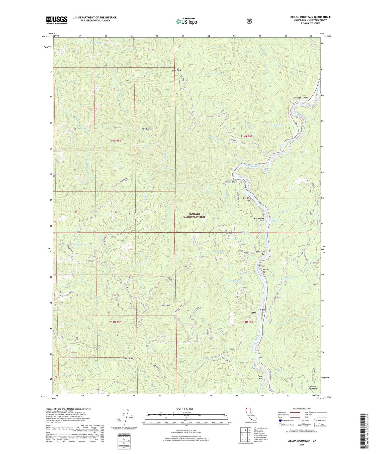
Dillon Mountain California US Topo Map
Couldn't load pickup availability
Also explore the Dillon Mountain Forest Service Topo of this same quad for updated USFS data
2021 topographic map quadrangle Dillon Mountain in the state of California. Scale: 1:24000. Based on the newly updated USGS 7.5' US Topo map series, this map is in the following counties: Siskiyou. The map contains contour data, water features, and other items you are used to seeing on USGS maps, but also has updated roads and other features. This is the next generation of topographic maps. Printed on high-quality waterproof paper with UV fade-resistant inks.
Quads adjacent to this one:
West: Chimney Rock
Northwest: Prescott Mountain
North: Bear Peak
Northeast: Clear Creek
East: Ukonom Mountain
Southeast: Somes Bar
South: Bark Shanty Gulch
Southwest: Lonesome Ridge
This map covers the same area as the classic USGS quad with code o41123e5.
Contains the following named places: Aubrey Cemetery, Aubrey Creek, Bear Gulch, Blue Nose Bluff, Blue Nose Mine, Burns Creek, Carter Creek, Cedar Creek, Coffee Can Creek, Cottage Grove, Dark Canyon, Dillion Creek Campground, Dillon Creek, Dillon Mountain, Dobbins Creek, Elliott Creek, Eyese Bar, Eyese Creek, Iron Phone, Jackass Creek, Kennedy Creek, Kennedy Homestead, Lone Pine Bar, Mill Creek, Mud Creek, North Fork Dillon Creek, Patsiluvra, Persido Bar, Pony Peak, Rattlesnake Bar, Rock Creek, Soldier Creek, Squirrel Creek, Swillup Creek, Thomas Creek, Three Creeks, Ti Bar, Ti Bar Forest Service Station, Ti Bar School, Ti Creek


