MyTopo
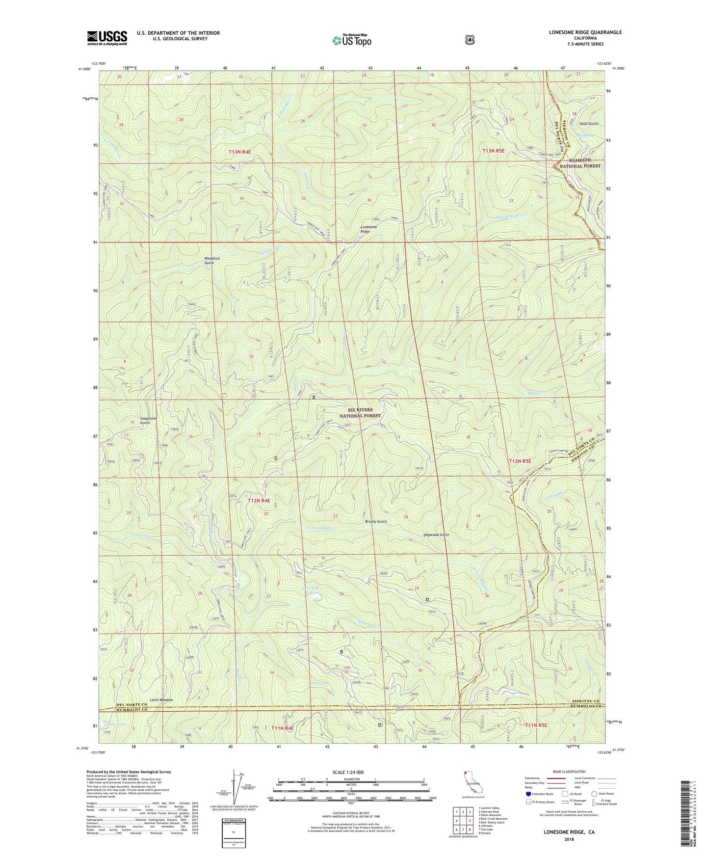
Lonesome Ridge California US Topo Map
Couldn't load pickup availability
Also explore the Lonesome Ridge Forest Service Topo of this same quad for updated USFS data
2022 topographic map quadrangle Lonesome Ridge in the state of California. Scale: 1:24000. Based on the newly updated USGS 7.5' US Topo map series, this map is in the following counties: Del Norte, Siskiyou, Humboldt. The map contains contour data, water features, and other items you are used to seeing on USGS maps, but also has updated roads and other features. This is the next generation of topographic maps. Printed on high-quality waterproof paper with UV fade-resistant inks.
Quads adjacent to this one:
West: Blue Creek Mountain
Northwest: Summit Valley
North: Chimney Rock
Northeast: Dillon Mountain
East: Bark Shanty Gulch
Southeast: Orleans
South: Fish Lake
Southwest: Johnsons
This map covers the same area as the classic USGS quad with code o41123d6.
Contains the following named places: Brushy Gulch, Dans Creek, Deer Lick Creek, Deer Lick Lake, Dogwood Gulch, East Fork Bluff Creek, Ferris Camp, Laird Meadow, Lightning Ridge, Lonesome Ridge, Louse Camp, McDuff Camp, North Fork Bluff Creek, Notice Creek, Onion Lake, Salal Spring, Scorpion Creek, Vans Camp, Wildcat Creek, Woodtick Gulch