MyTopo
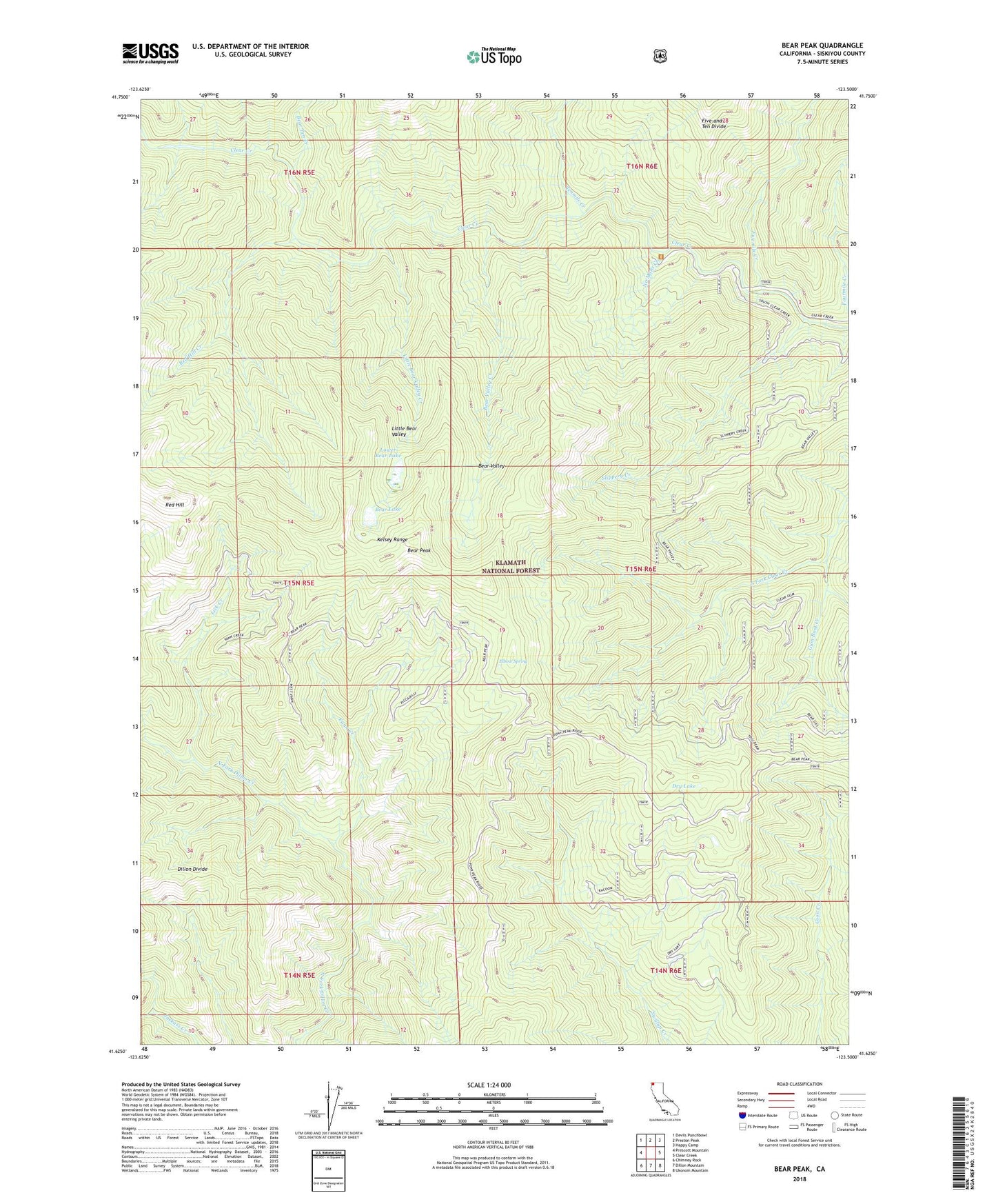
Bear Peak California US Topo Map
Couldn't load pickup availability
Also explore the Bear Peak Forest Service Topo of this same quad for updated USFS data
2021 topographic map quadrangle Bear Peak in the state of California. Scale: 1:24000. Based on the newly updated USGS 7.5' US Topo map series, this map is in the following counties: Siskiyou. The map contains contour data, water features, and other items you are used to seeing on USGS maps, but also has updated roads and other features. This is the next generation of topographic maps. Printed on high-quality waterproof paper with UV fade-resistant inks.
Quads adjacent to this one:
West: Prescott Mountain
Northwest: Devils Punchbowl
North: Preston Peak
Northeast: Happy Camp
East: Clear Creek
Southeast: Ukonom Mountain
South: Dillon Mountain
Southwest: Chimney Rock
This map covers the same area as the classic USGS quad with code o41123f5.
Contains the following named places: Bear Lake, Bear Peak, Bear Pen Creek, Bear Valley, Bear Valley Creek, Dry Lake, Elbow Spring, Fivemile Creek, Gum Boot Creek, Kelsey Trail, Lick Creek, Little Bear Valley, Little Bear Valley Creek, Lower Bear Lake, No Mans Creek, Red Hill, Red Hill Creek, Slippery Creek, Tenmile Creek, Vann Creek