MyTopo
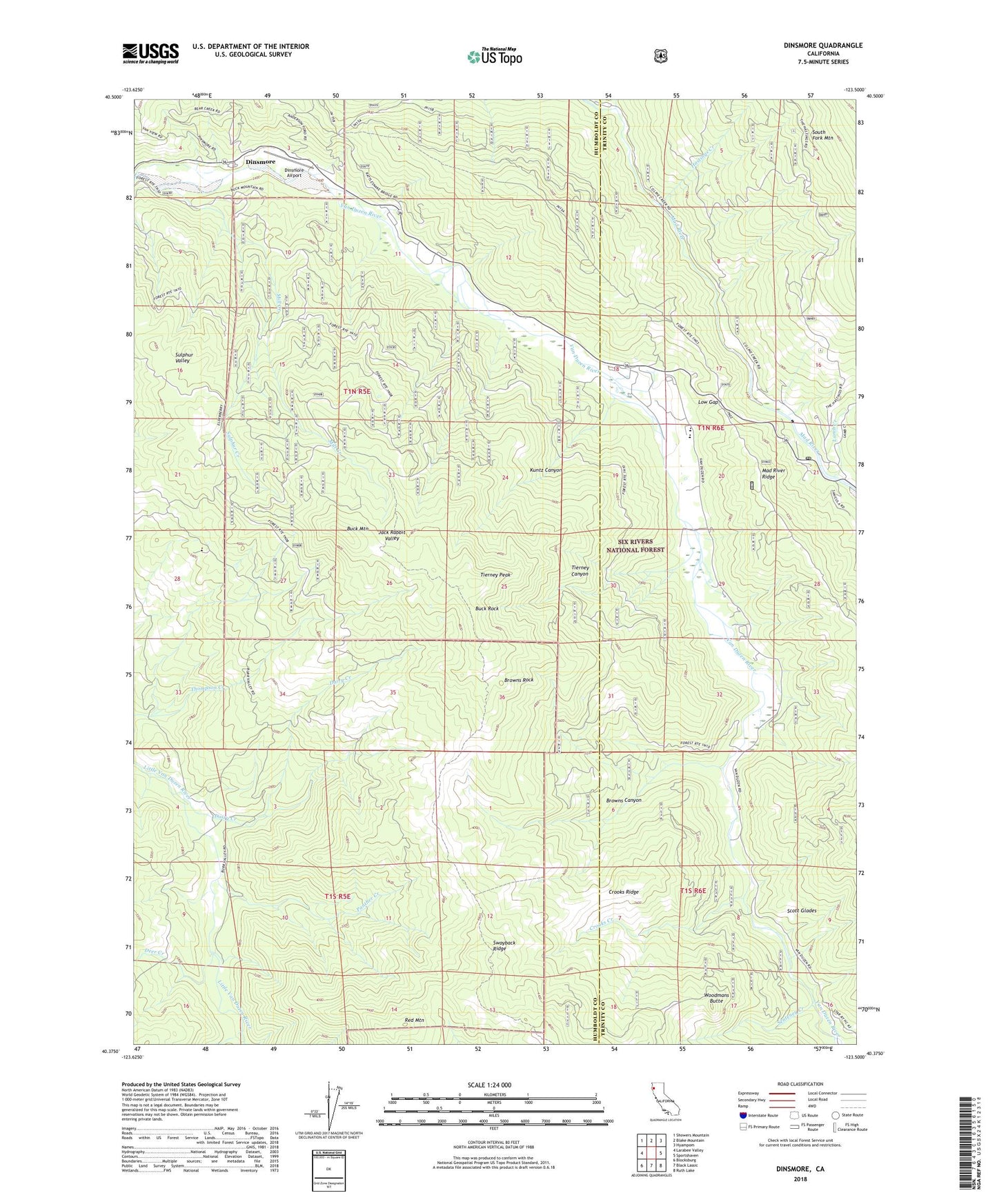
Dinsmore California US Topo Map
Couldn't load pickup availability
Also explore the Dinsmore Forest Service Topo of this same quad for updated USFS data
2022 topographic map quadrangle Dinsmore in the state of California. Scale: 1:24000. Based on the newly updated USGS 7.5' US Topo map series, this map is in the following counties: Humboldt, Trinity. The map contains contour data, water features, and other items you are used to seeing on USGS maps, but also has updated roads and other features. This is the next generation of topographic maps. Printed on high-quality waterproof paper with UV fade-resistant inks.
Quads adjacent to this one:
West: Larabee Valley
Northwest: Showers Mountain
North: Blake Mountain
Northeast: Hyampom
East: Sportshaven
Southeast: Ruth Lake
South: Black Lassic
Southwest: Blocksburg
This map covers the same area as the classic USGS quad with code o40123d5.
Contains the following named places: Browns Canyon, Browns Rock, Buck Mountain, Buck Rock, Cobb Ranch, County Line Creek, Crooks Creek, Crooks Ridge, Dairy Creek, Deer Creek, Dinsmore, Dinsmore Airport, Dinsmore Pit, Hastings Creek, Jack Rabbit Valley, Kuntz Canyon, Lamb Creek, Low Gap, Mad River, Mad River Post Office, Mad River Ranger Station, Mill Creek, Panther Creek, Red Mountain, Scott Glades, Senteney Creek, Simmons Camp, Southern Trinity Area Rescue, Southern Trinity High School, Sulphur Creek, Sulphur Valley, Tierney Canyon, Tierney Peak, Van Duzen Elementary School, Van Duzen Public Camp, Woodmans Butte