MyTopo
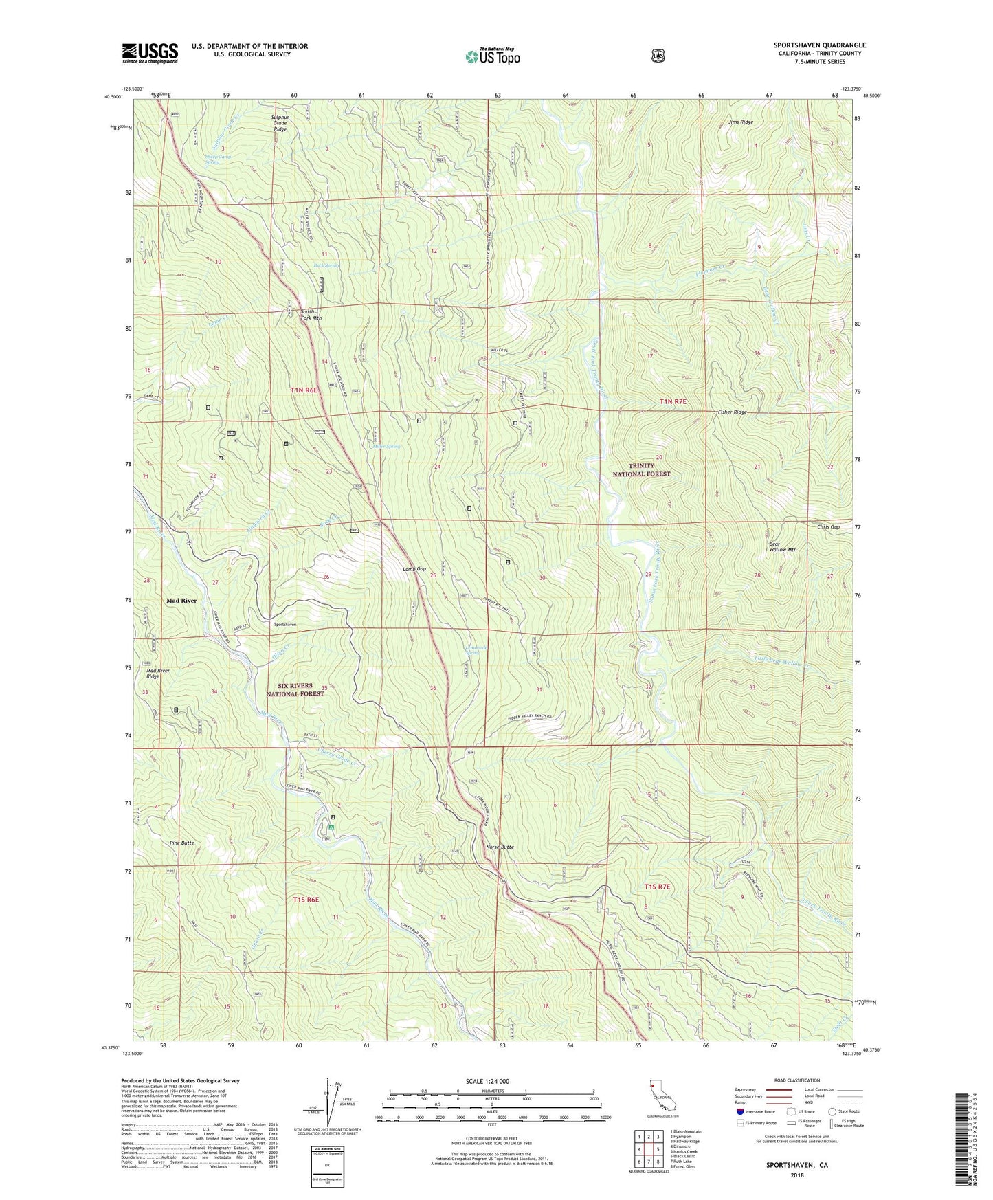
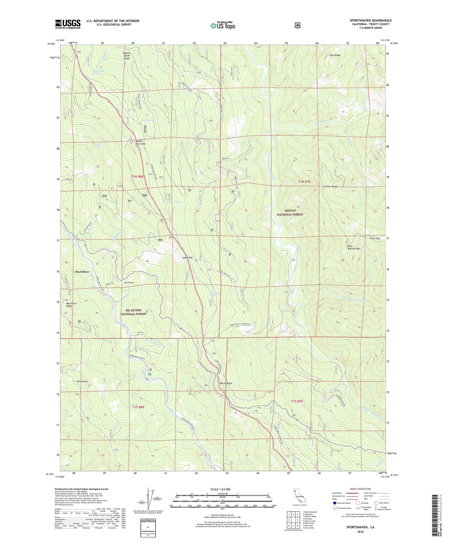
Sportshaven California US Topo Map
Couldn't load pickup availability
Also explore the Sportshaven Forest Service Topo of this same quad for updated USFS data
2022 topographic map quadrangle Sportshaven in the state of California. Scale: 1:24000. Based on the newly updated USGS 7.5' US Topo map series, this map is in the following counties: Trinity. The map contains contour data, water features, and other items you are used to seeing on USGS maps, but also has updated roads and other features. This is the next generation of topographic maps. Printed on high-quality waterproof paper with UV fade-resistant inks.
Quads adjacent to this one:
West: Dinsmore
Northwest: Blake Mountain
North: Hyampom
Northeast: Halfway Ridge
East: Naufus Creek
Southeast: Forest Glen
South: Ruth Lake
Southwest: Black Lassic
This map covers the same area as the classic USGS quad with code o40123d4.
Contains the following named places: Bear Wallow Creek, Bear Wallow Mountain, Buck Spring, Cherry Glade Creek, Chris Gap, Feldmiller Ranch, Fisher Ridge, Grace Creek, Graham Place, Grunerts Place, Hidden Valley Ranch, Jims Creek, Jims Ridge, Klondike Mine, Lamb Gap, Lemonade Spring, Little Bear Wallow Creek, Mad River Campground, Mad River Census Designated Place, Maynard Creek, McClellan Place, Miller Place, Miller Spring, Miller Spring Recreation Site, Norgaar, Norse Butte, Oak Grove, Olsen Creek, Pine Butte, Plummer Creek, Rock Creek, Sand Place, Sheep Camp Spring, Sids Place, Sportshaven, Sulphur Glade Ridge, Windy Nip