
MyTopo
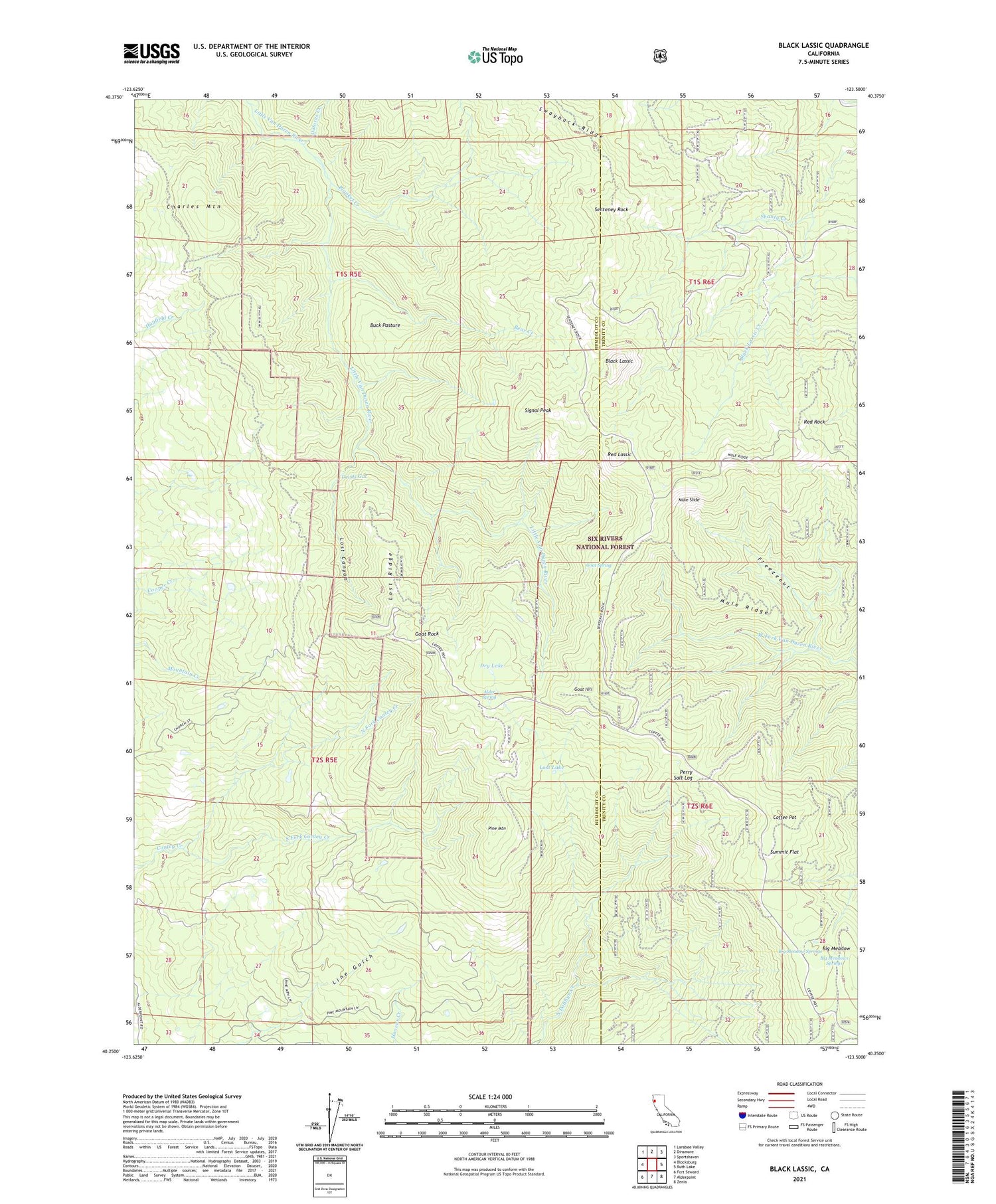
Black Lassic California US Topo Map
Couldn't load pickup availability
Also explore the Black Lassic Forest Service Topo of this same quad for updated USFS data
2021 topographic map quadrangle Black Lassic in the state of California. Scale: 1:24000. Based on the newly updated USGS 7.5' US Topo map series, this map is in the following counties: Humboldt, Trinity. The map contains contour data, water features, and other items you are used to seeing on USGS maps, but also has updated roads and other features. This is the next generation of topographic maps. Printed on high-quality waterproof paper with UV fade-resistant inks.
Quads adjacent to this one:
West: Blocksburg
Northwest: Larabee Valley
North: Dinsmore
Northeast: Sportshaven
East: Ruth Lake
Southeast: Zenia
South: Alderpoint
Southwest: Fort Seward
This map covers the same area as the classic USGS quad with code o40123c5.
Contains the following named places: Alder Spring, Bear Creek, Big Meadow Camp, Big Meadow Springs, Big Meadows Springs, Black Lassic, Blanket Creek, Buck Pasture, Coffee Pot, Devils Gut, Dolores Creek, Dry Lake, Dutchman Camp, Fingal Ranch, Freezeout, Goat Camp, Goat Hill, Goat Rock, Goat Spring, Lassics Lookout, Lost Canyon, Lost Lake, Lost Ridge, Mount Lassic Wilderness, Mule Ridge, Mule Slide, North Fork Conley Creek, Perry Salt Log, Pine Mountain, Red Lassic, Red Rock, Senteney Rock, Signal Peak, South Fork Conley Creek, Summit Camp, Summit Flat, Swayback Ridge


