MyTopo
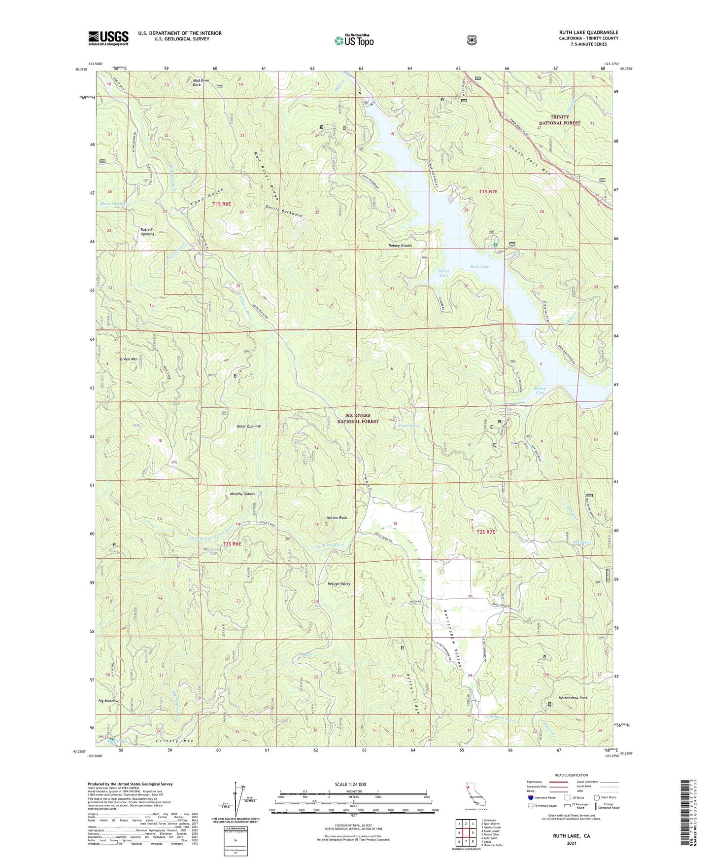
Ruth Lake California US Topo Map
Couldn't load pickup availability
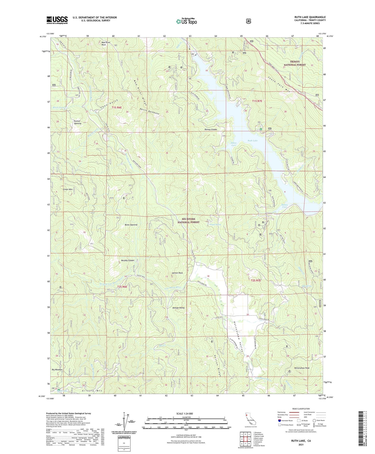
Also explore the Ruth Lake Forest Service Topo of this same quad for updated USFS data
2021 topographic map quadrangle Ruth Lake in the state of California. Scale: 1:24000. Based on the newly updated USGS 7.5' US Topo map series, this map is in the following counties: Trinity. The map contains contour data, water features, and other items you are used to seeing on USGS maps, but also has updated roads and other features. This is the next generation of topographic maps. Printed on high-quality waterproof paper with UV fade-resistant inks.
Quads adjacent to this one:
West: Black Lassic
Northwest: Dinsmore
North: Sportshaven
Northeast: Naufus Creek
East: Forest Glen
Southeast: Shannon Butte
South: Zenia
Southwest: Alderpoint
This map covers the same area as the classic USGS quad with code o40123c4.
Contains the following named places: Allen Spring, Bailey Canyon Campground, Big Meadow, Big Meadow Creek, Black Lassic Creek, Boles Opening, Coon Gulch, Devils Backbone, Dillon Cove, Duncan Ranch, Fir Cove Campground, Gilman Ranch, Green Mountain, Grizzly Mountain, Hale Creek, Hetten Cove, Hetten Creek, Hetten Ridge, Hetten Rock, Hettenshaw Peak, Hettenshaw School, Hettenshaw Valley, Mad River Ranger Station, Mad River Ridge, Mad River Rock, Murphy Glades, Old Wilburn Ranch, Old Willburn Ranch, Old Womans Home, Pickett Creek, Rainey Glades, Red Lassic Creek, Refuge Valley, Robert W Matthews Dam, Ruth Guard Station, Ruth Lake, Rutled Opening, Shanty Creek, Stapp Ranch, Ueland Place, Waggit Spring, Watts Lake, Watts Lake Recreation Site, West Fork Van Duzen River