MyTopo
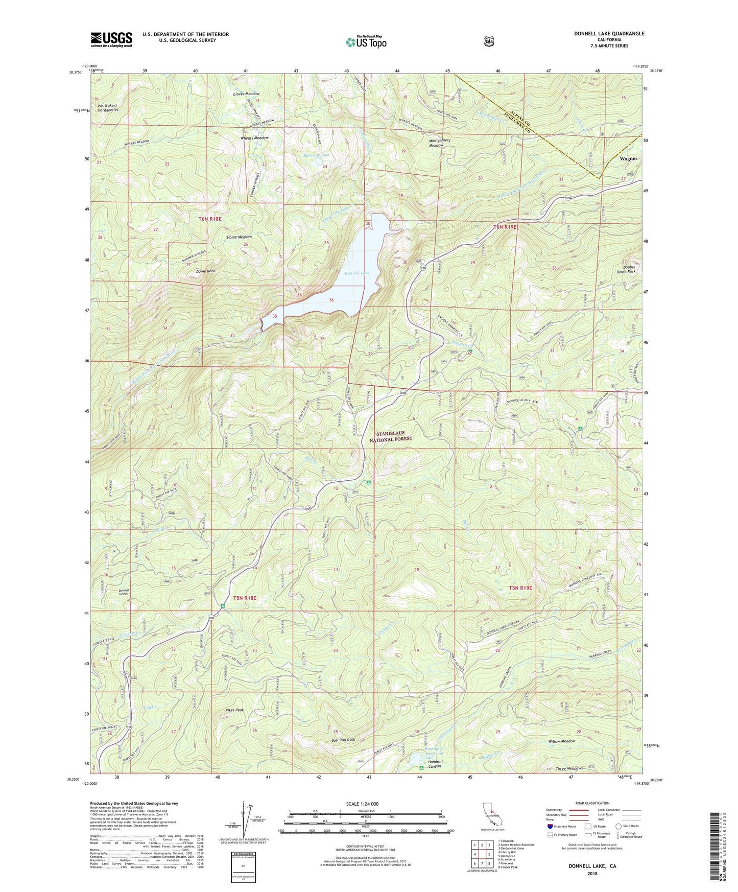
Donnell Lake California US Topo Map
Couldn't load pickup availability
Also explore the Donnell Lake Forest Service Topo of this same quad for updated USFS data
2021 topographic map quadrangle Donnell Lake in the state of California. Scale: 1:24000. Based on the newly updated USGS 7.5' US Topo map series, this map is in the following counties: Tuolumne, Alpine. The map contains contour data, water features, and other items you are used to seeing on USGS maps, but also has updated roads and other features. This is the next generation of topographic maps. Printed on high-quality waterproof paper with UV fade-resistant inks.
Quads adjacent to this one:
West: Liberty Hill
Northwest: Tamarack
North: Spicer Meadow Reservoir
Northeast: Dardanelles Cone
East: Dardanelle
Southeast: Cooper Peak
South: Pinecrest
Southwest: Strawberry
This map covers the same area as the classic USGS quad with code o38119c8.
Contains the following named places: Bull Run Rock, Burgson Lake, Cascade Campground, Cascade Creek, Clark Fork, Clover Meadow, Dardanelles Creek, Dardanelles Outlook, Dome Rock, Donnell Lake, Donnell Tunnel, Donnell Vista Point, Donnell Vista Point Picnic Area, Donnells 62-005 Dam, Double Dome Rock, Drew Creek, Fence Creek, Hammill Canyon, Herring Creek Reservoir, Horse Meadow, McCormick Creek, Middle Fork Stanislaus River, Mill Campground, Mill Creek Cemetery, Montgomery Meadow, Niagara Creek, Niagra Campground, Pikes Peak, Wagner, Wheats Cow Camp, Wheats Meadow, Wheats Meadow Creek, Willow Creek, Willow Meadow