MyTopo
Spicer Meadow Reservoir California US Topo Map
Couldn't load pickup availability
Also explore the Spicer Meadow Reservoir Forest Service Topo of this same quad for updated USFS data
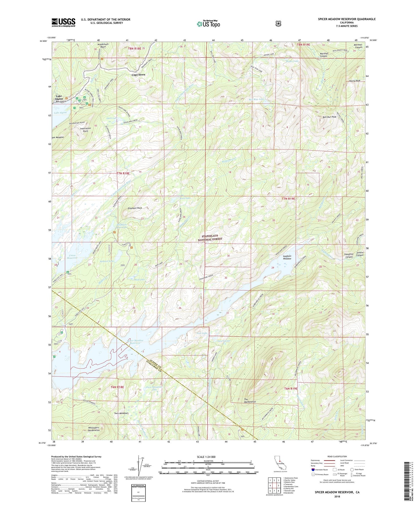
2021 topographic map quadrangle Spicer Meadow Reservoir in the state of California. Scale: 1:24000. Based on the newly updated USGS 7.5' US Topo map series, this map is in the following counties: Alpine, Tuolumne. The map contains contour data, water features, and other items you are used to seeing on USGS maps, but also has updated roads and other features. This is the next generation of topographic maps. Printed on high-quality waterproof paper with UV fade-resistant inks.
Quads adjacent to this one:
West: Tamarack
Northwest: Mokelumne Peak
North: Pacific Valley
Northeast: Ebbetts Pass
East: Dardanelles Cone
Southeast: Dardanelle
South: Donnell Lake
Southwest: Liberty Hill
This map covers the same area as the classic USGS quad with code o38119d8.
Contains the following named places: Backpackers Campground, Bee Gulch, Bull Run Creek, Bull Run Lake, Bull Run Peak, Cape Horn, Chickaree Picnic Area, Duck Lake, Elephant Rock, Elephant Rock Lake, Gabbott Meadow, Heiser Lake, Henry Peak, Hobart Creek, Inspiration Point, Jenkins Canyon, Lake Alpine, Lost Lake, Marshall Canyon, Mud Lake, Pine Marten Campground, Rock Lake, Silver Valley Campground, Slaughter Canyon, Spicer Meadow Reservoir, Spicers Meadow 99-004 Dam, Summit Lake, Sword Lake, Twin Meadows, Twin Meadows Lake, Union 99-005 Dam, Union Reservoir, Wilderness Creek, ZIP Code: 95223