MyTopo
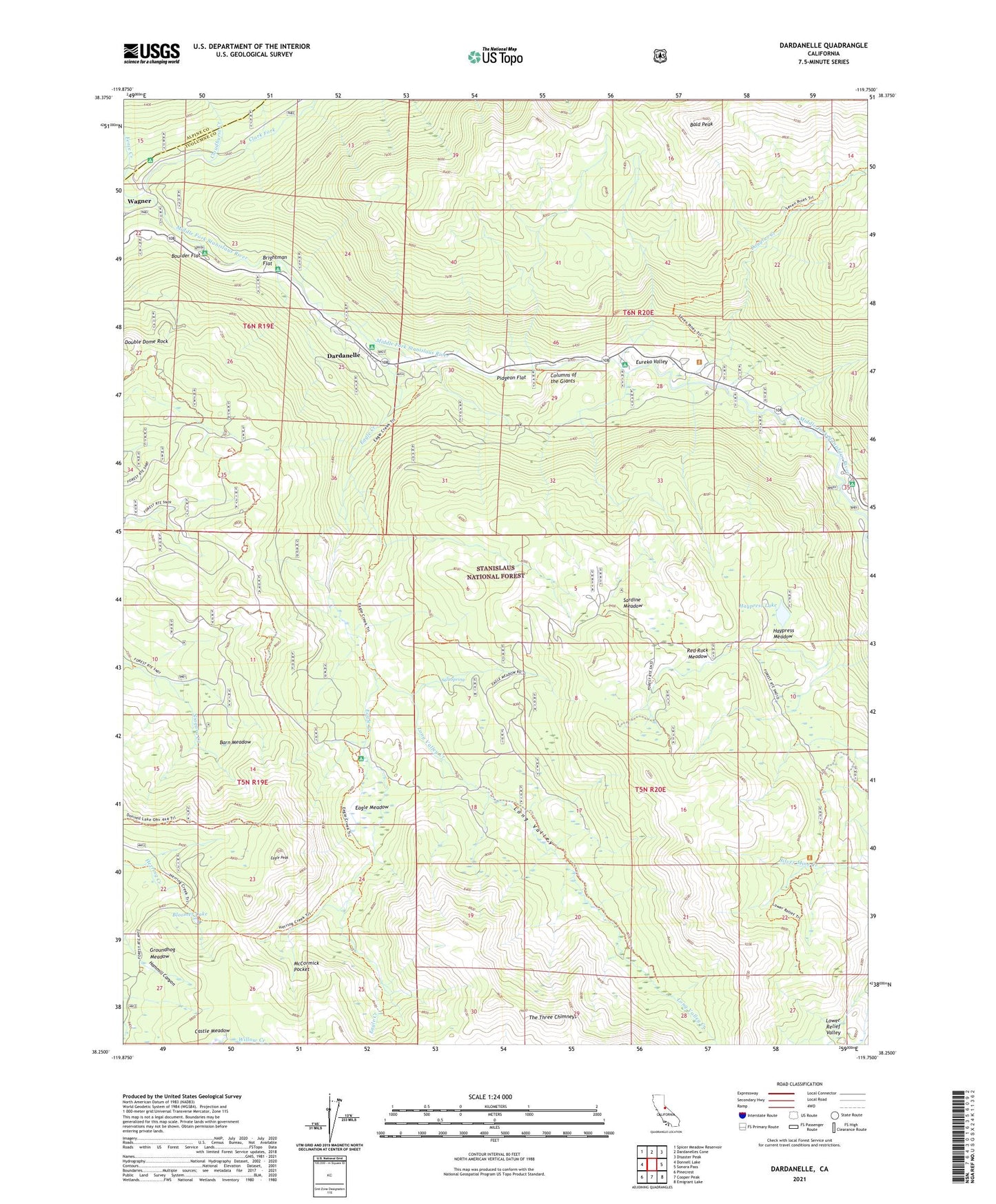
Dardanelle California US Topo Map
Couldn't load pickup availability
Also explore the Dardanelle Forest Service Topo of this same quad for updated USFS data
2021 topographic map quadrangle Dardanelle in the state of California. Scale: 1:24000. Based on the newly updated USGS 7.5' US Topo map series, this map is in the following counties: Tuolumne, Alpine. The map contains contour data, water features, and other items you are used to seeing on USGS maps, but also has updated roads and other features. This is the next generation of topographic maps. Printed on high-quality waterproof paper with UV fade-resistant inks.
Quads adjacent to this one:
West: Donnell Lake
Northwest: Spicer Meadow Reservoir
North: Dardanelles Cone
Northeast: Disaster Peak
East: Sonora Pass
Southeast: Emigrant Lake
South: Cooper Peak
Southwest: Pinecrest
This map covers the same area as the classic USGS quad with code o38119c7.
Contains the following named places: Baker Campground, Baker Station, Bald Peak, Barn Meadow, Bennett Juniper, Bloomer Lake, Boulder Flat, Brightman Flat, Brightman Flat Campground, Cloudburst Creek, Columns of the Giants, Dardanelle, Dardanelle Post Office, Dardanelles Campground, Dougals Picnic Area, Douglas Creek, Douglas Resort, Eagle Creek, Eagle Meadow, Eagle Peak, Eureka Valley, Groundhog Meadow, Haypress Lake, Haypress Meadow, Long Valley, Long Valley Creek, Lower Relief Valley, Martins Cow Camp, McCormick Pocket, Pidgeon Flat, Pigeon Flat Campground, Red Rock Meadow, Salt Spring, Sardine Meadow, The Three Chimneys, ZIP Codes: 95314, 95364