MyTopo
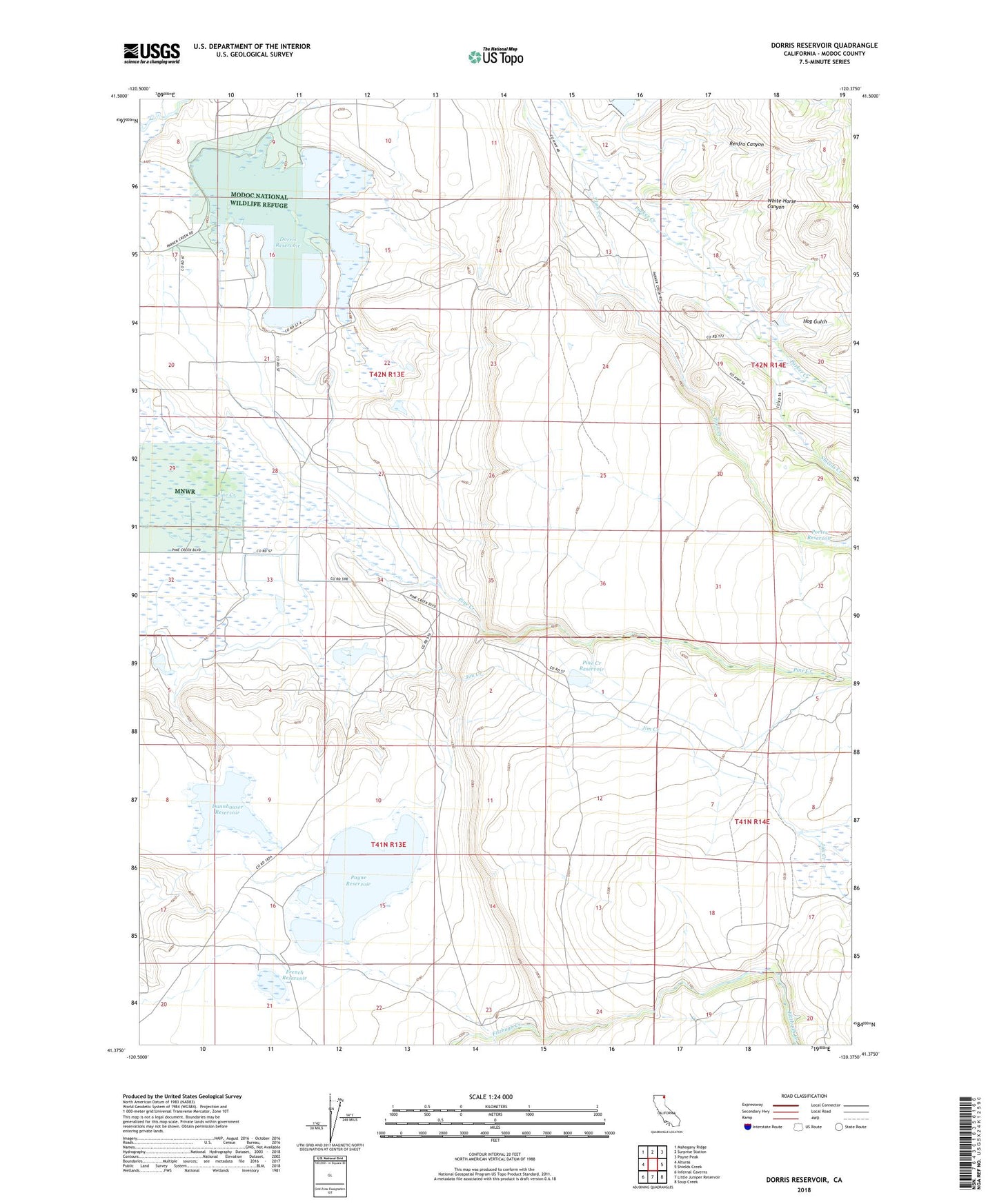
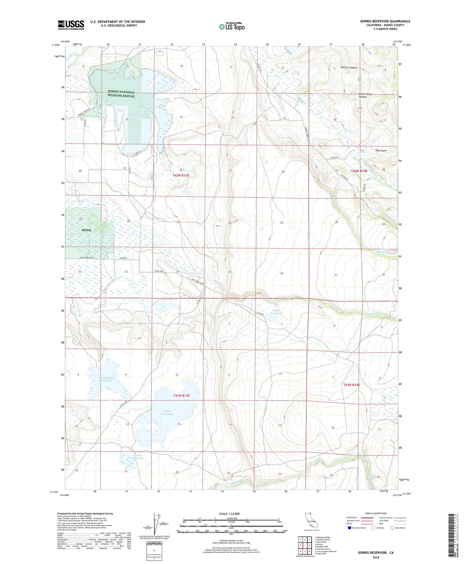
Dorris Reservoir California US Topo Map
Couldn't load pickup availability
Also explore the Dorris Reservoir Forest Service Topo of this same quad for updated USFS data
2021 topographic map quadrangle Dorris Reservoir in the state of California. Scale: 1:24000. Based on the newly updated USGS 7.5' US Topo map series, this map is in the following counties: Modoc. The map contains contour data, water features, and other items you are used to seeing on USGS maps, but also has updated roads and other features. This is the next generation of topographic maps. Printed on high-quality waterproof paper with UV fade-resistant inks.
Quads adjacent to this one:
West: Alturas
Northwest: Mahogany Ridge
North: Surprise Station
Northeast: Payne Peak
East: Shields Creek
Southeast: Soup Creek
South: Little Juniper Reservoir
Southwest: Infernal Caverns
This map covers the same area as the classic USGS quad with code o41120d4.
Contains the following named places: Brooks, Dannhauser 161 Dam, Dannhauser Reservoir, Dorris Dam, Dorris Reservoir, French Reservoir, Hog Gulch, Payne 143 Dam, Payne Reservoir, Pine Creek Reservoir, Plum Canyon 139 Dam, Plum Creek, Porter Reservoir, Renfro Canyon, Shields Creek, Upper Pasture 161-002 Dam, White Horse Canyon, Yankee Jim Ranch