MyTopo
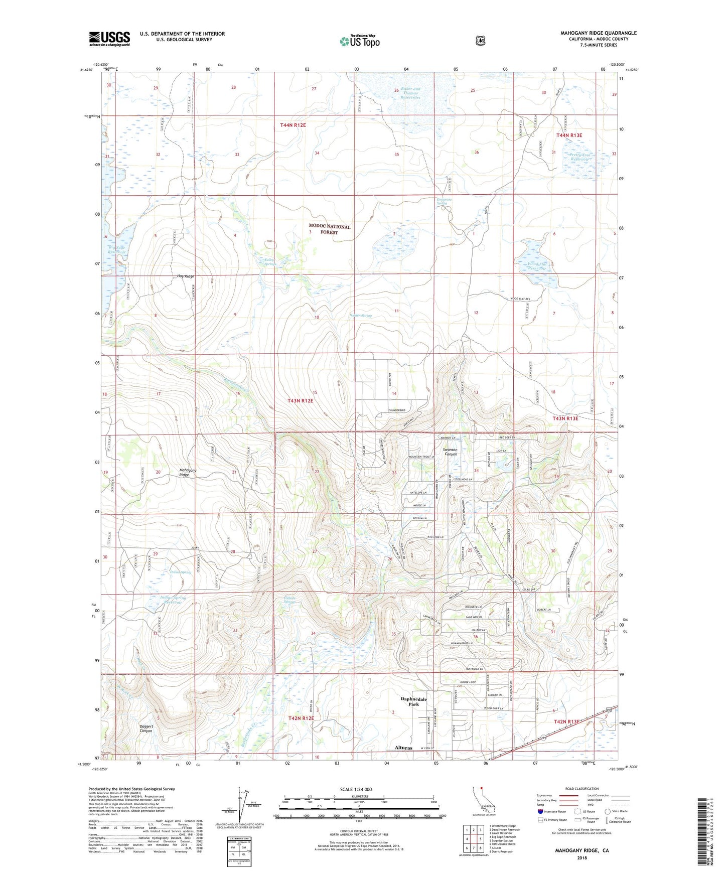
Mahogany Ridge California US Topo Map
Couldn't load pickup availability
Also explore the Mahogany Ridge Forest Service Topo of this same quad for updated USFS data
2021 topographic map quadrangle Mahogany Ridge in the state of California. Scale: 1:24000. Based on the newly updated USGS 7.5' US Topo map series, this map is in the following counties: Modoc. The map contains contour data, water features, and other items you are used to seeing on USGS maps, but also has updated roads and other features. This is the next generation of topographic maps. Printed on high-quality waterproof paper with UV fade-resistant inks.
Quads adjacent to this one:
West: Big Sage Reservoir
Northwest: Whittemore Ridge
North: Dead Horse Reservoir
Northeast: Lauer Reservoir
East: Surprise Station
Southeast: Dorris Reservoir
South: Alturas
Southwest: Rattlesnake Butte
This map covers the same area as the classic USGS quad with code o41120e5.
Contains the following named places: Big Dobe South 129-002 Dam, Daggert Canyon, Daphnedale Park, Daphnedale Park Census Designated Place, Emigrant Spring, Emigrant Spring Reservoir, Hidden Spring, Hillside Springs, Hog Ridge, Indian Spring, Indian Spring Reservoir, KCNO-AM (Alturas), Kelley Springs, Mahogany Ridge, Pretty Tree Reservoir, Rattlesnake Ditch, Swanson Canyon, West Rock Creek, Wood Flat Reservoir