MyTopo
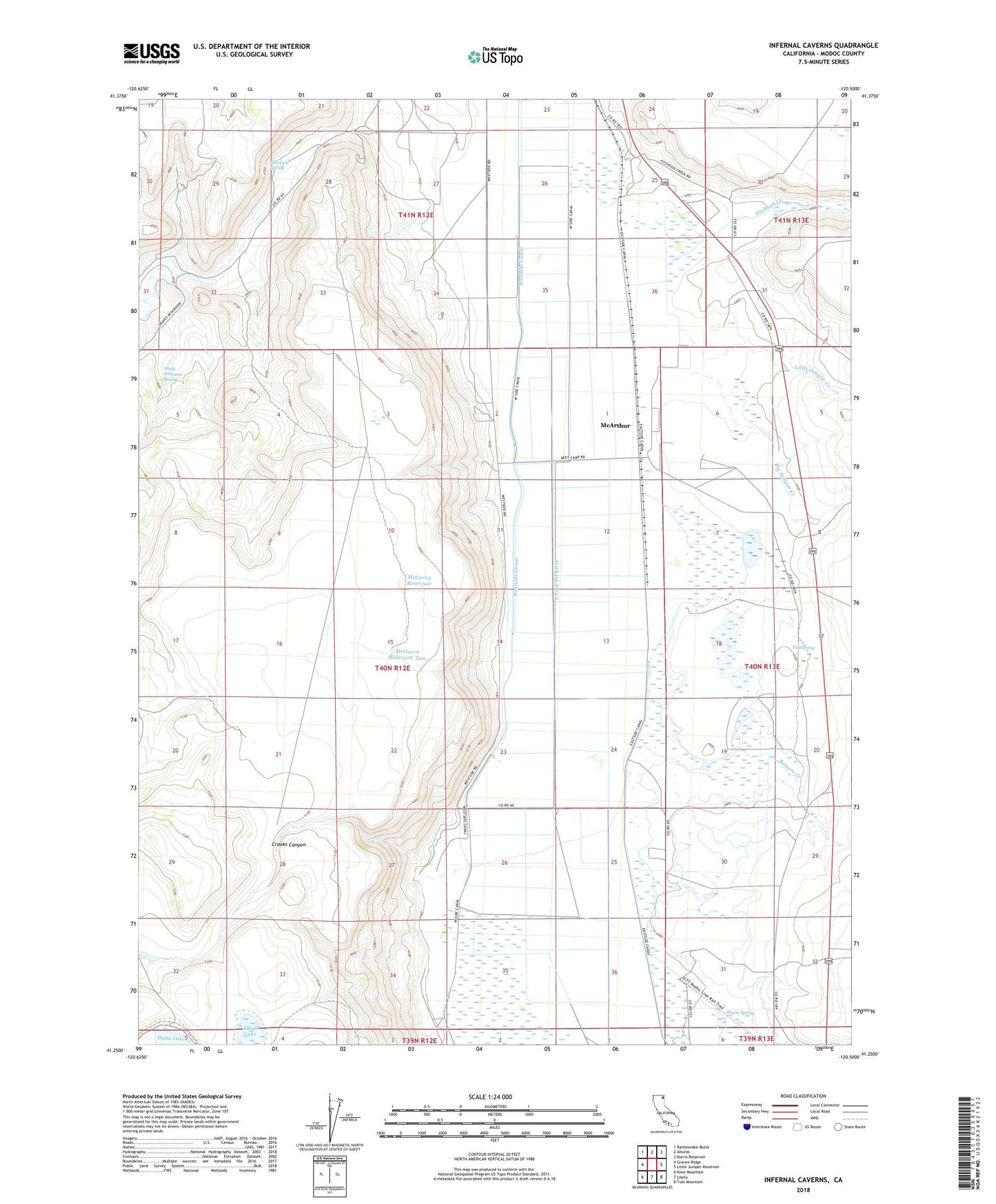
Infernal Caverns California US Topo Map
Couldn't load pickup availability
Also explore the Infernal Caverns Forest Service Topo of this same quad for updated USFS data
2021 topographic map quadrangle Infernal Caverns in the state of California. Scale: 1:24000. Based on the newly updated USGS 7.5' US Topo map series, this map is in the following counties: Modoc. The map contains contour data, water features, and other items you are used to seeing on USGS maps, but also has updated roads and other features. This is the next generation of topographic maps. Printed on high-quality waterproof paper with UV fade-resistant inks.
Quads adjacent to this one:
West: Graven Ridge
Northwest: Rattlesnake Butte
North: Alturas
Northeast: Dorris Reservoir
East: Little Juniper Reservoir
Southeast: Tule Mountain
South: Likely
Southwest: Knox Mountain
This map covers the same area as the classic USGS quad with code o41120c5.
Contains the following named places: Alkali Lake, Bayley, Beet Camp, Big Juniper Creek, Bormister, Christensen, Corporation Ranch, Crooks Canyon, Derner, Eastside Canal, Fitzhigh Creek Ranch, Fitzhugh Creek, Infernal Caverns Battleground Memorial Monument, KCNO-AM (Alturas), Likely Fire Department, Little Juniper Creek, McArthur, McGarva, McGarva Reservoir, McGarva Reservoir Two, Pat Spring, Ramsey, Romero Creek, Sherlock Spring, Wade Williams Spring, Warm Spring, Westside Canal, Williams, Winema Airstrip