MyTopo
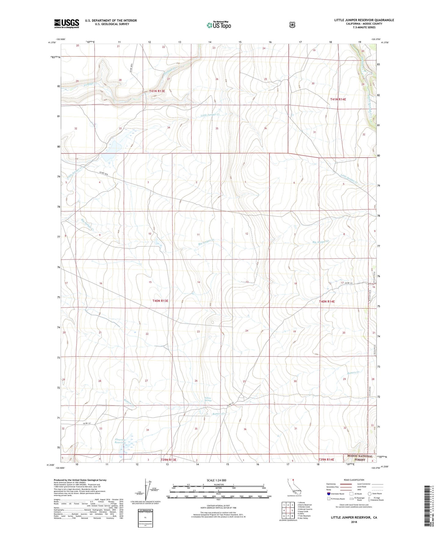
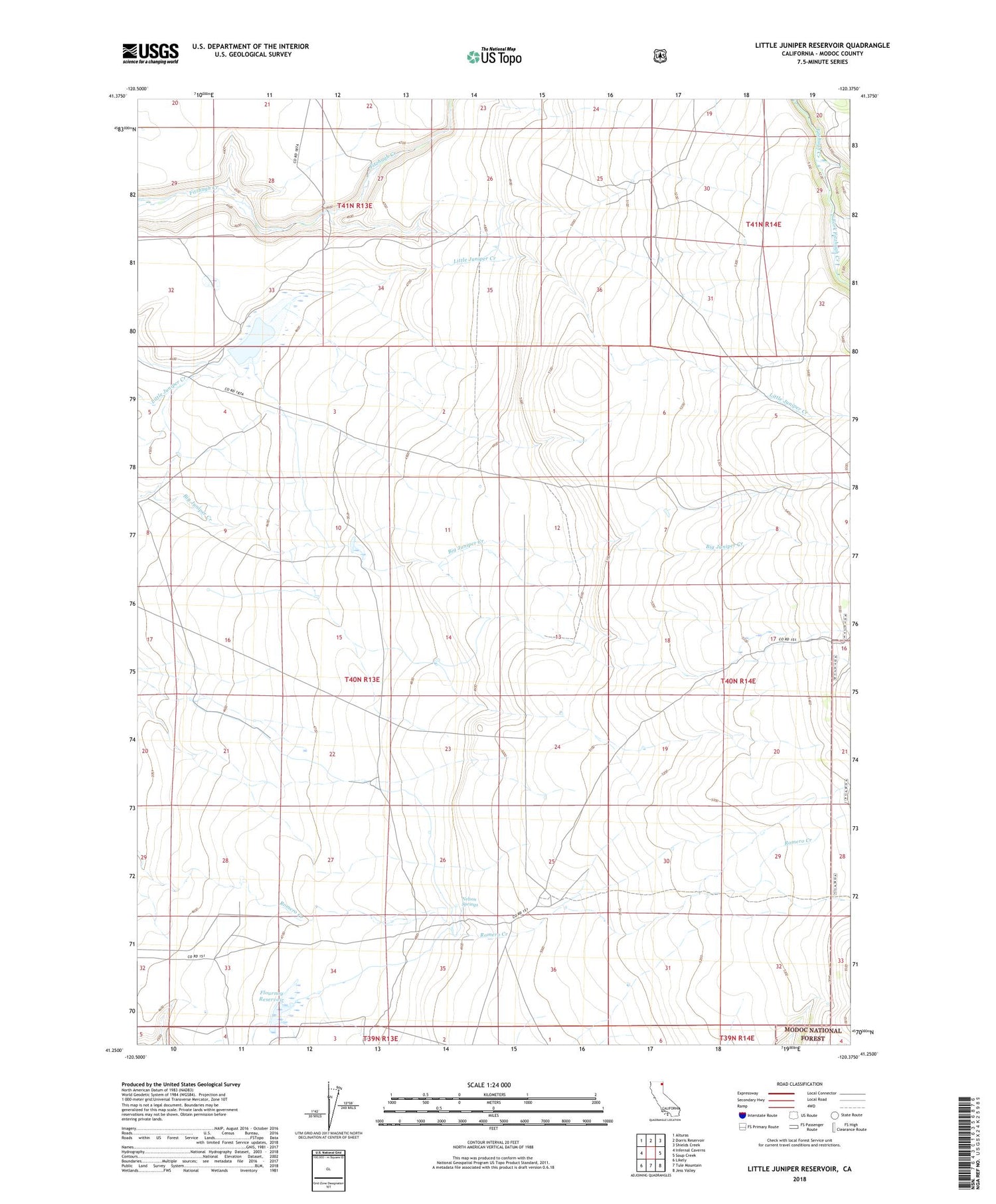
Little Juniper Reservoir California US Topo Map
Couldn't load pickup availability
Also explore the Little Juniper Reservoir Forest Service Topo of this same quad for updated USFS data
2021 topographic map quadrangle Little Juniper Reservoir in the state of California. Scale: 1:24000. Based on the newly updated USGS 7.5' US Topo map series, this map is in the following counties: Modoc. The map contains contour data, water features, and other items you are used to seeing on USGS maps, but also has updated roads and other features. This is the next generation of topographic maps. Printed on high-quality waterproof paper with UV fade-resistant inks.
Quads adjacent to this one:
West: Infernal Caverns
Northwest: Alturas
North: Dorris Reservoir
Northeast: Shields Creek
East: Soup Creek
Southeast: Jess Valley
South: Tule Mountain
Southwest: Likely
This map covers the same area as the classic USGS quad with code o41120c4.
Contains the following named places: Flournoy Reservoir, Little Juniper 136 Dam, Little Juniper Reservoir, Nelson Springs, North Fork Fitzhugh Creek, South Fork Fitzhugh Creek