MyTopo
Longvale California US Topo Map
Couldn't load pickup availability
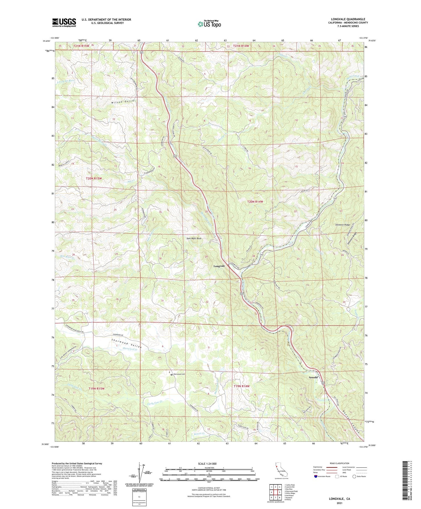
2021 topographic map quadrangle Longvale in the state of California. Scale: 1:24000. Based on the newly updated USGS 7.5' US Topo map series, this map is in the following counties: Mendocino. The map contains contour data, water features, and other items you are used to seeing on USGS maps, but also has updated roads and other features. This is the next generation of topographic maps. Printed on high-quality waterproof paper with UV fade-resistant inks.
Quads adjacent to this one:
West: Sherwood Peak
Northwest: Cahto Peak
North: Laytonville
Northeast: Dos Rios
East: Willis Ridge
Southeast: Willits
South: Burbeck
Southwest: Northspur
This map covers the same area as the classic USGS quad with code o39123e4.
Contains the following named places: Alder Creek, Arnold, Cherry Creek, Corral Creek, Curly Cow Creek, Dutch Henry Creek, Irvine Rest Area, Longvale, Moss Cove Rest Area, Munson Ranch, Pim Creek, Reeves Canyon, Sam Watt Creek, Sam Watt Rock, Sherwood Cemetery, Sherwood Elementary School, Sherwood Valley, Sherwood Valley Rancheria, Stemple Ranch, Wilson Gulch