MyTopo
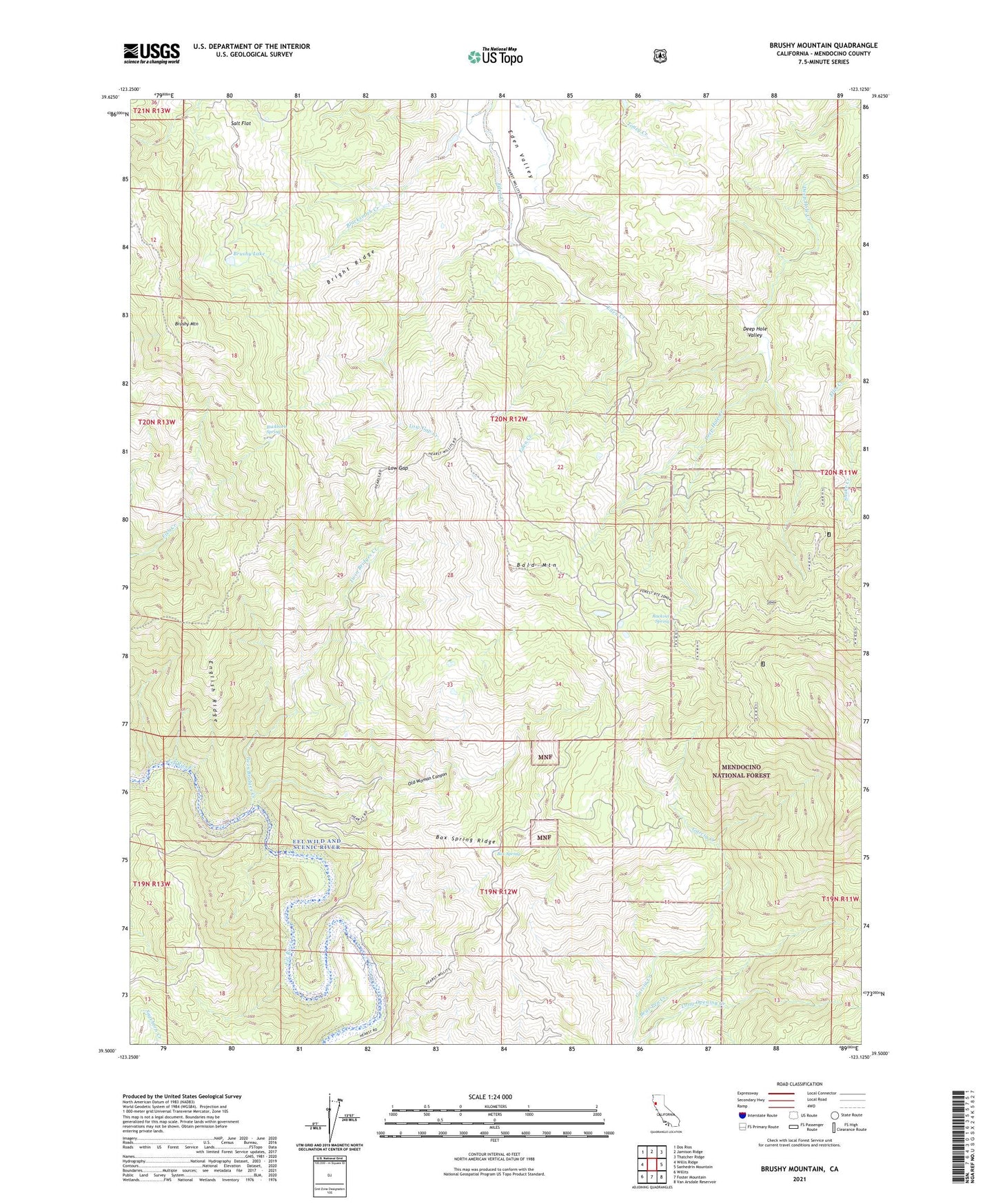
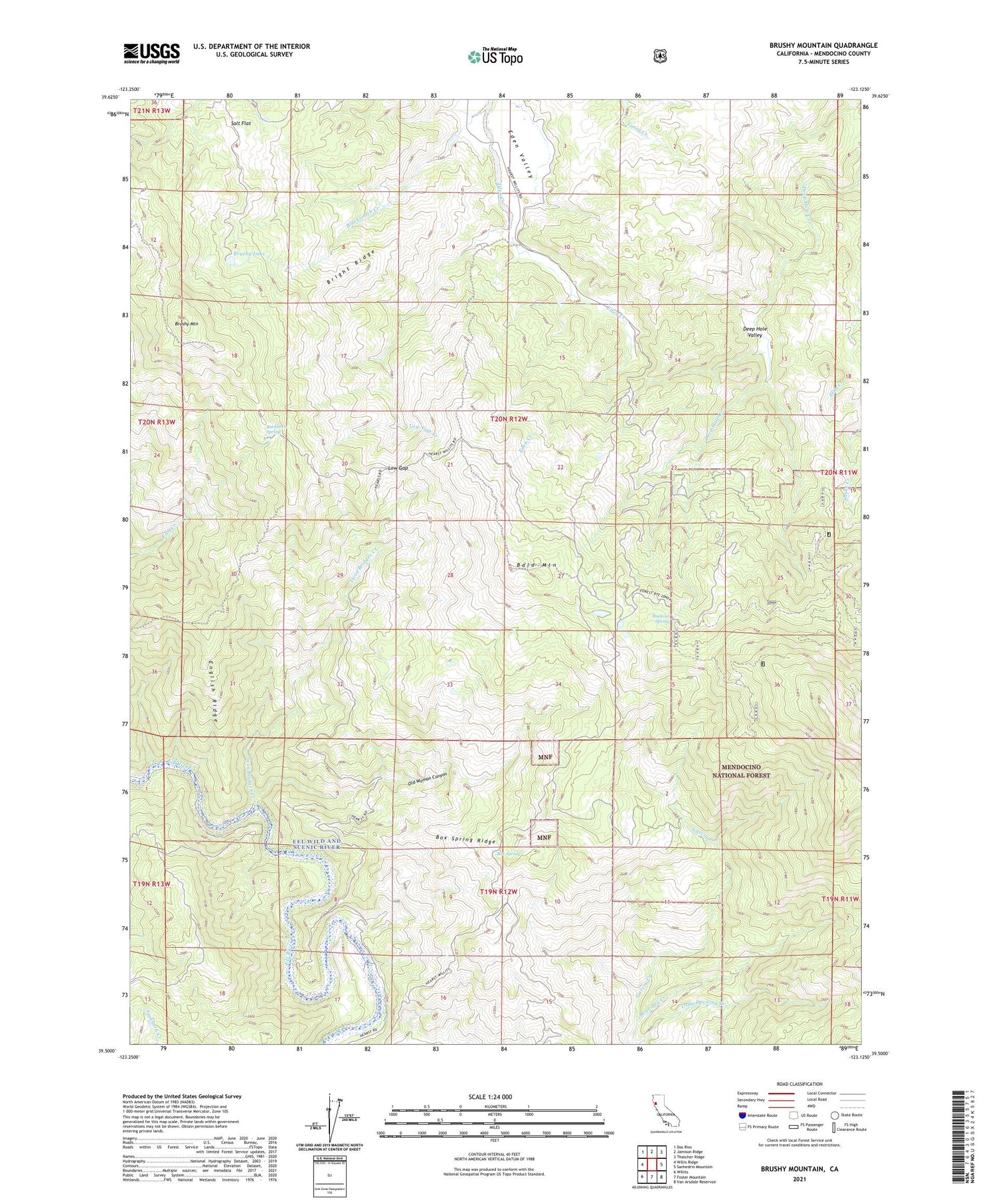
Brushy Mountain California US Topo Map
Couldn't load pickup availability
Also explore the Brushy Mountain Forest Service Topo of this same quad for updated USFS data
2021 topographic map quadrangle Brushy Mountain in the state of California. Scale: 1:24000. Based on the newly updated USGS 7.5' US Topo map series, this map is in the following counties: Mendocino. The map contains contour data, water features, and other items you are used to seeing on USGS maps, but also has updated roads and other features. This is the next generation of topographic maps. Printed on high-quality waterproof paper with UV fade-resistant inks.
Quads adjacent to this one:
West: Willis Ridge
Northwest: Dos Rios
North: Jamison Ridge
Northeast: Thatcher Ridge
East: Sanhedrin Mountain
Southeast: Van Arsdale Reservoir
South: Foster Mountain
Southwest: Willits
This map covers the same area as the classic USGS quad with code o39123e2.
Contains the following named places: Bald Mountain, Bear Pen Creek, Blacksmith Creek, Box Spring, Box Spring Ridge, Bright Ridge, Brushy Lake, Brushy Mountain, Buckhorn Spring, Camp Grant, Deep Hole Valley, English Ridge, Low Gap, Low Gap Creek, Old Woman Canyon, Rackout Spring, Salt Flat, Summer Camp, Twin Bridges Creek