MyTopo
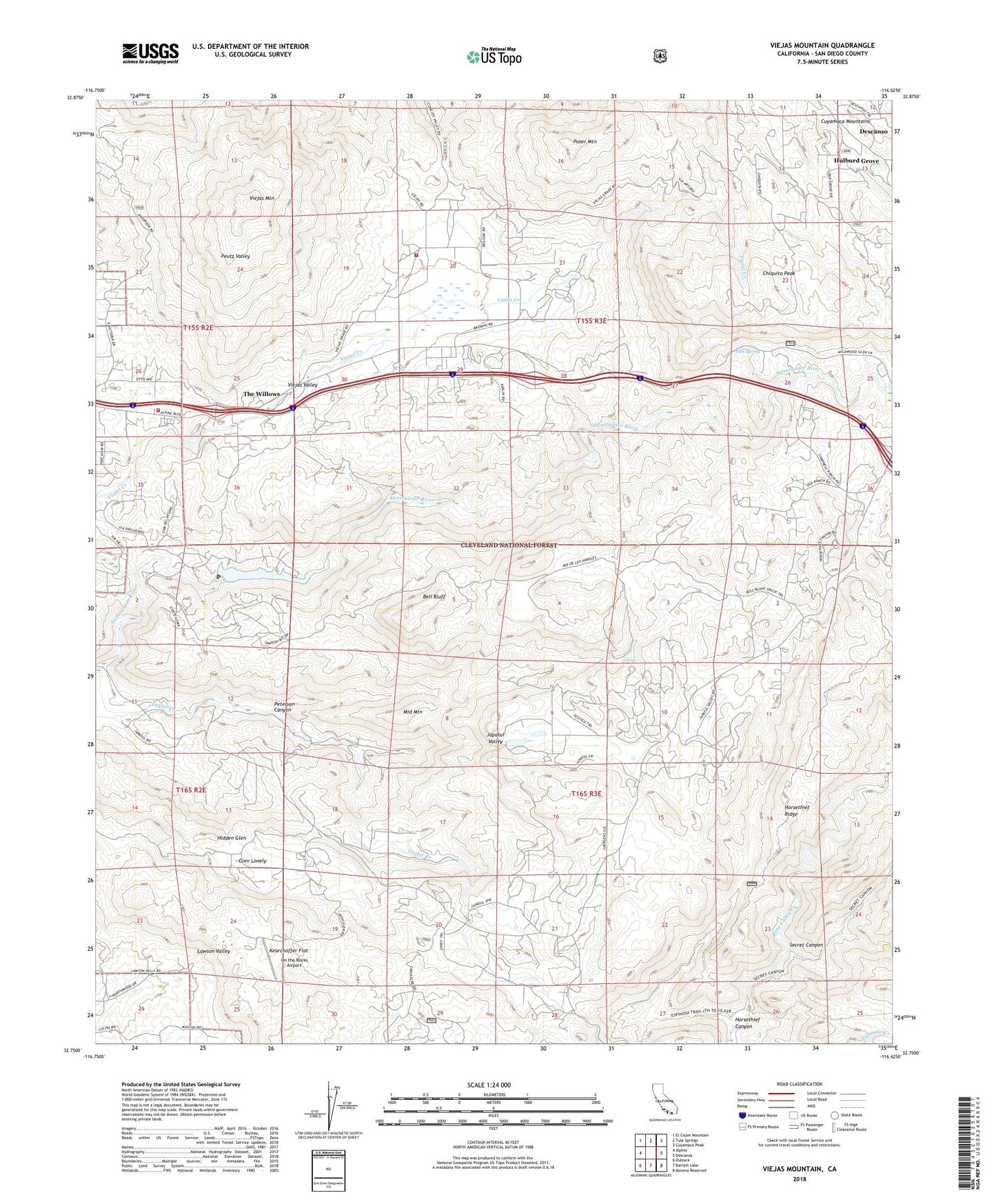
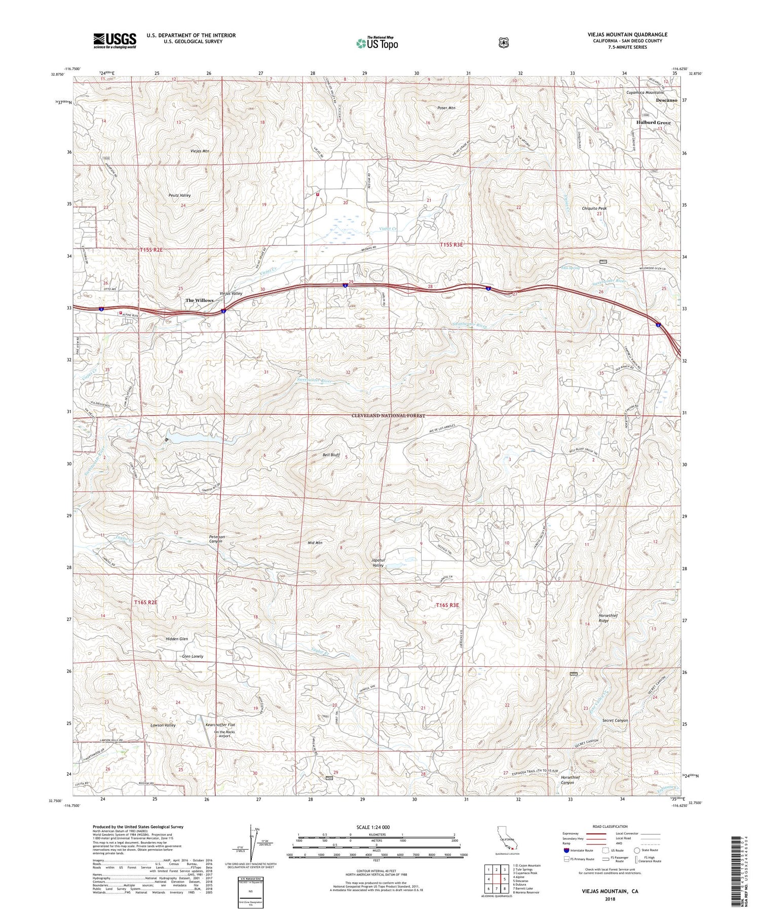
Viejas Mountain California US Topo Map
Couldn't load pickup availability
2021 topographic map quadrangle Viejas Mountain in the state of California. Scale: 1:24000. Based on the newly updated USGS 7.5' US Topo map series, this map is in the following counties: San Diego. The map contains contour data, water features, and other items you are used to seeing on USGS maps, but also has updated roads and other features. This is the next generation of topographic maps. Printed on high-quality waterproof paper with UV fade-resistant inks.
Quads adjacent to this one:
West: Alpine
Northwest: El Cajon Mountain
North: Tule Springs
Northeast: Cuyamaca Peak
East: Descanso
Southeast: Morena Reservoir
South: Barrett Lake
Southwest: Dulzura
This map covers the same area as the classic USGS quad with code o32116g6.
Contains the following named places: Ajax Prospect, Bell Bluff, Carveacre Ranch, Chiquito Peak, Descanso Campground, Descanso Census Designated Place, Descanso Mine, Descanso Ranger District, Ellis Spring, First Baptist Church of the Willows, Five Willow Spring, Glen Lonely, Hidden Glen, Horsethief Canyon, Horsethief Ridge Trail, Japatul School, Japatul Valley, Kearchoffer Flat, Lyster Ranch, Mar-Tar-Awa Campground, Middle Mountain, On the Rocks Airport, Palo Verde 860 Dam, Palo Verde Lake, Poser Mountain, San Diego East Visitors Bureau, Secret Canyon, Stallion Oaks, Stallion Oaks Campground, Taylor Creek, The Willows, United States Forest Service Cleveland National Forest Fire Station Descanso, Viejas Fire Department, Viejas Honor Camp, Viejas Mountain, Viejas Outlet Center Shopping Center, Viejas Prospect, Viejas Reservation, Viejas Valley, Wettleson Prospect, ZIP Code: 91901