MyTopo
Dutchmans Knoll California US Topo Map
Couldn't load pickup availability
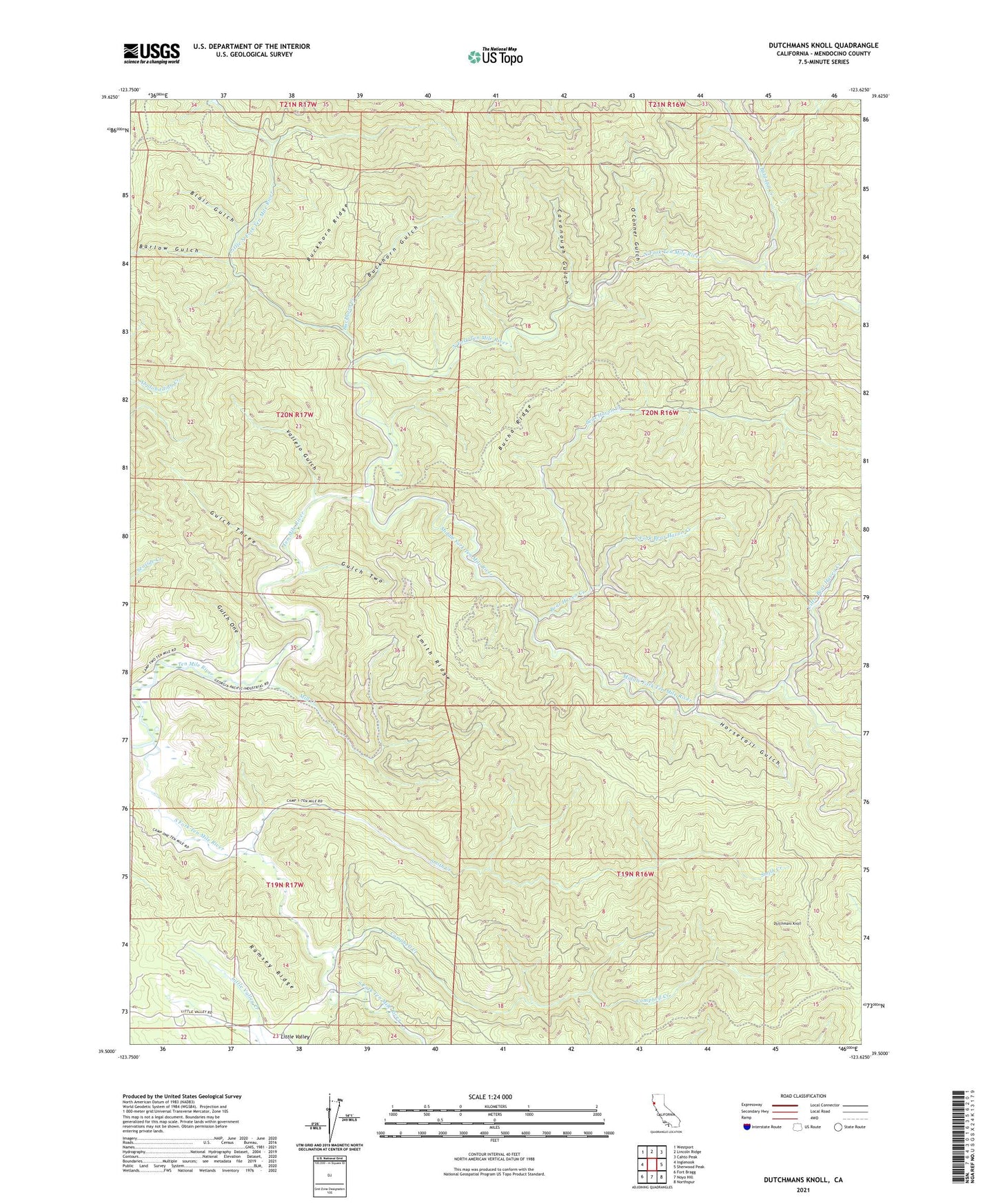
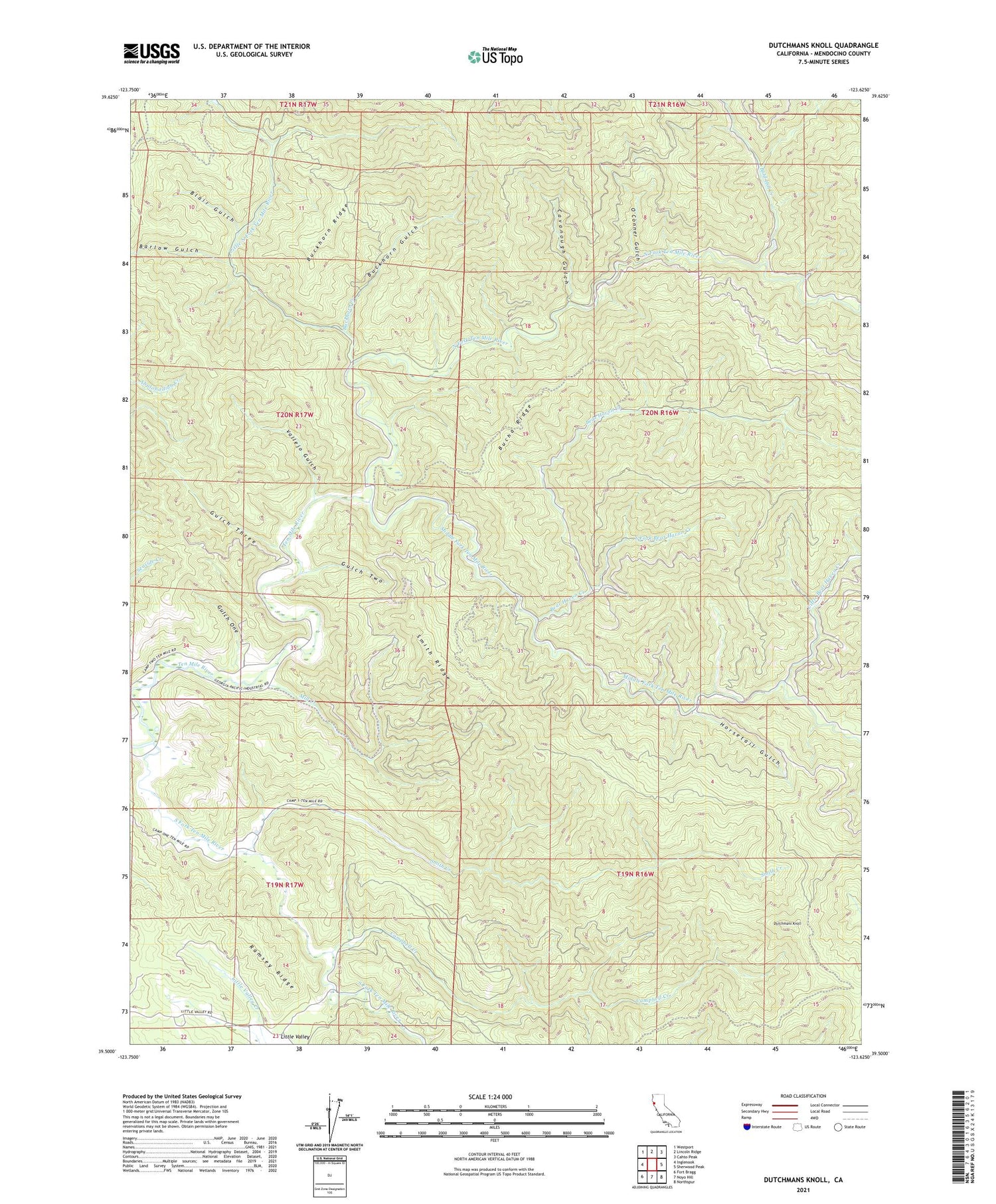
2021 topographic map quadrangle Dutchmans Knoll in the state of California. Scale: 1:24000. Based on the newly updated USGS 7.5' US Topo map series, this map is in the following counties: Mendocino. The map contains contour data, water features, and other items you are used to seeing on USGS maps, but also has updated roads and other features. This is the next generation of topographic maps. Printed on high-quality waterproof paper with UV fade-resistant inks.
Quads adjacent to this one:
West: Inglenook
Northwest: Westport
North: Lincoln Ridge
Northeast: Cahto Peak
East: Sherwood Peak
Southeast: Northspur
South: Noyo Hill
Southwest: Fort Bragg
This map covers the same area as the classic USGS quad with code o39123e6.
Contains the following named places: Bald Hill Creek, Barlow Gulch, Bear Haven Creek, Blair Gulch, Buckhorn Creek, Buckhorn Gulch, Buckhorn Ridge, Camp Two, Campbell Creek, Cavanough Gulch, Dutchmans Knoll, Gulch One, Gulch Three, Gulch Two, Horsetail Gulch, Little Bear Haven Creek, Little North Fork Ten Mile River, Middle Fork Ten Mile River, Mill Creek, North Fork Ten Mile River, O'Conner Gulch, O'Conner Orchard, Smith Creek, South Fork Bear Haven Creek, South Fork Ten Mile River, Vallejo Gulch