MyTopo
Cahto Peak California US Topo Map
Couldn't load pickup availability
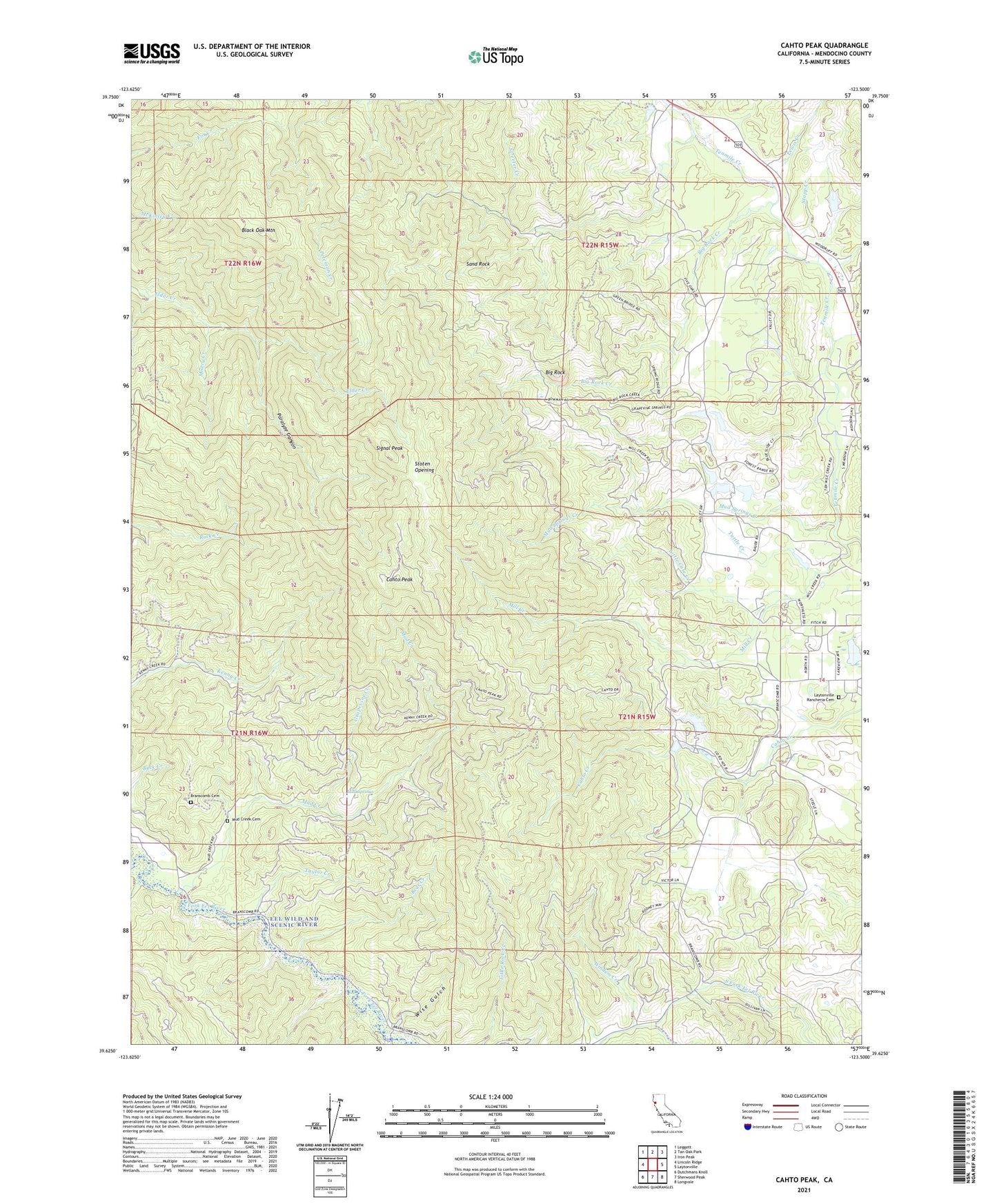
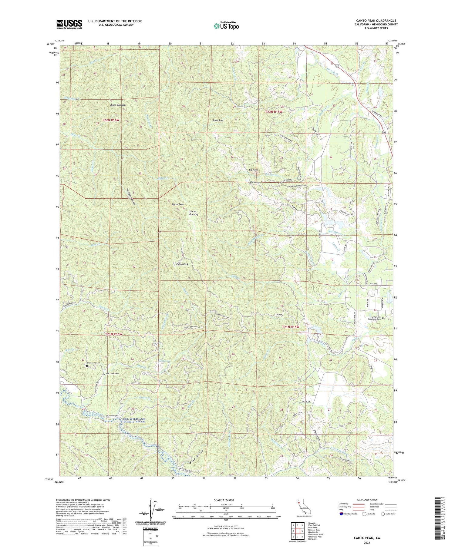
2021 topographic map quadrangle Cahto Peak in the state of California. Scale: 1:24000. Based on the newly updated USGS 7.5' US Topo map series, this map is in the following counties: Mendocino. The map contains contour data, water features, and other items you are used to seeing on USGS maps, but also has updated roads and other features. This is the next generation of topographic maps. Printed on high-quality waterproof paper with UV fade-resistant inks.
Quads adjacent to this one:
West: Lincoln Ridge
Northwest: Leggett
North: Tan Oak Park
Northeast: Iron Peak
East: Laytonville
Southeast: Longvale
South: Sherwood Peak
Southwest: Dutchmans Knoll
This map covers the same area as the classic USGS quad with code o39123f5.
Contains the following named places: Admiral William Standley State Recreation Area, Bear Creek, Big Rock, Big Rock Creek, Black Oak Mountain, Branscomb Cemetery, Cahto Peak, Cahto Peak Lookout Tower, Grapevine Creek, Haun Creek, KFWU-TV (Fort Bragg), Laytonville Rancheria, Laytonville Rancheria Cemetery, Lewis Creek, Little Case Creek, Mast 1380 Dam, Mast Mill, Middleton Creek, Mill Creek, Misery Creek, Mud Creek, Mud Creek Cemetery, Mud Springs, Mud Springs Creek, Paralyze Canyon, Ranch Primero, Sand Rock, Signal Peak, Stapp Creek, Stoten Opening, Streeter Creek, Taylor Creek, Tuttle Creek, Wilson Creek, Windem Creek, Wise Gulch, ZIP Code: 95417