MyTopo
Sherwood Peak California US Topo Map
Couldn't load pickup availability
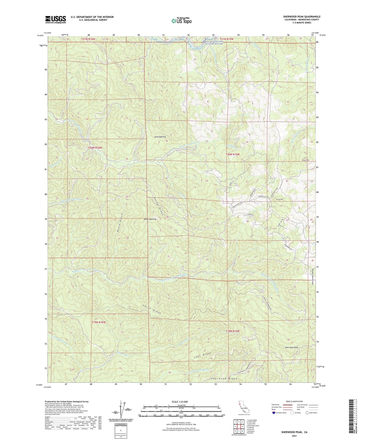
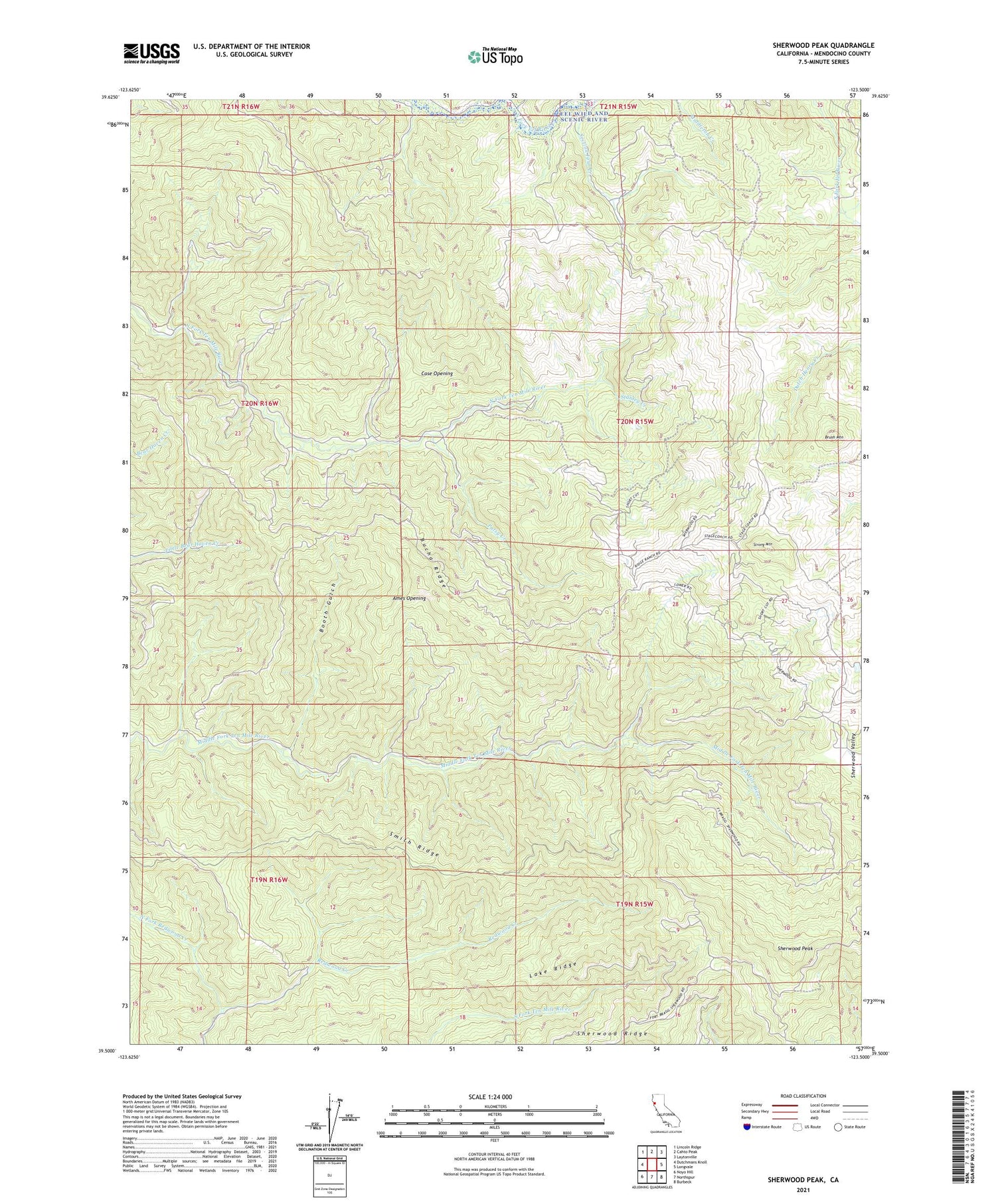
2021 topographic map quadrangle Sherwood Peak in the state of California. Scale: 1:24000. Based on the newly updated USGS 7.5' US Topo map series, this map is in the following counties: Mendocino. The map contains contour data, water features, and other items you are used to seeing on USGS maps, but also has updated roads and other features. This is the next generation of topographic maps. Printed on high-quality waterproof paper with UV fade-resistant inks.
Quads adjacent to this one:
West: Dutchmans Knoll
Northwest: Lincoln Ridge
North: Cahto Peak
Northeast: Laytonville
East: Longvale
Southeast: Burbeck
South: Northspur
Southwest: Noyo Hill
This map covers the same area as the classic USGS quad with code o39123e5.
Contains the following named places: Ames Opening, Baxman Ranch, Booth Gulch, Brush Mountain, Bucha Ridge, Case Opening, Clarke Ranch, Lake Ridge, Little Rock Creek, North Fork Redwood Creek, Patsy Creek, Section Four Creek, Sherwood Peak, Sherwood Ridge, Smith Ridge, Stanley Creek, Strong Mountain