MyTopo
Duzel Rock California US Topo Map
Couldn't load pickup availability
Also explore the Duzel Rock Forest Service Topo of this same quad for updated USFS data
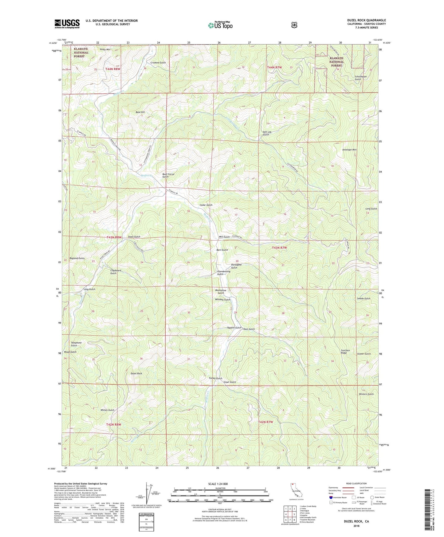
2022 topographic map quadrangle Duzel Rock in the state of California. Scale: 1:24000. Based on the newly updated USGS 7.5' US Topo map series, this map is in the following counties: Siskiyou. The map contains contour data, water features, and other items you are used to seeing on USGS maps, but also has updated roads and other features. This is the next generation of topographic maps. Printed on high-quality waterproof paper with UV fade-resistant inks.
Quads adjacent to this one:
West: Fort Jones
Northwest: Indian Creek Baldy
North: Yreka
Northeast: Montague
East: Gazelle
Southeast: China Mountain
South: Gazelle Mountain
Southwest: McConaughy Gulch
This map covers the same area as the classic USGS quad with code o41122e6.
Contains the following named places: Antelope Mountain, Bald Hill, Barn Gulch, Beef Corral Gulch, Cedar Gulch, Clapboard Gulch, Cottonwood Creek, Crooked Gulch, Duzel Creek, Duzel Rock, East Gulch, Farley Gulch, Glendenning Gulch, Highland School, KYRE-FM (Yreka), Long Gulch, Mill Gulch, Moonshine Gulch, Piney Mountain, Portugese Gulch, Salt Log Gulch, Sissel Gulch, Spring Branch, Stack Gulch, Tapplin Gulch, Telephone Gulch, Whiskey Gulch, Wood Gulch