MyTopo
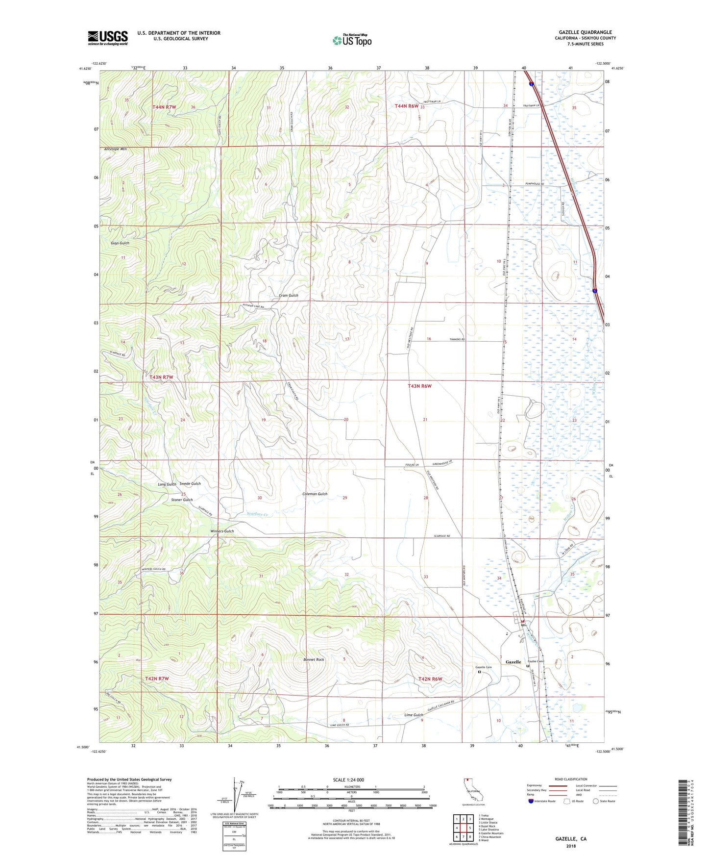
Gazelle California US Topo Map
Couldn't load pickup availability
Also explore the Gazelle Forest Service Topo of this same quad for updated USFS data
2021 topographic map quadrangle Gazelle in the state of California. Scale: 1:24000. Based on the newly updated USGS 7.5' US Topo map series, this map is in the following counties: Siskiyou. The map contains contour data, water features, and other items you are used to seeing on USGS maps, but also has updated roads and other features. This is the next generation of topographic maps. Printed on high-quality waterproof paper with UV fade-resistant inks.
Quads adjacent to this one:
West: Duzel Rock
Northwest: Yreka
North: Montague
Northeast: Little Shasta
East: Lake Shastina
Southeast: Weed
South: China Mountain
Southwest: Gazelle Mountain
This map covers the same area as the classic USGS quad with code o41122e5.
Contains the following named places: Bonnet Rock, Coleman Gulch, Foulke Cemetery, Gazelle, Gazelle Cemetery, Gazelle Census Designated Place, Gazelle Elementary School, Gazelle Fire Department, Gazelle Post Office, Lime Gulch, Long Gulch, Pythian Cave Microwave Relay Station, Scarface Creek, Siskiyou County, Stoner Gulch, Swede Gulch, Winters Gulch, ZIP Code: 96038