MyTopo
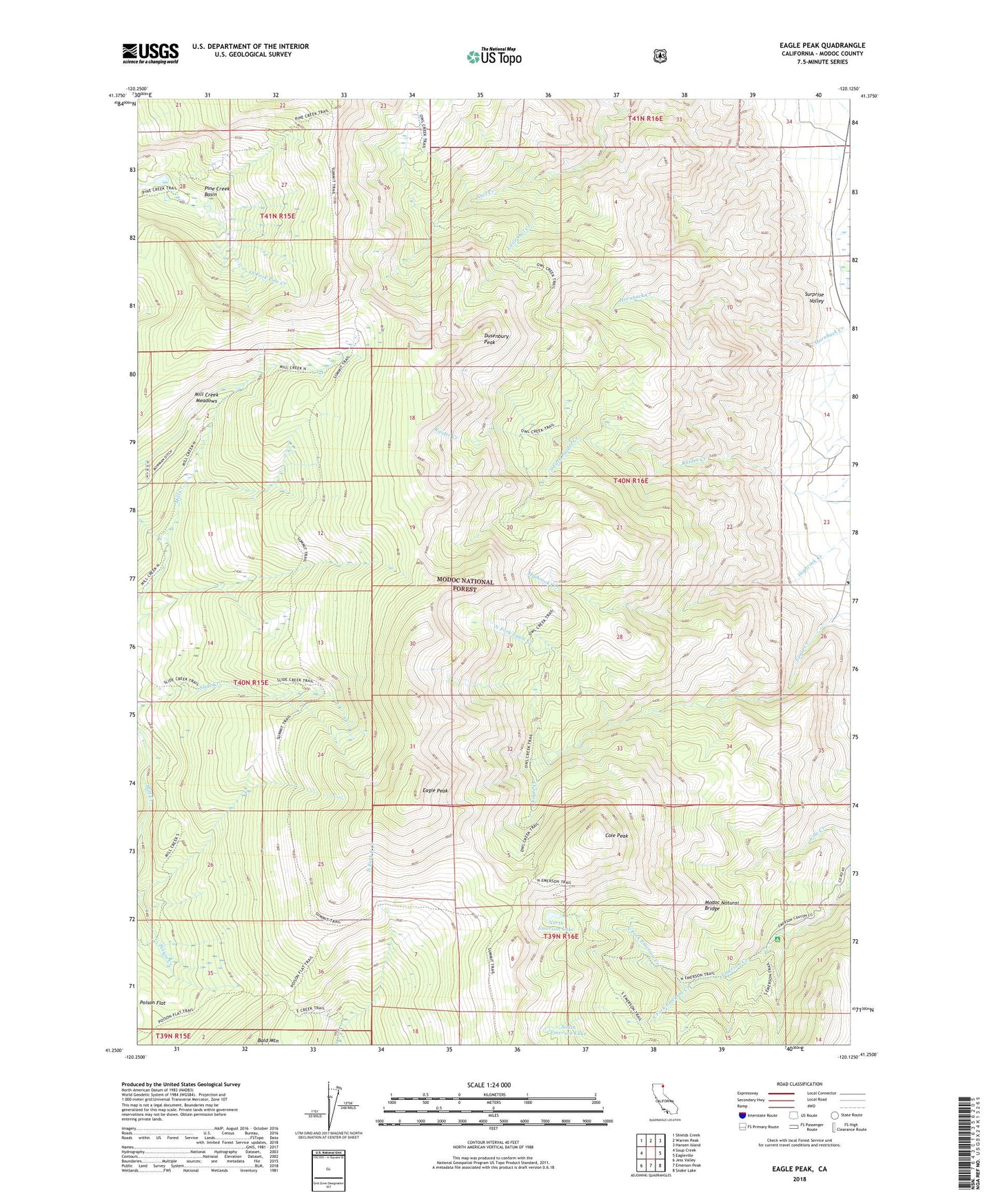
Eagle Peak California US Topo Map
Couldn't load pickup availability
Also explore the Eagle Peak Forest Service Topo of this same quad for updated USFS data
2021 topographic map quadrangle Eagle Peak in the state of California. Scale: 1:24000. Based on the newly updated USGS 7.5' US Topo map series, this map is in the following counties: Modoc. The map contains contour data, water features, and other items you are used to seeing on USGS maps, but also has updated roads and other features. This is the next generation of topographic maps. Printed on high-quality waterproof paper with UV fade-resistant inks.
Quads adjacent to this one:
West: Soup Creek
Northwest: Shields Creek
North: Warren Peak
Northeast: Hansen Island
East: Eagleville
Southeast: Snake Lake
South: Emerson Peak
Southwest: Jess Valley
This map covers the same area as the classic USGS quad with code o41120c2.
Contains the following named places: Bald Mountain, Cole Peak, Dusenbury Peak, Eagle Peak, Emerson Camp, Emerson Creek Trail, Emerson Recreation Site, Little Owl Creek, Mill Creek Meadows, Modoc Natural Bridge, North Emerson Lake, North Fork Eagle Creek, North Fork Emerson Creek, Pine Creek Basin, Pine Creek Trail, Poison Flat Trail, Saddleback, South Emerson Lake, South Fork Emerson Creek, South Fork Raider Creek, South Warner Wilderness, Summit Trail, Warner Mountains