MyTopo
Elledge Peak California US Topo Map
Couldn't load pickup availability
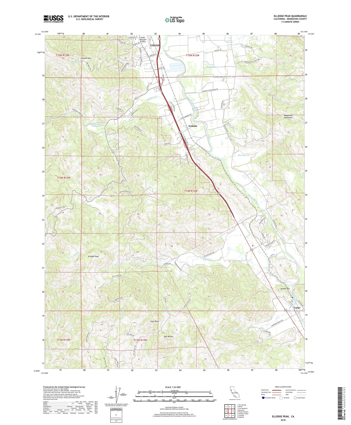
2021 topographic map quadrangle Elledge Peak in the state of California. Scale: 1:24000. Based on the newly updated USGS 7.5' US Topo map series, this map is in the following counties: Mendocino. The map contains contour data, water features, and other items you are used to seeing on USGS maps, but also has updated roads and other features. This is the next generation of topographic maps. Printed on high-quality waterproof paper with UV fade-resistant inks.
Quads adjacent to this one:
West: Boonville
Northwest: Orrs Springs
North: Ukiah
Northeast: Cow Mountain
East: Purdys Gardens
Southeast: Hopland
South: Yorkville
Southwest: Ornbaun Valley
This map covers the same area as the classic USGS quad with code o39123a2.
Contains the following named places: Alder Spring, Burnie Hill Ranch, Bus McGall, City of Ukiah Wastewater Treatment Plant, Cleland Mountain, Crawford Creek, El Roble, El Robles Ranch, Elledge Peak, Goat Rock, Grace Hudson Elementary School, Henry Ranch, Hopland Fire Department Station 2, Howell Creek, Indian Cemetery, Knight Hill, KPRA-FM (Ukiah), Largo, McNab 384 Dam, McNab Creek, McNab Ranch, Morrison Creek, North Fork Feliz Creek, P C Crawford Ranch, Parsons Creek, Robinson Creek, Ukiah Junior Academy, Ukiah Rancheria, W L Crawford Ranch