MyTopo
Ornbaun Valley California US Topo Map
Couldn't load pickup availability
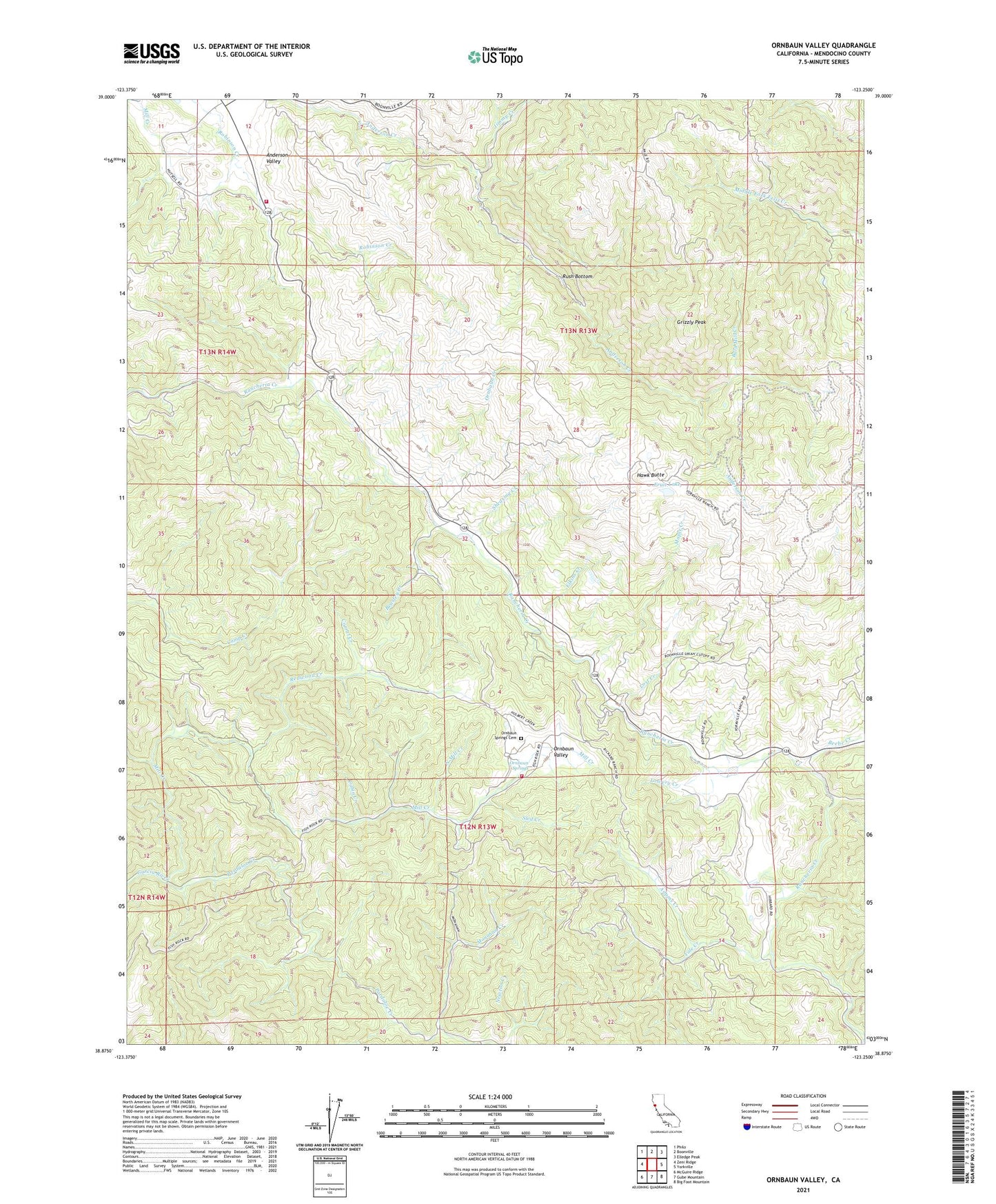
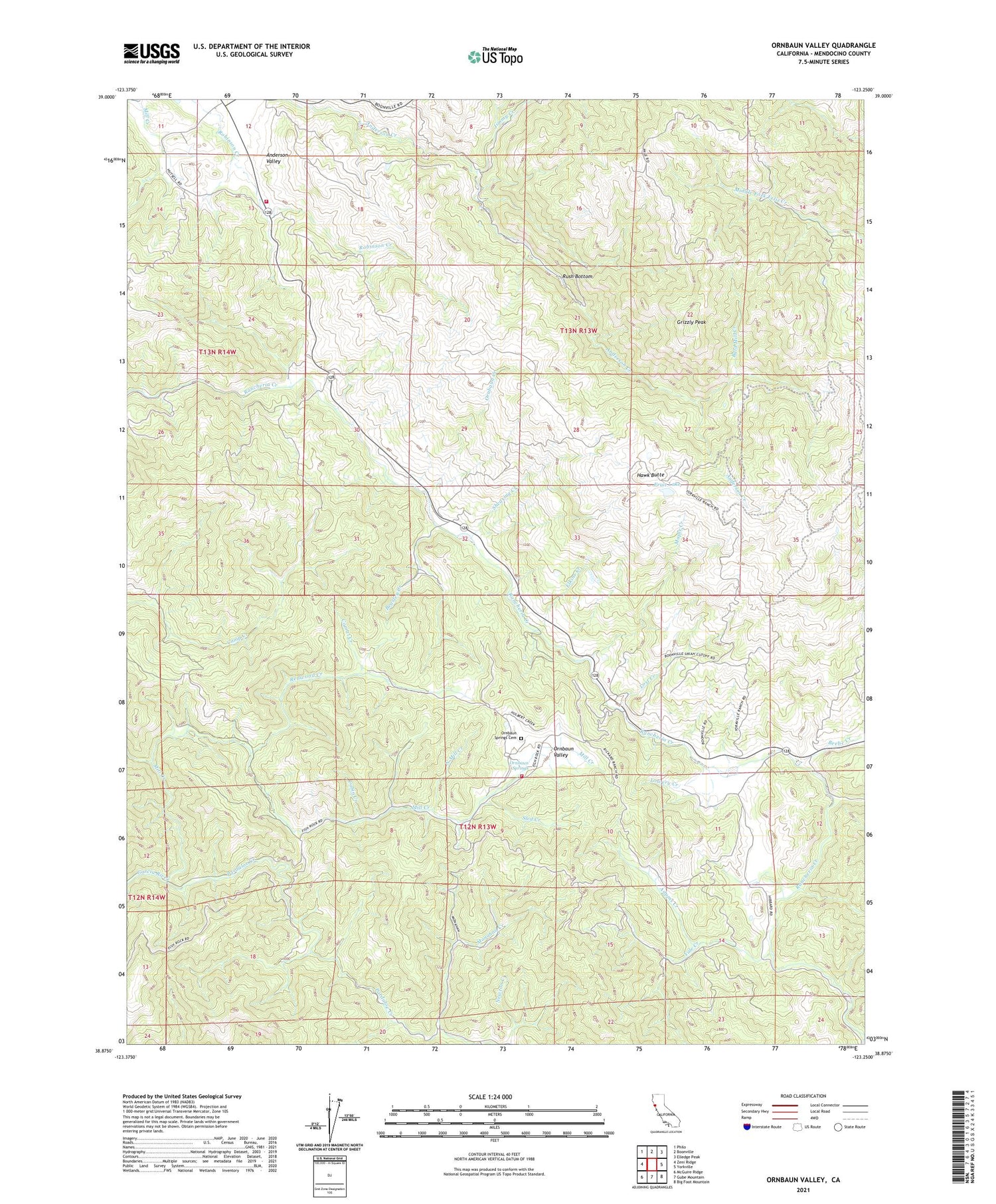
2021 topographic map quadrangle Ornbaun Valley in the state of California. Scale: 1:24000. Based on the newly updated USGS 7.5' US Topo map series, this map is in the following counties: Mendocino. The map contains contour data, water features, and other items you are used to seeing on USGS maps, but also has updated roads and other features. This is the next generation of topographic maps. Printed on high-quality waterproof paper with UV fade-resistant inks.
Quads adjacent to this one:
West: Zeni Ridge
Northwest: Philo
North: Boonville
Northeast: Elledge Peak
East: Yorkville
Southeast: Big Foot Mountain
South: Gube Mountain
Southwest: McGuire Ridge
This map covers the same area as the classic USGS quad with code o38123h3.
Contains the following named places: Adams Creek, Anderson Valley Volunteer Fire Station, Bald Mill Creek, Beasley Creek, Beebe Creek, Boonville Fire Control Station, Burgess Ranch, Cabin Creek, California Department of Forestry and Fire Protection Boonville Station, Corral Creek, Elkins Creek, Fruit Lake, Grizzly Peak, Hawk Butte, Hibberd Ranch, Jimmy Creek, Lost Creek, Lowery Creek, Mailliard Ranch, Mailliard Redwoods State Natural Reserve, Maple Creek, Milk Ranch, Mill Creek, Monahan Creek, North Mill Creek, Ogles Ranch, Old Ornbaun Hot Springs, Ornbaun Creek, Ornbaun Ranch, Ornbaun Springs, Ornbaun Springs Cemetery, Ornbaun Valley, Pardaloe Creek, Pardaloe Ranch, Rector Ranch, Redwood Creek, Rush Bottom, Shearing Creek, Sled Creek, Yale Creek, Yorkville Ranch, ZIP Code: 95494