MyTopo
Estrella California US Topo Map
Couldn't load pickup availability
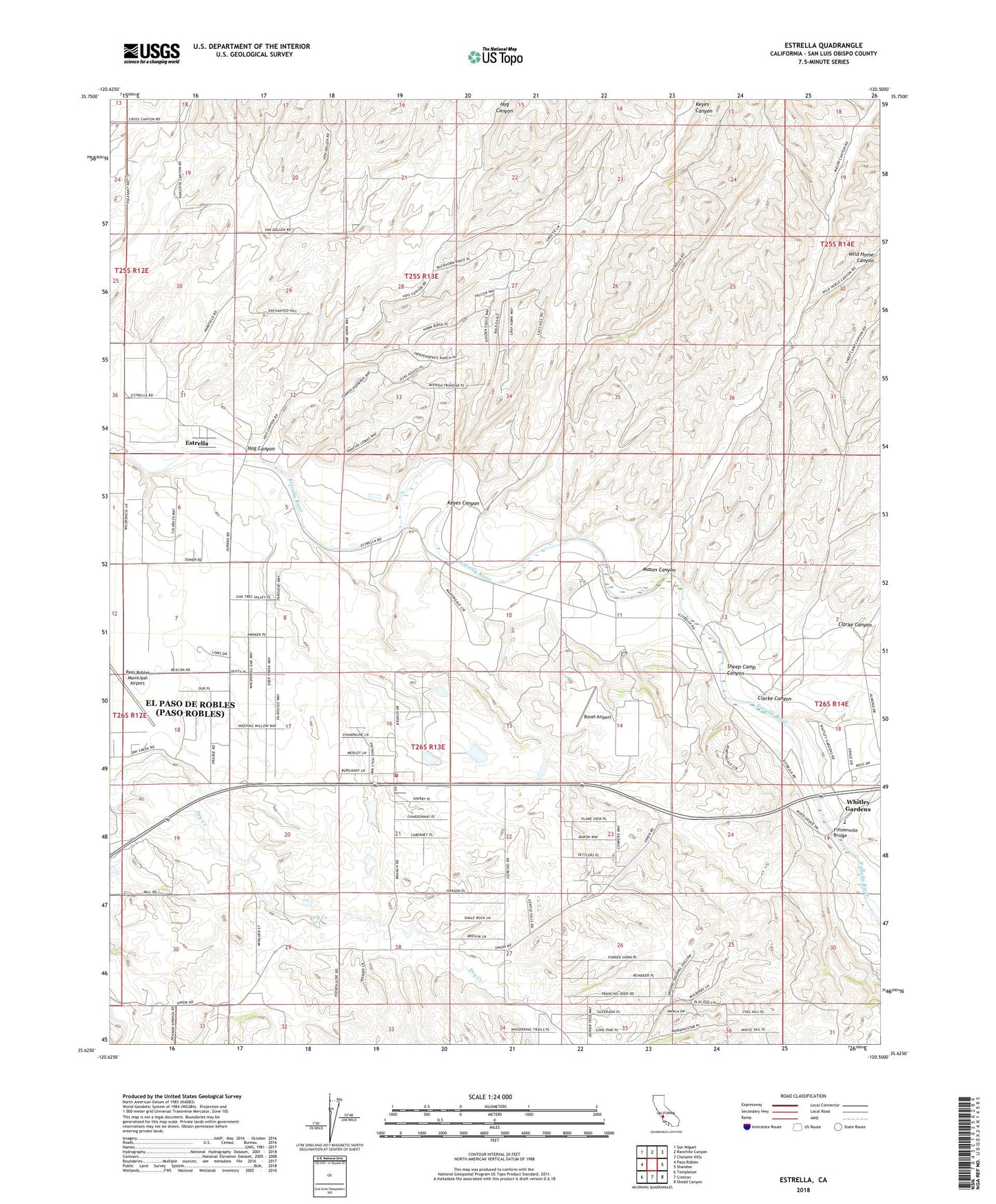
2021 topographic map quadrangle Estrella in the state of California. Scale: 1:24000. Based on the newly updated USGS 7.5' US Topo map series, this map is in the following counties: San Luis Obispo. The map contains contour data, water features, and other items you are used to seeing on USGS maps, but also has updated roads and other features. This is the next generation of topographic maps. Printed on high-quality waterproof paper with UV fade-resistant inks.
Quads adjacent to this one:
West: Paso Robles
Northwest: San Miguel
North: Ranchito Canyon
Northeast: Cholame Hills
East: Shandon
Southeast: Shedd Canyon
South: Creston
Southwest: Templeton
This map covers the same area as the classic USGS quad with code o35120f5.
Contains the following named places: Arciero Winery, Baron Vineyards, Bern, Bonel Airport, California Department of Forestry and Fire Protection Station 52 Meridian, Clarke Canyon, Dry Canyon, Dry Creek School, Estrella, Estrella River Winery, Fifteenmile Bridge, Hillman Ranch, Hog Canyon, Keyes Canyon, Keyes School, Mason Canyon, Paso Robles Division, Paso Robles Landfill, Phillips Freedom Community School, Phillips School, Pine Creek, Pleasant Valley School, Ranchito School, Sheep Camp Canyon, Union, Union School, Whitley Gardens, Whitley Gardens Census Designated Place, Wild Horse Canyon