MyTopo
Paso Robles California US Topo Map
Couldn't load pickup availability
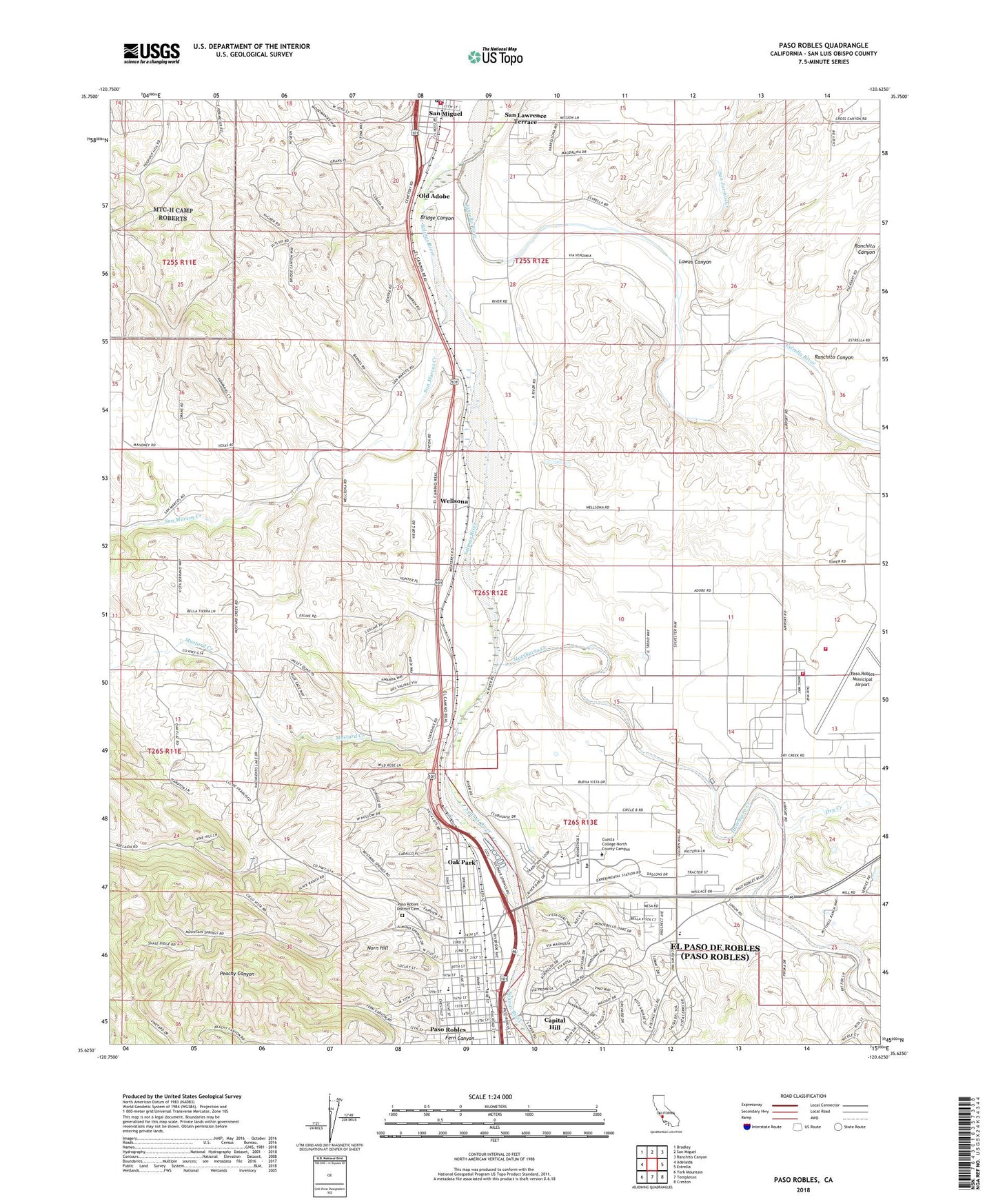
2021 topographic map quadrangle Paso Robles in the state of California. Scale: 1:24000. Based on the newly updated USGS 7.5' US Topo map series, this map is in the following counties: San Luis Obispo. The map contains contour data, water features, and other items you are used to seeing on USGS maps, but also has updated roads and other features. This is the next generation of topographic maps. Printed on high-quality waterproof paper with UV fade-resistant inks.
Quads adjacent to this one:
West: Adelaida
Northwest: Bradley
North: San Miguel
Northeast: Ranchito Canyon
East: Estrella
Southeast: Creston
South: Templeton
Southwest: York Mountain
This map covers the same area as the classic USGS quad with code o35120f6.
Contains the following named places: Advanced Christian Training School, Barney Schwartz Park, Bridge Canyon, California Mid-State Fairground, California State School for Boys, Capital Hill, Christian Life Center, City of El Paso de Robles, Covenant Community Church, Cuesta College North County Campus, Dayspring Foursquare Church, Downtown City Park, Dry Creek, Eberle Winery, El Paso Calling Mission Church, El Paso De Robles School, Estrella Army Air Field, Estrella River, Estrella School, Family Worship Center, Fern Canyon, First Apostolic Church, First Baptist Church, First Church of Christ Scientist, First Church of God, First United Methodist Church, Full Gospel Church, George H Flamson Middle School, Georgia Brown Elementary School, Golden Hills Church of Christ, Grace Baptist Church, Huerhuero Creek, Hunter Ranch Golf Course, Iglesia Evangelica, KPRL-AM (Paso Robles), Las Pozas, Lowes Canyon, Martin Brothers Winery, Mid State Baptist Church, Mission San Miguel Arcangel, Mission View Vineyards, Mustard Creek, New Covenant Church of God, New Light Baptist Church, Norn Hill, North County Christian Fellowship Church, North River Road Pit, Northside Church of Christ, Oak Flat School, Oak Park, Old Adobe, Paso Robles, Paso Robles Chamber of Commerce, Paso Robles City Hall, Paso Robles District Cemetery, Paso Robles Fire Station 3, Paso Robles High School Culinary Arts Academy, Paso Robles Municipal Airport, Paso Robles Municipal Pool, Paso Robles Public Library, Paso Robles Public Schools Teachers Center, Paso Robles Union High School, Pioneer Museum, Pioneer Park, Plymouth Congregational Church, Ranchito Canyon, Saint James Episcopal Church, Saint Rose of Lima Catholic Church, San Jacinto Creek, San Lawrence Terrace, San Marcos Creek, San Marcos School, San Miguel Community Services District Fire Department, San Miguel Post Office, Second Baptist Church, The Arts Academy at Bauer Speck Elementary School, Wellsona, ZIP Code: 93446