MyTopo
San Miguel California US Topo Map
Couldn't load pickup availability
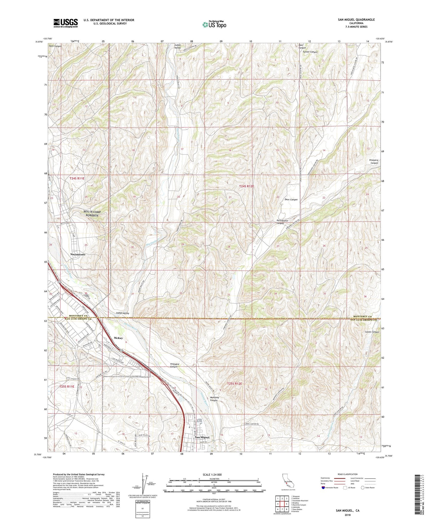
2021 topographic map quadrangle San Miguel in the state of California. Scale: 1:24000. Based on the newly updated USGS 7.5' US Topo map series, this map is in the following counties: Monterey, San Luis Obispo. The map contains contour data, water features, and other items you are used to seeing on USGS maps, but also has updated roads and other features. This is the next generation of topographic maps. Printed on high-quality waterproof paper with UV fade-resistant inks.
Quads adjacent to this one:
West: Bradley
Northwest: Wunpost
North: Valleton
Northeast: Stockdale Mountain
East: Ranchito Canyon
Southeast: Estrella
South: Paso Robles
Southwest: Adelaida
This map covers the same area as the classic USGS quad with code o35120g6.
Contains the following named places: Big Sandy Creek, Camp Roberts Emergency Services, Camp Roberts Fire Department, Deer Canyon, Garelli Field, Indian Valley, Lillian Larsen Elementary School, Mahoney Canyon, McKay, Monroe School, Nacimiento, National Guard Base Military Training Area Camp Roberts, Portuguese Canyon, San Miguel, San Miguel Assembly of God Church, San Miguel Branch San Luis Obispo City-County Library, San Miguel Census Designated Place, San Miguel Community Center, San Miguel Park, Tunnel Canyon, Vineyard Canyon, Vineyard School