MyTopo
Falls Ridge California US Topo Map
Couldn't load pickup availability
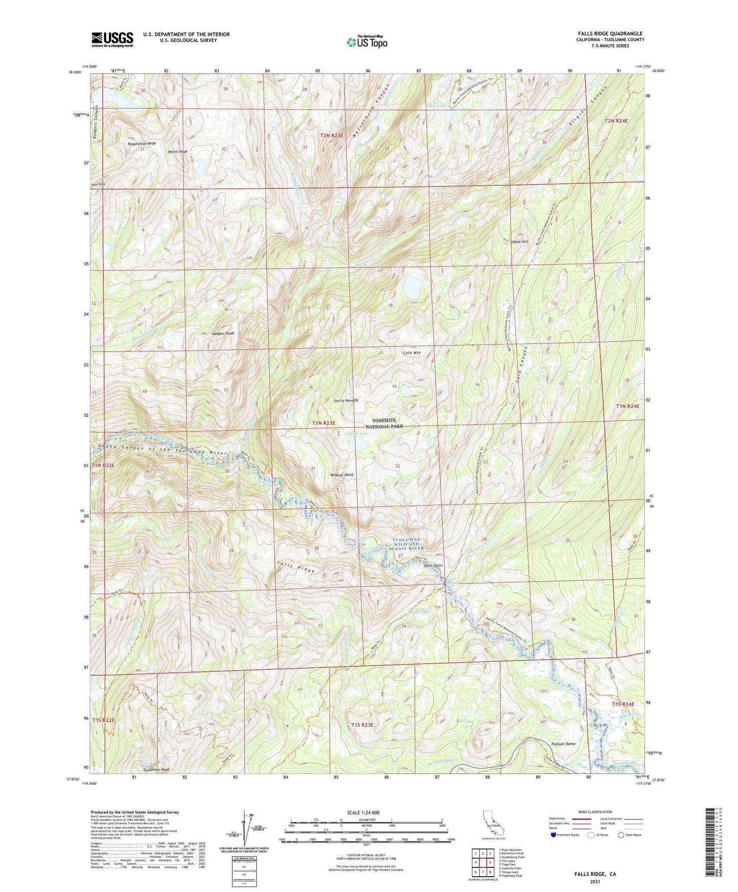
2021 topographic map quadrangle Falls Ridge in the state of California. Scale: 1:24000. Based on the newly updated USGS 7.5' US Topo map series, this map is in the following counties: Tuolumne. The map contains contour data, water features, and other items you are used to seeing on USGS maps, but also has updated roads and other features. This is the next generation of topographic maps. Printed on high-quality waterproof paper with UV fade-resistant inks.
Quads adjacent to this one:
West: Ten Lakes
Northwest: Piute Mountain
North: Matterhorn Peak
Northeast: Dunderberg Peak
East: Tioga Pass
Southeast: Vogelsang Peak
South: Tenaya Lake
Southwest: Yosemite Falls
This map covers the same area as the classic USGS quad with code o37119h4.
Contains the following named places: Alkali Creek, Budd Creek, California Falls, Cold Canyon, Cold Mountain, Conness Creek, Delaney Creek, Dingley Creek, Elbow Hill, Falls Ridge, Glen Aulin, Glen Aulin High Sierra Camp, Hooper Peak, Le Conte Falls, Matterhorn Canyon, Matterhorn Creek, Mattie Lake, McGee Lake, Miller Lake, Pettit Peak, Pothole Dome, Regulation Creek, Regulation Peak, Return Creek, Rodgers Lake, South Fork Cathedral Creek, Spiller Creek, Tuolumne Falls, Tuolumne Meadows, Tuolumne Peak, Virginia Canyon, Virginia Lake, Waterwheel Falls, West Peak, White Cascade, Wildcat Point